Property Record
7610 E Mcdowell Rd, Scottsdale, AZ 85257
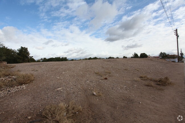

Property Detail
7610 E Mcdowell Rd
131-22-508
E 100F OF W 315 OF S 240F OF SW4 SE4 SEC 35 EX S 65F RD
Autorepair
Maricopa
C-4
Arizona
C and X Area of minimal flood hazard, usually depicted on FIRMs as above the 500-year flood level.
0.68 AC
2025
Scottsdale South
2025
Phoenix
217900
Phoenix-Mesa-Chandler, AZ
3,124 SF
NEARBY LISTINGS FOR SALE OR LEASE
-
-
-
-
-
-
-
No Photo
-
View all Scottsdale listings for sale on LoopNet.com
DEMOGRAPHICS near 7610 E Mcdowell Rd
1 mile
3 mile
5 mile
2025 Total Population
18,317
100,294
294,790
2030 Population
19,181
106,181
309,404
Pop Growth 2025-2030
+ 4.72%
+ 5.87%
+ 4.96%
Average Age
40
40
37
2025 Total Households
8,529
50,224
133,065
HH Growth 2025-2030
+ 4.75%
+ 6.08%
+ 5.25%
Median Household Inc
$92,117
$87,316
$77,776
Avg Household Size
2.00
1.90
2.10
2025 Avg HH Vehicles
2.00
2.00
2.00
Median Home Value
$553,944
$595,473
$557,547
Median Year Built
1972
1979
1981
Nearby Places
Map Layers
Map Styles
 Street
 Aerial
Layers
 Traffic
 Biking
Places
Listings with unknown addresses are not visible on the map
- Restaurants
- Banks
- Shops
- Fitness
- Groceries
PUBLIC TRANSPORTATION
AIRPORT
Phoenix Sky Harbor International
Drive
Walk
Distance
Phoenix Sky Harbor International
14 min
7.4 mi
Phoenix-Mesa Gateway
Drive
Walk
Distance
Phoenix-Mesa Gateway
39 min
26.1 mi
Nearby Properties
Address
Land Use
TOTAL SIZE
Lot Size
Zoning
Address
Land Use
TOTAL SIZE
Lot Size
Zoning
Address
Land Use
TOTAL SIZE
Lot Size
Zoning
4.59 AC
I-1
Address
Land Use
TOTAL SIZE
Lot Size
Zoning
1,870,689 SF
46.77 AC
I-P
Address
Land Use
TOTAL SIZE
Lot Size
Zoning
75,000 SF
12.19 AC
I-1
Address
Land Use
TOTAL SIZE
Lot Size
Zoning
2,636,740 SF
21.88 AC
C-DT
Address
Land Use
TOTAL SIZE
Lot Size
Zoning
401,544 SF
64.59 AC
GID
Address
Land Use
TOTAL SIZE
Lot Size
Zoning
2.54 AC
Address
Land Use
TOTAL SIZE
Lot Size
Zoning
9,160 SF
2.57 AC
DDMU2
Address
Land Use
TOTAL SIZE
Lot Size
Zoning
981,325 SF
8.31 AC
Address
Land Use
TOTAL SIZE
Lot Size
Zoning
3.77 AC
PNC
Address
Land Use
TOTAL SIZE
Lot Size
Zoning
44,971 SF
2.06 AC
C-R
Address
Land Use
TOTAL SIZE
Lot Size
Zoning
58,061 SF
5.43 AC
C-C
Address
Land Use
TOTAL SIZE
Lot Size
Zoning
697,894 SF
8.43 AC
PAD
Address
Land Use
TOTAL SIZE
Lot Size
Zoning
3,010 SF
35.44 AC
R110
Address
Land Use
TOTAL SIZE
Lot Size
Zoning
511,014 SF
5.01 AC
I-1
Address
Land Use
TOTAL SIZE
Lot Size
Zoning
307,604 SF
37.83 AC
R-7
Address
Land Use
TOTAL SIZE
Lot Size
Zoning
301,376 SF
8.77 AC
PAD
Address
Land Use
TOTAL SIZE
Lot Size
Zoning
688,550 SF
149.95 AC
R-6
Address
Land Use
TOTAL SIZE
Lot Size
Zoning
776,898 SF
27.32 AC
C-R
Address
Land Use
TOTAL SIZE
Lot Size
Zoning
544,646 SF
1.65 AC
MU4
Address
Land Use
TOTAL SIZE
Lot Size
Zoning
285,883 SF
12.62 AC
I-1
Address
Land Use
TOTAL SIZE
Lot Size
Zoning
518,223 SF
3.54 AC
C-C
Address
Land Use
TOTAL SIZE
Lot Size
Zoning
401,437 SF
17.70 AC
C-R
Address
Land Use
TOTAL SIZE
Lot Size
Zoning
831,861 SF
4.25 AC
MU4
Address
Land Use
TOTAL SIZE
Lot Size
Zoning
377,014 SF
1.81 AC
PAD
Address
Land Use
TOTAL SIZE
Lot Size
Zoning
640,230 SF
3.94 AC
MU4
The World's #1 Commercial Real Estate Marketplace
Connect with us
© 2026 CoStar Group
The information above has been obtained from sources believed reliable. While we do not doubt its accuracy we have not verified it and make no guarantee, warranty or representation about it. It is your responsibility to independently confirm its accuracy and completeness. Any projections, opinions, assumptions, or estimates used are for example only and do not represent the current or future performance of the property. The value of this transaction to you depends on tax and other factors which should be evaluated by your tax, financial, and legal advisors. You and your advisors should conduct a careful, independent investigation of the property to determine to your satisfaction the suitability of the property for your needs.