Property Record
7610 Industrial Hwy, Macon, GA 31216


NEARBY LISTINGS FOR SALE OR LEASE
Property Detail
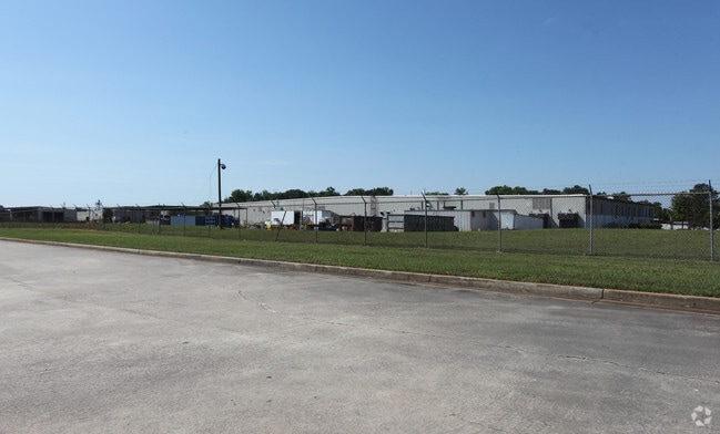
7610 Industrial Hwy
O140-0051
As Built Plan For American Standard
Manufacturinglight
Bibb
X
Georgia
13021C0235G
204
2025
12.96 AC
2025
Outlying Bibb County
013502
Atlanta
107,960 SF
Macon-Bibb County, GA
DEMOGRAPHICS near 7610 Industrial Hwy
1 Mile
3 Mile
5 Mile
2024 Total Population
296
8,446
35,136
2029 Population
296
8,505
37,030
Pop Growth 2024-2029
0.00%
+ 0.70%
+ 5.39%
Average Age
40
42
40
2024 Total Households
114
3,324
13,743
HH Growth 2024-2029
0.00%
+ 0.69%
+ 5.25%
Median Household Inc
$69,374
$74,332
$57,217
Avg Household Size
2.60
2.50
2.50
2024 Avg HH Vehicles
2.00
2.00
2.00
Median Home Value
$167,646
$177,860
$148,297
Median Year Built
1987
1990
1986
Nearby Places
Map Layers
Map Styles
 Street
 Aerial
- Restaurants
- Banks
- Shops
- Fitness
- Groceries
SALE & LEASE HISTORY
LISTING DATE
SALE/LEASE

Apr 01, 2019
For Sale
Apr 01, 2019
For Lease
Nearby Properties
Address
Land Use
TOTAL SIZE
Lot Size
Zoning
Address
Land Use
TOTAL SIZE
Lot Size
Zoning
17,952 SF
1,075.78 AC
M-1
Address
Land Use
TOTAL SIZE
Lot Size
Zoning
780,000 SF
70.50 AC
M-2
Address
Land Use
TOTAL SIZE
Lot Size
Zoning
11,088 SF
59.57 AC
M-2
Address
Land Use
TOTAL SIZE
Lot Size
Zoning
560,025 SF
79.35 AC
M-1
Address
Land Use
TOTAL SIZE
Lot Size
Zoning
235,345 SF
22.90 AC
M-1
Address
Land Use
TOTAL SIZE
Lot Size
Zoning
5,096 SF
17.65 AC
A
Address
Land Use
TOTAL SIZE
Lot Size
Zoning
194,390 SF
242 AC
A
Address
Land Use
TOTAL SIZE
Lot Size
Zoning
20,252 SF
22.87 AC
A
Address
Land Use
TOTAL SIZE
Lot Size
Zoning
100,000 SF
32.51 AC
M-2
Address
Land Use
TOTAL SIZE
Lot Size
Zoning
52,615 SF
16.38 AC
A
Address
Land Use
TOTAL SIZE
Lot Size
Zoning
113,895 SF
10 AC
M-1
Address
Land Use
TOTAL SIZE
Lot Size
Zoning
30,568 SF
7.44 AC
A
Address
Land Use
TOTAL SIZE
Lot Size
Zoning
102,163 SF
10.02 AC
M-1
Address
Land Use
TOTAL SIZE
Lot Size
Zoning
213,621 SF
21.66 AC
M-1
Address
Land Use
TOTAL SIZE
Lot Size
Zoning
66,158 SF
22.57 AC
M-1
Address
Land Use
TOTAL SIZE
Lot Size
Zoning
152,300 SF
24.47 AC
M-1
Address
Land Use
TOTAL SIZE
Lot Size
Zoning
19,440 SF
28.87 AC
M-1
Address
Land Use
TOTAL SIZE
Lot Size
Zoning
324,570 SF
43.89 AC
M-1
Address
Land Use
TOTAL SIZE
Lot Size
Zoning
87,597 SF
10 AC
M-1
Address
Land Use
TOTAL SIZE
Lot Size
Zoning
200,100 SF
18.73 AC
M-2
Address
Land Use
TOTAL SIZE
Lot Size
Zoning
104,627 SF
12.74 AC
M-1
Address
Land Use
TOTAL SIZE
Lot Size
Zoning
52,850 SF
22.73 AC
M-2
Address
Land Use
TOTAL SIZE
Lot Size
Zoning
50,682 SF
11.78 AC
M-1
Address
Land Use
TOTAL SIZE
Lot Size
Zoning
199,348 SF
10.52 AC
M-1
Address
Land Use
TOTAL SIZE
Lot Size
Zoning
224,044 SF
15.11 AC
M-1
Address
Land Use
TOTAL SIZE
Lot Size
Zoning
58,750 SF
7.14 AC
M-1
Address
Land Use
TOTAL SIZE
Lot Size
Zoning
62,100 SF
10 AC
M-2
Address
Land Use
TOTAL SIZE
Lot Size
Zoning
48,536 SF
16.72 AC
M-1
Address
Land Use
TOTAL SIZE
Lot Size
Zoning
151,980 SF
13.46 AC
M-1
Address
Land Use
TOTAL SIZE
Lot Size
Zoning
6,063 SF
3.77 AC
A/M-2
The World's #1 Commercial Real Estate Marketplace
Connect with us
© 2026 CoStar Group
The information above has been obtained from sources believed reliable. While we do not doubt its accuracy we have not verified it and make no guarantee, warranty or representation about it. It is your responsibility to independently confirm its accuracy and completeness. Any projections, opinions, assumptions, or estimates used are for example only and do not represent the current or future performance of the property. The value of this transaction to you depends on tax and other factors which should be evaluated by your tax, financial, and legal advisors. You and your advisors should conduct a careful, independent investigation of the property to determine to your satisfaction the suitability of the property for your needs.