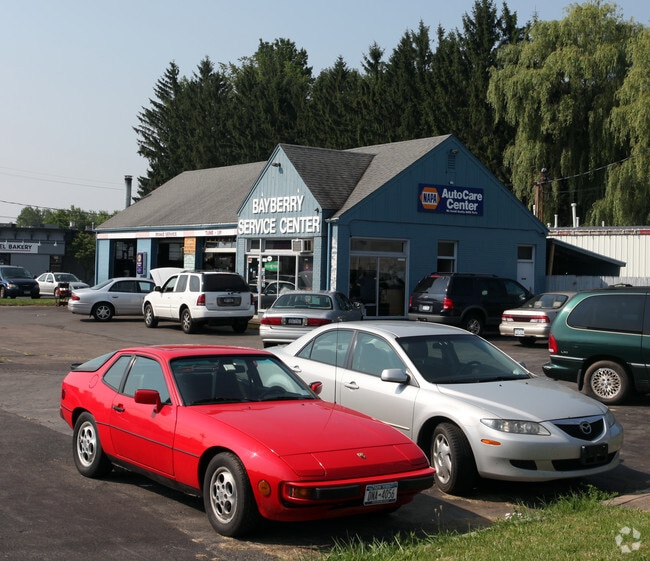
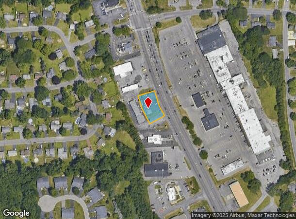
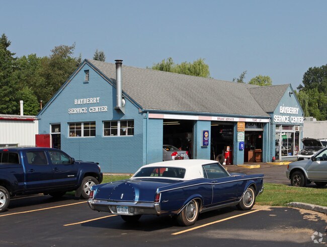
Property Record
7613 Oswego Rd, Liverpool, NY 13090
NEARBY LISTINGS FOR SALE OR LEASE
Property Detail
7613 Oswego Rd
312489-093-000-0003-039-000-0000
FL 74
Servicestation
Onondaga
X
New York
36067C0088F
39.000
2025
0.37 AC
2024
NE Outer Onondaga County
011101
Syracuse
1,752 SF
Syracuse, NY
DEMOGRAPHICS near 7613 Oswego Rd
1 Mile
3 Mile
5 Mile
2024 Total Population
9,043
44,211
102,397
2029 Population
8,793
43,052
99,584
Pop Growth 2024-2029
(2.76%)
(2.62%)
(2.75%)
Average Age
41
41
42
2024 Total Households
3,702
18,586
43,703
HH Growth 2024-2029
(3.00%)
(2.80%)
(2.93%)
Median Household Inc
$81,550
$73,220
$73,183
Avg Household Size
2.40
2.30
2.30
2024 Avg HH Vehicles
2.00
2.00
2.00
Median Home Value
$157,605
$170,208
$167,931
Median Year Built
1968
1975
1973
Nearby Places
- Restaurants
- Banks
- Shops
- Fitness
- Groceries
PUBLIC TRANSPORTATION
COMMUTER RAIL
Syracuse (Toronto - New York - VIA Rail)
DRIVE
WALK
Distance
Syracuse (Toronto - New York - VIA Rail)
12 min
5.7 mi
Nyf (Empire Service - Amtrak, Maple Leaf - Amtrak)
DRIVE
WALK
Distance
Nyf (Empire Service - Amtrak, Maple Leaf - Amtrak)
16 min
9.3 mi
AIRPORT
Syracuse Hancock International
DRIVE
WALK
Distance
Syracuse Hancock International
16 min
9.3 mi
Freight Ports
Albany, NY Port
DRIVE
WALK
Distance
Albany, NY Port
176 min
148.5 mi
Nearby Properties
Address
Land Use
TOTAL SIZE
Lot Size
Zoning
Address
Land Use
TOTAL SIZE
Lot Size
Zoning
7,392 SF
14.86 AC
03 - MULTI
Address
Land Use
TOTAL SIZE
Lot Size
Zoning
77,150 SF
159.25 AC
06 - INDUS
Address
Land Use
TOTAL SIZE
Lot Size
Zoning
3,968 SF
14.31 AC
03 - MULTI
Address
Land Use
TOTAL SIZE
Lot Size
Zoning
163,725 SF
21.46 AC
02 - SINGL
Address
Land Use
TOTAL SIZE
Lot Size
Zoning
7,229 SF
111.29 AC
05 - COMME
Address
Land Use
TOTAL SIZE
Lot Size
Zoning
32,586 SF
6.87 AC
06 - INDUS
Address
Land Use
TOTAL SIZE
Lot Size
Zoning
57,993 SF
18.43 AC
02 - SINGL
Address
Land Use
TOTAL SIZE
Lot Size
Zoning
3,744 SF
10.60 AC
03 - MULTI
Address
Land Use
TOTAL SIZE
Lot Size
Zoning
3,696 SF
10.12 AC
03 - MULTI
Address
Land Use
TOTAL SIZE
Lot Size
Zoning
71,194 SF
10.76 AC
02 - SINGL
Address
Land Use
TOTAL SIZE
Lot Size
Zoning
11,059 SF
8.23 AC
06 - INDUS
Address
Land Use
TOTAL SIZE
Lot Size
Zoning
210,170 SF
17.87 AC
06 - INDUS
Address
Land Use
TOTAL SIZE
Lot Size
Zoning
8,992 SF
6.63 AC
06 - INDUS
Address
Land Use
TOTAL SIZE
Lot Size
Zoning
99,442 SF
11.75 AC
PUD
Address
Land Use
TOTAL SIZE
Lot Size
Zoning
28,800 SF
6.86 AC
R40
Address
Land Use
TOTAL SIZE
Lot Size
Zoning
182.16 AC
02 - SINGL
Address
Land Use
TOTAL SIZE
Lot Size
Zoning
38,620 SF
29.42 AC
02 - SINGL
Address
Land Use
TOTAL SIZE
Lot Size
Zoning
125,780 SF
10.13 AC
02 - SINGL
Address
Land Use
TOTAL SIZE
Lot Size
Zoning
11,059 SF
5.30 AC
06 - INDUS
Address
Land Use
TOTAL SIZE
Lot Size
Zoning
515,918 SF
14.76 AC
05 - COMME
Address
Land Use
TOTAL SIZE
Lot Size
Zoning
82,071 SF
6.29 AC
06 - INDUS
Address
Land Use
TOTAL SIZE
Lot Size
Zoning
61,701 SF
15.87 AC
R40
Address
Land Use
TOTAL SIZE
Lot Size
Zoning
28,800 SF
4.72 AC
PUD
Address
Land Use
TOTAL SIZE
Lot Size
Zoning
13,911 SF
2.48 AC
03 - MULTI
Address
Land Use
TOTAL SIZE
Lot Size
Zoning
17,251 SF
32.17 AC
08 - GOVER
Address
Land Use
TOTAL SIZE
Lot Size
Zoning
10,983 SF
3.49 AC
06 - INDUS
Address
Land Use
TOTAL SIZE
Lot Size
Zoning
23,820 SF
0.49 AC
05 - COMME
Address
Land Use
TOTAL SIZE
Lot Size
Zoning
35,042 SF
4.39 AC
03 - MULTI
Address
Land Use
TOTAL SIZE
Lot Size
Zoning
16,589 SF
0.50 AC
05 - COMME
Address
Land Use
TOTAL SIZE
Lot Size
Zoning
11,640 SF
87.11 AC
02 - SINGL
The World's #1 Commercial Real Estate Marketplace
Connect with us
© 2025 CoStar Group
The information above has been obtained from sources believed reliable. While we do not doubt its accuracy we have not verified it and make no guarantee, warranty or representation about it. It is your responsibility to independently confirm its accuracy and completeness. Any projections, opinions, assumptions, or estimates used are for example only and do not represent the current or future performance of the property. The value of this transaction to you depends on tax and other factors which should be evaluated by your tax, financial, and legal advisors. You and your advisors should conduct a careful, independent investigation of the property to determine to your satisfaction the suitability of the property for your needs.