Property Record
7615 E Pinnacle Peak Rd, Scottsdale, AZ 85255
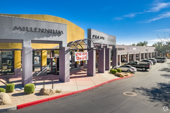

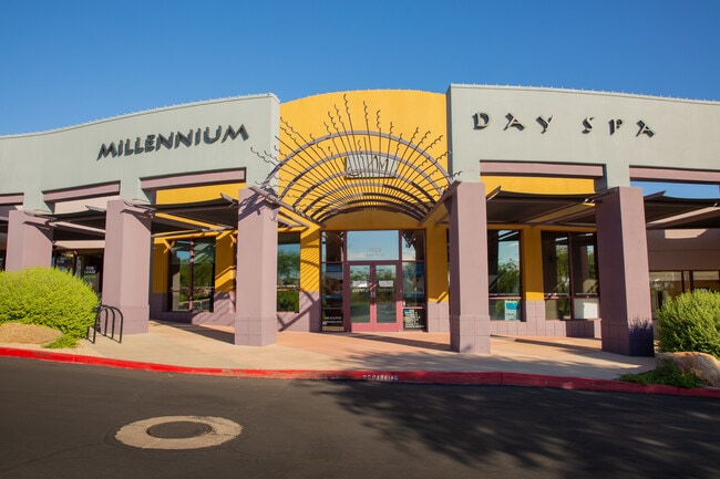
Property Detail
7615 E Pinnacle Peak Rd
212-02-002J
PT E2 SEC 14 DAF COM S4 COR SD SEC 14 TH N ALG N-S MID-SEC LN 2640.54F TO CEN SD SEC 14 TH E 55F TO PT ON E R/W LN MILLER RD TH N 1665.06F TPOB TH CONT N 895.08F TO PT CUR WH RAD BRS E 25F TH NELY ALG SD CUR 39.33F TO PT ON S R/W LN PINNACLE PEAK RD
Storebuilding
Maricopa
C-N
Arizona
B and X Area of moderate flood hazard, usually the area between the limits of the 100-year and 500-year floods.
5.78 AC
2025
North Scottsdale
2025
Phoenix
216841
Phoenix-Mesa-Chandler, AZ
40,915 SF
NEARBY LISTINGS FOR SALE OR LEASE
-
-
View all Scottsdale listings for lease on LoopNet.com
DEMOGRAPHICS near 7615 E Pinnacle Peak Rd
1 mile
3 mile
5 mile
2025 Total Population
7,230
31,293
106,541
2030 Population
7,582
33,461
113,117
Pop Growth 2025-2030
+ 4.87%
+ 6.93%
+ 6.17%
Average Age
47
47
45
2025 Total Households
3,006
14,214
46,553
HH Growth 2025-2030
+ 4.86%
+ 7.44%
+ 6.74%
Median Household Inc
$124,815
$132,025
$133,810
Avg Household Size
2.30
2.20
2.20
2025 Avg HH Vehicles
2.00
2.00
2.00
Median Home Value
$854,881
$995,704
$892,718
Median Year Built
1998
2002
2000
Nearby Places
Map Layers
Map Styles
 Street
 Aerial
Layers
 Traffic
 Biking
Places
Listings with unknown addresses are not visible on the map
- Restaurants
- Banks
- Shops
- Fitness
- Groceries
PUBLIC TRANSPORTATION
AIRPORT
Phoenix Sky Harbor International
Drive
Walk
Distance
Phoenix Sky Harbor International
37 min
26.2 mi
Freight Ports
Port of San Diego
Drive
Walk
Distance
Port of San Diego
424 min
377.9 mi
SALE & LEASE HISTORY
LISTING DATE
SALE/LEASE

Sep 25, 2016
For Lease
Nearby Properties
Address
Land Use
TOTAL SIZE
Lot Size
Zoning
Address
Land Use
TOTAL SIZE
Lot Size
Zoning
20.98 AC
Address
Land Use
TOTAL SIZE
Lot Size
Zoning
13.01 AC
Address
Land Use
TOTAL SIZE
Lot Size
Zoning
14.58 AC
Address
Land Use
TOTAL SIZE
Lot Size
Zoning
1,479,005 SF
12.55 AC
PC
Address
Land Use
TOTAL SIZE
Lot Size
Zoning
Address
Land Use
TOTAL SIZE
Lot Size
Zoning
Address
Land Use
TOTAL SIZE
Lot Size
Zoning
229,856 SF
7.71 AC
C-T
Address
Land Use
TOTAL SIZE
Lot Size
Zoning
734,840 SF
33.12 AC
M-H
Address
Land Use
TOTAL SIZE
Lot Size
Zoning
90.73 AC
O-S
Address
Land Use
TOTAL SIZE
Lot Size
Zoning
255,313 SF
22.54 AC
PNC
Address
Land Use
TOTAL SIZE
Lot Size
Zoning
385,376 SF
13.65 AC
PAD
Address
Land Use
TOTAL SIZE
Lot Size
Zoning
702,652 SF
4.58 AC
Address
Land Use
TOTAL SIZE
Lot Size
Zoning
375,257 SF
12 AC
M-H
Address
Land Use
TOTAL SIZE
Lot Size
Zoning
41.63 AC
I-1
Address
Land Use
TOTAL SIZE
Lot Size
Zoning
731,843 SF
29.85 AC
M-H
Address
Land Use
TOTAL SIZE
Lot Size
Zoning
328,616 SF
10.56 AC
PAD
Address
Land Use
TOTAL SIZE
Lot Size
Zoning
397,568 SF
16.71 AC
PAD
Address
Land Use
TOTAL SIZE
Lot Size
Zoning
373,066 SF
13 AC
M-H
Address
Land Use
TOTAL SIZE
Lot Size
Zoning
58.66 AC
R-43AG
Address
Land Use
TOTAL SIZE
Lot Size
Zoning
161,955 SF
2.65 AC
Address
Land Use
TOTAL SIZE
Lot Size
Zoning
157,340 SF
4.40 AC
PC
Address
Land Use
TOTAL SIZE
Lot Size
Zoning
570.07 AC
R-43
Address
Land Use
TOTAL SIZE
Lot Size
Zoning
286,776 SF
5.86 AC
C-T
Address
Land Use
TOTAL SIZE
Lot Size
Zoning
48.10 AC
Address
Land Use
TOTAL SIZE
Lot Size
Zoning
201,308 SF
3.44 AC
PC
Address
Land Use
TOTAL SIZE
Lot Size
Zoning
66,317 SF
20.82 AC
R-190
Address
Land Use
TOTAL SIZE
Lot Size
Zoning
115,275 SF
12.16 AC
C-C
Address
Land Use
TOTAL SIZE
Lot Size
Zoning
100,378 SF
12.29 AC
C-C
Address
Land Use
TOTAL SIZE
Lot Size
Zoning
80,105 SF
12.35 AC
PAD
Address
Land Use
TOTAL SIZE
Lot Size
Zoning
311,819 SF
3.84 AC
R4
The World's #1 Commercial Real Estate Marketplace
Connect with us
© 2026 CoStar Group
The information above has been obtained from sources believed reliable. While we do not doubt its accuracy we have not verified it and make no guarantee, warranty or representation about it. It is your responsibility to independently confirm its accuracy and completeness. Any projections, opinions, assumptions, or estimates used are for example only and do not represent the current or future performance of the property. The value of this transaction to you depends on tax and other factors which should be evaluated by your tax, financial, and legal advisors. You and your advisors should conduct a careful, independent investigation of the property to determine to your satisfaction the suitability of the property for your needs.