Property Record
7615 Old Mount Holly Rd, Charlotte, NC 28214


NEARBY LISTINGS FOR SALE OR LEASE
-
-
View all Charlotte listings for sale on LoopNet.com
Property Detail
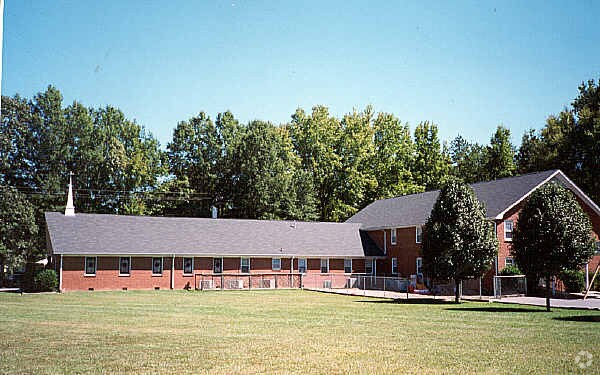
7615 Old Mount Holly Rd
Charlotte-Concord-Gastonia, NC-SC
Property/John B Cox Elsie M Co
057-243-05A
PM5-43
Industrialgeneral
Mecklenburg
X
North Carolina
3710452600K
5
2024
12.50 AC
2025
Northwest Charlotte
006016
Charlotte
5,220 SF
DEMOGRAPHICS near 7615 Old Mount Holly Rd
1 Mile
3 Mile
5 Mile
2024 Total Population
5,408
53,660
124,024
2029 Population
5,729
56,925
132,159
Pop Growth 2024-2029
+ 5.94%
+ 6.08%
+ 6.56%
Average Age
36
37
37
2024 Total Households
1,876
19,162
46,309
HH Growth 2024-2029
+ 6.02%
+ 6.19%
+ 6.73%
Median Household Inc
$70,548
$60,901
$58,480
Avg Household Size
2.80
2.70
2.60
2024 Avg HH Vehicles
2.00
2.00
2.00
Median Home Value
$188,228
$197,868
$218,622
Median Year Built
1993
1991
1992
Nearby Places
Map Layers
Map Styles
 Street
 Aerial
- Restaurants
- Banks
- Shops
- Fitness
- Groceries
PUBLIC TRANSPORTATION
COMMUTER RAIL
DRIVE
WALK
Distance
15 min
8.3 mi
AIRPORT
Charlotte/Douglas International
DRIVE
WALK
Distance
Charlotte/Douglas International
17 min
5.3 mi
Concord-Padgett Regional
DRIVE
WALK
Distance
Concord-Padgett Regional
26 min
19.3 mi
Nearby Properties
Address
Land Use
TOTAL SIZE
Lot Size
Zoning
Address
Land Use
TOTAL SIZE
Lot Size
Zoning
863,490 SF
93.41 AC
Address
Land Use
TOTAL SIZE
Lot Size
Zoning
15.94 AC
Address
Land Use
TOTAL SIZE
Lot Size
Zoning
625,790 SF
89.50 AC
I-2(CD)
Address
Land Use
TOTAL SIZE
Lot Size
Zoning
568,252 SF
56.05 AC
I-1(CD)
Address
Land Use
TOTAL SIZE
Lot Size
Zoning
242,699 SF
20.50 AC
R17MF
Address
Land Use
TOTAL SIZE
Lot Size
Zoning
394,084 SF
29.35 AC
Address
Land Use
TOTAL SIZE
Lot Size
Zoning
238,075 SF
9.52 AC
Address
Land Use
TOTAL SIZE
Lot Size
Zoning
250,079 SF
52.97 AC
R3
Address
Land Use
TOTAL SIZE
Lot Size
Zoning
536,042 SF
37.24 AC
R-22MF
Address
Land Use
TOTAL SIZE
Lot Size
Zoning
450,580 SF
36.74 AC
I-2(CD)
Address
Land Use
TOTAL SIZE
Lot Size
Zoning
3,428 SF
13.21 AC
R-17MF
Address
Land Use
TOTAL SIZE
Lot Size
Zoning
351,824 SF
20.17 AC
I-1(CD)
Address
Land Use
TOTAL SIZE
Lot Size
Zoning
164,140 SF
11.81 AC
I-1
Address
Land Use
TOTAL SIZE
Lot Size
Zoning
208,460 SF
23.20 AC
I-1(CD)
Address
Land Use
TOTAL SIZE
Lot Size
Zoning
346,795 SF
110.06 AC
I2
Address
Land Use
TOTAL SIZE
Lot Size
Zoning
251,672 SF
26.13 AC
I1CD
Address
Land Use
TOTAL SIZE
Lot Size
Zoning
89,113 SF
14.56 AC
R-3
Address
Land Use
TOTAL SIZE
Lot Size
Zoning
260,575 SF
17 AC
I-1(CD)
Address
Land Use
TOTAL SIZE
Lot Size
Zoning
252,539 SF
22.58 AC
R-3
Address
Land Use
TOTAL SIZE
Lot Size
Zoning
116,515 SF
4.59 AC
I1
Address
Land Use
TOTAL SIZE
Lot Size
Zoning
2,967 SF
9.01 AC
R-17MF
Address
Land Use
TOTAL SIZE
Lot Size
Zoning
401,879 SF
20.57 AC
I-1
Address
Land Use
TOTAL SIZE
Lot Size
Zoning
255,566 SF
21.29 AC
I-1(CD)
Address
Land Use
TOTAL SIZE
Lot Size
Zoning
61,665 SF
49.40 AC
R3
Address
Land Use
TOTAL SIZE
Lot Size
Zoning
154,986 SF
13.22 AC
R-3
Address
Land Use
TOTAL SIZE
Lot Size
Zoning
201,608 SF
16.71 AC
I-1(CD)
Address
Land Use
TOTAL SIZE
Lot Size
Zoning
38,352 SF
142 AC
R3
Address
Land Use
TOTAL SIZE
Lot Size
Zoning
48.24 AC
R-3
Address
Land Use
TOTAL SIZE
Lot Size
Zoning
232,212 SF
10.96 AC
I-2
Address
Land Use
TOTAL SIZE
Lot Size
Zoning
116,587 SF
12.80 AC
R17MF
The World's #1 Commercial Real Estate Marketplace
Connect with us
© 2026 CoStar Group
The information above has been obtained from sources believed reliable. While we do not doubt its accuracy we have not verified it and make no guarantee, warranty or representation about it. It is your responsibility to independently confirm its accuracy and completeness. Any projections, opinions, assumptions, or estimates used are for example only and do not represent the current or future performance of the property. The value of this transaction to you depends on tax and other factors which should be evaluated by your tax, financial, and legal advisors. You and your advisors should conduct a careful, independent investigation of the property to determine to your satisfaction the suitability of the property for your needs.