Property Record
7620 Fm 521 Rd, Rosharon, TX 77583
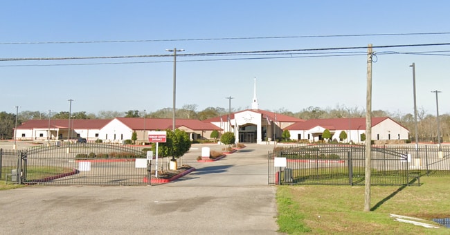
Property Detail
7620 Fm 521 Rd
Houston-Pasadena-The Woodlands, TX
0031 WM HALL, ACRES 24.845, (PT) UNRESTRICTED RESERVE A, WORD OF RESTORATION CHRISTIAN FELLOWSHIP CHURCH
0025-00-000-0170-907
FORT BEND
Taxexempt
Texas
SZ
3.91 AC
0
Southwest Outlier
2025
Houston
674506
NEARBY LISTINGS FOR SALE OR LEASE
DEMOGRAPHICS near 7620 Fm 521 Rd
1 mile
3 mile
5 mile
2025 Total Population
4,231
37,943
105,265
2030 Population
5,056
43,993
120,785
Pop Growth 2025-2030
+ 19.50%
+ 15.94%
+ 14.74%
Average Age
33
35
35
2025 Total Households
1,340
11,502
31,907
HH Growth 2025-2030
+ 19.85%
+ 16.32%
+ 15.12%
Median Household Inc
$79,281
$108,753
$111,473
Avg Household Size
3.10
3.30
3.30
2025 Avg HH Vehicles
2.00
2.00
2.00
Median Home Value
$282,347
$355,637
$353,553
Median Year Built
2010
2010
2010
Nearby Places
Map Layers
Map Styles
 Street
 Aerial
Layers
 Traffic
 Biking
Places
Listings with unknown addresses are not visible on the map
- Restaurants
- Banks
- Shops
- Fitness
- Groceries
PUBLIC TRANSPORTATION
AIRPORT
William P Hobby
Drive
Walk
Distance
William P Hobby
38 min
21.5 mi
Freight Ports
Port of Houston
Drive
Walk
Distance
Port of Houston
43 min
26.1 mi
Nearby Properties
Address
Land Use
TOTAL SIZE
Lot Size
Zoning
Address
Land Use
TOTAL SIZE
Lot Size
Zoning
Address
Land Use
TOTAL SIZE
Lot Size
Zoning
359,733 SF
62.50 AC
Address
Land Use
TOTAL SIZE
Lot Size
Zoning
228,566 SF
31.85 AC
Address
Land Use
TOTAL SIZE
Lot Size
Zoning
16.28 AC
Address
Land Use
TOTAL SIZE
Lot Size
Zoning
123,079 SF
14.99 AC
Address
Land Use
TOTAL SIZE
Lot Size
Zoning
Address
Land Use
TOTAL SIZE
Lot Size
Zoning
537.89 AC
Address
Land Use
TOTAL SIZE
Lot Size
Zoning
127,500 SF
7.60 AC
Address
Land Use
TOTAL SIZE
Lot Size
Zoning
70,000 SF
64.91 AC
Address
Land Use
TOTAL SIZE
Lot Size
Zoning
21,410 SF
16 AC
Address
Land Use
TOTAL SIZE
Lot Size
Zoning
2,000 SF
24.85 AC
Address
Land Use
TOTAL SIZE
Lot Size
Zoning
28,633 SF
9.36 AC
Address
Land Use
TOTAL SIZE
Lot Size
Zoning
224.26 AC
Address
Land Use
TOTAL SIZE
Lot Size
Zoning
4.30 AC
Address
Land Use
TOTAL SIZE
Lot Size
Zoning
37,000 SF
6.06 AC
0218
Address
Land Use
TOTAL SIZE
Lot Size
Zoning
274.73 AC
Address
Land Use
TOTAL SIZE
Lot Size
Zoning
Address
Land Use
TOTAL SIZE
Lot Size
Zoning
19.05 AC
Address
Land Use
TOTAL SIZE
Lot Size
Zoning
91.43 AC
SQ
Address
Land Use
TOTAL SIZE
Lot Size
Zoning
2.31 AC
S
Address
Land Use
TOTAL SIZE
Lot Size
Zoning
7.86 AC
SN
Address
Land Use
TOTAL SIZE
Lot Size
Zoning
Address
Land Use
TOTAL SIZE
Lot Size
Zoning
16,512 SF
3.04 AC
Address
Land Use
TOTAL SIZE
Lot Size
Zoning
Address
Land Use
TOTAL SIZE
Lot Size
Zoning
Address
Land Use
TOTAL SIZE
Lot Size
Zoning
14,543 SF
2.22 AC
Address
Land Use
TOTAL SIZE
Lot Size
Zoning
Address
Land Use
TOTAL SIZE
Lot Size
Zoning
1.86 AC
Address
Land Use
TOTAL SIZE
Lot Size
Zoning
35,930 SF
2.46 AC
0261
Address
Land Use
TOTAL SIZE
Lot Size
Zoning
41,540 SF
5.71 AC
The World's #1 Commercial Real Estate Marketplace
Connect with us
© 2026 CoStar Group
The information above has been obtained from sources believed reliable. While we do not doubt its accuracy we have not verified it and make no guarantee, warranty or representation about it. It is your responsibility to independently confirm its accuracy and completeness. Any projections, opinions, assumptions, or estimates used are for example only and do not represent the current or future performance of the property. The value of this transaction to you depends on tax and other factors which should be evaluated by your tax, financial, and legal advisors. You and your advisors should conduct a careful, independent investigation of the property to determine to your satisfaction the suitability of the property for your needs.