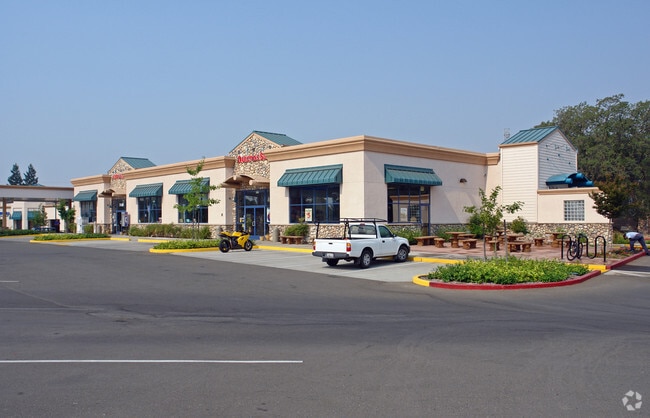
Property Record
7620 Folsom Auburn Rd, Folsom, CA 95630


NEARBY LISTINGS FOR SALE OR LEASE
Property Detail
7620 Folsom Auburn Rd
Sacramento--Roseville--Arden-Arcade, CA
Parcel Map
227-0190-030
PARCEL MAP, LOT A
Servicestation
Sacramento
X
California
06067C0108J
a
2024
1.99 AC
2025
Folsom
008210
Sacramento
7,464 SF
DEMOGRAPHICS near 7620 Folsom Auburn Rd
1 Mile
3 Mile
5 Mile
2024 Total Population
6,409
57,485
176,164
2029 Population
6,449
58,674
179,919
Pop Growth 2024-2029
+ 0.62%
+ 2.07%
+ 2.13%
Average Age
48
43
42
2024 Total Households
2,135
20,794
64,008
HH Growth 2024-2029
+ 0.70%
+ 2.19%
+ 2.16%
Median Household Inc
$104,024
$110,378
$119,050
Avg Household Size
2.20
2.50
2.60
2024 Avg HH Vehicles
2.00
2.00
2.00
Median Home Value
$720,316
$713,270
$694,854
Median Year Built
1983
1986
1988
Nearby Places
Map Layers
Map Styles
 Street
 Aerial
- Restaurants
- Banks
- Shops
- Fitness
- Groceries
PUBLIC TRANSPORTATION
COMMUTER RAIL
Roseville (California Zephyr - Amtrak, Capitol Corridor - Amtrak)
DRIVE
WALK
Distance
Roseville (California Zephyr - Amtrak, Capitol Corridor - Amtrak)
19 min
10.0 mi
AIRPORT
Sacramento International
DRIVE
WALK
Distance
Sacramento International
43 min
29.6 mi
Freight Ports
Port of Stockton
DRIVE
WALK
Distance
Port of Stockton
83 min
69.6 mi
Nearby Properties
Address
Land Use
TOTAL SIZE
Lot Size
Zoning
Address
Land Use
TOTAL SIZE
Lot Size
Zoning
424,801 SF
32.65 AC
R-M (PD)
Address
Land Use
TOTAL SIZE
Lot Size
Zoning
129,465 SF
8.30 AC
C-1 (PD)
Address
Land Use
TOTAL SIZE
Lot Size
Zoning
115,076 SF
22.09 AC
SP-INDUSTR
Address
Land Use
TOTAL SIZE
Lot Size
Zoning
289,557 SF
28.31 AC
R-M (PD)
Address
Land Use
TOTAL SIZE
Lot Size
Zoning
264,478 SF
13.46 AC
R-M (PD)
Address
Land Use
TOTAL SIZE
Lot Size
Zoning
415,320 SF
32.51 AC
R-M (PD) O
Address
Land Use
TOTAL SIZE
Lot Size
Zoning
157,580 SF
16.93 AC
R-M
Address
Land Use
TOTAL SIZE
Lot Size
Zoning
54,336 SF
4.88 AC
BP (PD)
Address
Land Use
TOTAL SIZE
Lot Size
Zoning
10,800 SF
6.70 AC
RAB100
Address
Land Use
TOTAL SIZE
Lot Size
Zoning
153,983 SF
4.16 AC
MU
Address
Land Use
TOTAL SIZE
Lot Size
Zoning
121,155 SF
4.70 AC
C-2 (PD)
Address
Land Use
TOTAL SIZE
Lot Size
Zoning
137,447 SF
10.90 AC
C1UPDC
Address
Land Use
TOTAL SIZE
Lot Size
Zoning
138,332 SF
13.70 AC
R-M (PD)
Address
Land Use
TOTAL SIZE
Lot Size
Zoning
121,190 SF
6.65 AC
R-4 (PD)
Address
Land Use
TOTAL SIZE
Lot Size
Zoning
120,556 SF
14.77 AC
C-2 (PD)
Address
Land Use
TOTAL SIZE
Lot Size
Zoning
134,216 SF
7.79 AC
SPA
Address
Land Use
TOTAL SIZE
Lot Size
Zoning
132,670 SF
12.84 AC
C-2 (PD)
Address
Land Use
TOTAL SIZE
Lot Size
Zoning
139,734 SF
8.03 AC
SPA
Address
Land Use
TOTAL SIZE
Lot Size
Zoning
65,961 SF
7.56 AC
SP-C-2 (SP
Address
Land Use
TOTAL SIZE
Lot Size
Zoning
138,416 SF
10.19 AC
C-2 (PD)
Address
Land Use
TOTAL SIZE
Lot Size
Zoning
90,530 SF
4.32 AC
BP (PD)
Address
Land Use
TOTAL SIZE
Lot Size
Zoning
10.11 AC
SP-RM-17 (
Address
Land Use
TOTAL SIZE
Lot Size
Zoning
52,774 SF
4.70 AC
C-2 (PD)
Address
Land Use
TOTAL SIZE
Lot Size
Zoning
104,127 SF
10.24 AC
C-2 (PD)
Address
Land Use
TOTAL SIZE
Lot Size
Zoning
56,200 SF
4.79 AC
C-2 (PD)
Address
Land Use
TOTAL SIZE
Lot Size
Zoning
Address
Land Use
TOTAL SIZE
Lot Size
Zoning
79,080 SF
6.71 AC
C-2 (PD)
Address
Land Use
TOTAL SIZE
Lot Size
Zoning
95,018 SF
9.85 AC
C-2 (PD)
Address
Land Use
TOTAL SIZE
Lot Size
Zoning
60,037 SF
1.57 AC
BP (PD)
Address
Land Use
TOTAL SIZE
Lot Size
Zoning
31,722 SF
151.30 AC
RSAGB40
The World's #1 Commercial Real Estate Marketplace
Connect with us
© 2026 CoStar Group
The information above has been obtained from sources believed reliable. While we do not doubt its accuracy we have not verified it and make no guarantee, warranty or representation about it. It is your responsibility to independently confirm its accuracy and completeness. Any projections, opinions, assumptions, or estimates used are for example only and do not represent the current or future performance of the property. The value of this transaction to you depends on tax and other factors which should be evaluated by your tax, financial, and legal advisors. You and your advisors should conduct a careful, independent investigation of the property to determine to your satisfaction the suitability of the property for your needs.