Property Record
7620 S Osborne Rd, Upper Marlboro, MD 20772


NEARBY LISTINGS FOR SALE OR LEASE
-
-
View all Upper Marlboro listings for sale on LoopNet.com
Property Detail
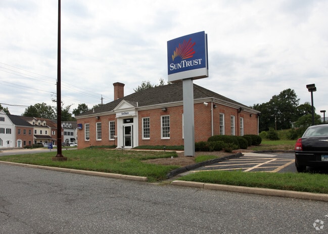
7620 S Osborne Rd
Washington-Arlington-Alexandria, DC-VA-MD-WV
Osborne Shopping Center Prcl D
15-1711191
PARCEL D L4081 F347
Financialbuilding
Prince George's
X
Maryland
24033C0270E
4081
2024
0.83 AC
2025
Branch Avenue Corridor
800707
Washington, DC
2,280 SF
DEMOGRAPHICS near 7620 S Osborne Rd
1 Mile
3 Mile
5 Mile
2024 Total Population
2,160
28,447
62,222
2029 Population
2,124
27,760
61,019
Pop Growth 2024-2029
(1.67%)
(2.42%)
(1.93%)
Average Age
44
42
42
2024 Total Households
831
10,097
22,612
HH Growth 2024-2029
(1.68%)
(2.52%)
(2.02%)
Median Household Inc
$112,575
$130,902
$129,084
Avg Household Size
2.50
2.80
2.70
2024 Avg HH Vehicles
2.00
2.00
2.00
Median Home Value
$379,817
$418,829
$418,653
Median Year Built
1992
1993
1993
Nearby Places
Map Layers
Map Styles
 Street
 Aerial
- Restaurants
- Banks
- Shops
- Fitness
- Groceries
PUBLIC TRANSPORTATION
AIRPORT
Ronald Reagan Washington Ntl
DRIVE
WALK
Distance
Ronald Reagan Washington Ntl
39 min
19.7 mi
Baltimore/Washington International Thurgood Marshall
DRIVE
WALK
Distance
Baltimore/Washington International Thurgood Marshall
52 min
35.3 mi
Freight Ports
Port of Baltimore
DRIVE
WALK
Distance
Port of Baltimore
60 min
40.8 mi
SALE & LEASE HISTORY
LISTING DATE
SALE/LEASE

Sep 24, 2016
For Sale
Nearby Properties
Address
Land Use
TOTAL SIZE
Lot Size
Zoning
Address
Land Use
TOTAL SIZE
Lot Size
Zoning
28.85 AC
RR
Address
Land Use
TOTAL SIZE
Lot Size
Zoning
207,504 SF
8.84 AC
I1
Address
Land Use
TOTAL SIZE
Lot Size
Zoning
115,500 SF
3.10 AC
IE
Address
Land Use
TOTAL SIZE
Lot Size
Zoning
190,603 SF
16.08 AC
RMF20
Address
Land Use
TOTAL SIZE
Lot Size
Zoning
55,450 SF
7.76 AC
CGO
Address
Land Use
TOTAL SIZE
Lot Size
Zoning
7.22 AC
RR
Address
Land Use
TOTAL SIZE
Lot Size
Zoning
132,574 SF
25 AC
AR
Address
Land Use
TOTAL SIZE
Lot Size
Zoning
109,507 SF
10.21 AC
RSF95
Address
Land Use
TOTAL SIZE
Lot Size
Zoning
48,247 SF
26.15 AC
AR
Address
Land Use
TOTAL SIZE
Lot Size
Zoning
102,000 SF
6.91 AC
I1
Address
Land Use
TOTAL SIZE
Lot Size
Zoning
94,295 SF
10.02 AC
RR
Address
Land Use
TOTAL SIZE
Lot Size
Zoning
33,350 SF
24.12 AC
RR
Address
Land Use
TOTAL SIZE
Lot Size
Zoning
40,764 SF
4.69 AC
IE
Address
Land Use
TOTAL SIZE
Lot Size
Zoning
106,182 SF
7.07 AC
RMF20
Address
Land Use
TOTAL SIZE
Lot Size
Zoning
2.49 AC
CGO
Address
Land Use
TOTAL SIZE
Lot Size
Zoning
46,000 SF
3.93 AC
IE
Address
Land Use
TOTAL SIZE
Lot Size
Zoning
108,378 SF
5.11 AC
I1
Address
Land Use
TOTAL SIZE
Lot Size
Zoning
29,206 SF
4.57 AC
CGO
Address
Land Use
TOTAL SIZE
Lot Size
Zoning
55,547 SF
10 AC
RR
Address
Land Use
TOTAL SIZE
Lot Size
Zoning
72.67 AC
TACE
Address
Land Use
TOTAL SIZE
Lot Size
Zoning
44,710 SF
10.05 AC
ROS
Address
Land Use
TOTAL SIZE
Lot Size
Zoning
10,662 SF
1.72 AC
CGO
Address
Land Use
TOTAL SIZE
Lot Size
Zoning
1,400 SF
4.27 AC
CGO
Address
Land Use
TOTAL SIZE
Lot Size
Zoning
76,336 SF
5.93 AC
CGO
Address
Land Use
TOTAL SIZE
Lot Size
Zoning
35,125 SF
21.47 AC
RR
Address
Land Use
TOTAL SIZE
Lot Size
Zoning
34,226 SF
21.72 AC
AR
Address
Land Use
TOTAL SIZE
Lot Size
Zoning
341.03 AC
ROS
Address
Land Use
TOTAL SIZE
Lot Size
Zoning
4,701 SF
2.01 AC
CN
Address
Land Use
TOTAL SIZE
Lot Size
Zoning
42,300 SF
2.30 AC
IE
Address
Land Use
TOTAL SIZE
Lot Size
Zoning
398.62 AC
ROS
The World's #1 Commercial Real Estate Marketplace
Connect with us
© 2025 CoStar Group
The information above has been obtained from sources believed reliable. While we do not doubt its accuracy we have not verified it and make no guarantee, warranty or representation about it. It is your responsibility to independently confirm its accuracy and completeness. Any projections, opinions, assumptions, or estimates used are for example only and do not represent the current or future performance of the property. The value of this transaction to you depends on tax and other factors which should be evaluated by your tax, financial, and legal advisors. You and your advisors should conduct a careful, independent investigation of the property to determine to your satisfaction the suitability of the property for your needs.