Property Record
7621 E Kemper Rd, Cincinnati, OH 45249


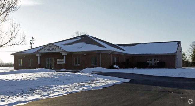
Property Detail
7621 E Kemper Rd
Cincinnati, OH-KY-IN
E KEMPER RD 1.6204 ACSS7 T3 R2
600-0140-0448
Hamilton
Officebuilding
Ohio
B and X Area of moderate flood hazard, usually the area between the limits of the 100-year and 500-year floods.
1.62 AC
2025
Mason/Montgomery
2025
Cincinnati/Dayton
022302
NEARBY LISTINGS FOR SALE OR LEASE
DEMOGRAPHICS near 7621 E Kemper Rd
1 mile
3 mile
5 mile
2025 Total Population
4,075
54,856
146,372
2030 Population
4,086
55,886
149,374
Pop Growth 2025-2030
+ 0.27%
+ 1.88%
+ 2.05%
Average Age
43
41
41
2025 Total Households
1,718
21,312
57,126
HH Growth 2025-2030
+ 0.23%
+ 1.80%
+ 2.06%
Median Household Inc
$84,780
$111,862
$113,148
Avg Household Size
2.30
2.50
2.50
2025 Avg HH Vehicles
2.00
2.00
2.00
Median Home Value
$308,073
$400,949
$376,312
Median Year Built
1983
1983
1983
Nearby Places
Map Layers
Map Styles
 Street
 Aerial
Transit
 Traffic
 Biking
Places
Listings with unknown addresses are not visible on the map
- Restaurants
- Banks
- Shops
- Fitness
- Groceries
PUBLIC TRANSPORTATION
AIRPORT
Cincinnati/Northern Kentucky International
Drive
Walk
Distance
Cincinnati/Northern Kentucky International
49 min
31.2 mi
Nearby Properties
Address
Land Use
TOTAL SIZE
Lot Size
Zoning
Address
Land Use
TOTAL SIZE
Lot Size
Zoning
74.81 AC
Address
Land Use
TOTAL SIZE
Lot Size
Zoning
6.03 AC
Address
Land Use
TOTAL SIZE
Lot Size
Zoning
274,436 SF
27.12 AC
Address
Land Use
TOTAL SIZE
Lot Size
Zoning
80,767 SF
7.31 AC
Address
Land Use
TOTAL SIZE
Lot Size
Zoning
58.52 AC
Address
Land Use
TOTAL SIZE
Lot Size
Zoning
29.31 AC
DD
Address
Land Use
TOTAL SIZE
Lot Size
Zoning
29.79 AC
M1
Address
Land Use
TOTAL SIZE
Lot Size
Zoning
71,866 SF
14.33 AC
Address
Land Use
TOTAL SIZE
Lot Size
Zoning
Address
Land Use
TOTAL SIZE
Lot Size
Zoning
124.81 AC
Address
Land Use
TOTAL SIZE
Lot Size
Zoning
29.95 AC
Address
Land Use
TOTAL SIZE
Lot Size
Zoning
47,788 SF
25.84 AC
Address
Land Use
TOTAL SIZE
Lot Size
Zoning
Address
Land Use
TOTAL SIZE
Lot Size
Zoning
28.73 AC
DD
Address
Land Use
TOTAL SIZE
Lot Size
Zoning
10.87 AC
OO
Address
Land Use
TOTAL SIZE
Lot Size
Zoning
121,429 SF
14.59 AC
Address
Land Use
TOTAL SIZE
Lot Size
Zoning
Address
Land Use
TOTAL SIZE
Lot Size
Zoning
211,734 SF
18.14 AC
Address
Land Use
TOTAL SIZE
Lot Size
Zoning
67,636 SF
8.74 AC
Address
Land Use
TOTAL SIZE
Lot Size
Zoning
555 SF
7.20 AC
M1
Address
Land Use
TOTAL SIZE
Lot Size
Zoning
19.25 AC
E
Address
Land Use
TOTAL SIZE
Lot Size
Zoning
116,775 SF
12.37 AC
Address
Land Use
TOTAL SIZE
Lot Size
Zoning
2,173 SF
22 AC
E
Address
Land Use
TOTAL SIZE
Lot Size
Zoning
16.76 AC
EE
Address
Land Use
TOTAL SIZE
Lot Size
Zoning
30,844 SF
15.87 AC
Address
Land Use
TOTAL SIZE
Lot Size
Zoning
11,880 SF
23.07 AC
DD
Address
Land Use
TOTAL SIZE
Lot Size
Zoning
8.77 AC
O
Address
Land Use
TOTAL SIZE
Lot Size
Zoning
3,608 SF
8.05 AC
M1
Address
Land Use
TOTAL SIZE
Lot Size
Zoning
27.35 AC
A
Address
Land Use
TOTAL SIZE
Lot Size
Zoning
17.10 AC
The World's #1 Commercial Real Estate Marketplace
Connect with us
© 2026 CoStar Group
The information above has been obtained from sources believed reliable. While we do not doubt its accuracy we have not verified it and make no guarantee, warranty or representation about it. It is your responsibility to independently confirm its accuracy and completeness. Any projections, opinions, assumptions, or estimates used are for example only and do not represent the current or future performance of the property. The value of this transaction to you depends on tax and other factors which should be evaluated by your tax, financial, and legal advisors. You and your advisors should conduct a careful, independent investigation of the property to determine to your satisfaction the suitability of the property for your needs.