Property Record
7630 Byron Ave, Miami Beach, FL 33141
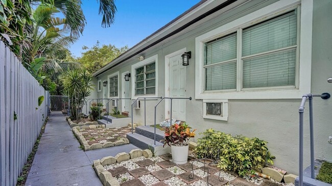


This Property Is For Sale
Property Detail
7630 Byron Ave
02-3202-007-1850
ALTOS DEL MAR NO 3 PB 8-41 LOT 11 BLK 22 LOT SIZE 50.000 X 113 OR 18996-3705 01 2000 5
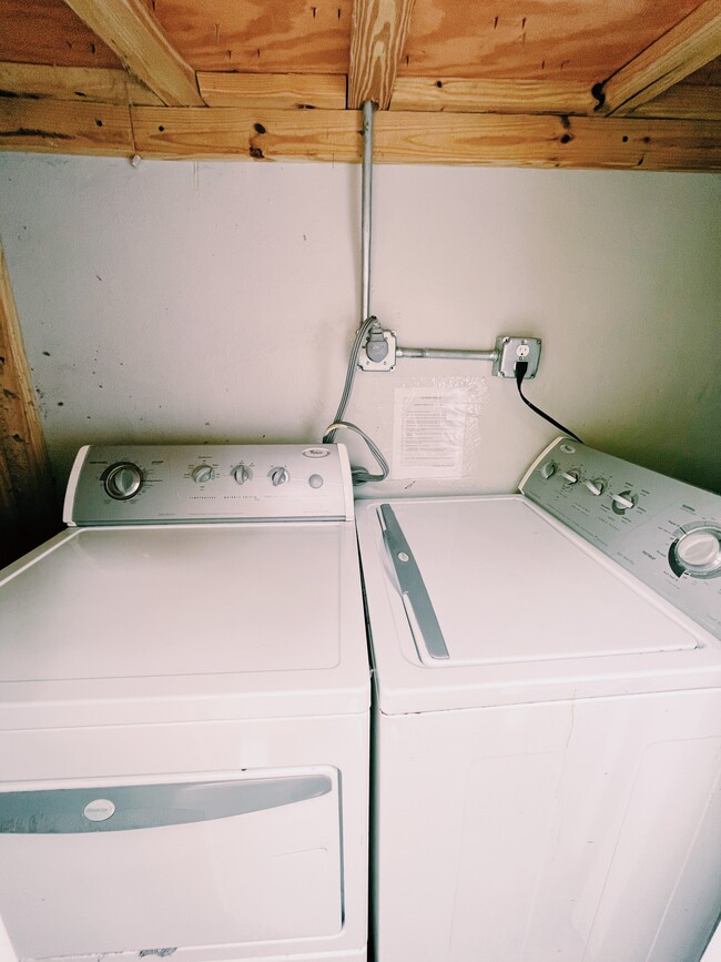
Multifamilydwelling
Miami-Dade
3900
Florida
AE The base floodplain where base flood elevations are provided. AE Zones are now used on new format FIRMs instead of A1-A30 Zones.
11
2025
0.13 AC
2025
North Shore
003913
South Florida
3,400 SF
Miami-Miami Beach-Kendall, FL
NEARBY LISTINGS FOR SALE OR LEASE
DEMOGRAPHICS near 7630 Byron Ave
1 mile
3 mile
5 mile
2025 Total Population
30,494
98,692
252,470
2030 Population
33,677
110,867
279,272
Pop Growth 2025-2030
+ 10.44%
+ 12.34%
+ 10.62%
Average Age
45
45
43
2025 Total Households
14,732
45,980
107,330
HH Growth 2025-2030
+ 10.56%
+ 12.50%
+ 11.02%
Median Household Inc
$62,363
$84,179
$73,096
Avg Household Size
2.00
2.10
2.20
2025 Avg HH Vehicles
1.00
1.00
1.00
Median Home Value
$694,111
$825,605
$757,124
Median Year Built
1968
1970
1970
Nearby Places
Map Layers
Map Styles
 Street
 Aerial
Layers
 Traffic
 Biking
Places
Listings with unknown addresses are not visible on the map
- Restaurants
- Banks
- Shops
- Fitness
- Groceries
PUBLIC TRANSPORTATION
COMMUTER RAIL
Aventura (Mainline - Brightline)
Drive
Walk
Distance
Aventura (Mainline - Brightline)
21 min
9.4 mi
AIRPORT
Miami International
Drive
Walk
Distance
Miami International
35 min
17.1 mi
Fort Lauderdale/Hollywood International
Drive
Walk
Distance
Fort Lauderdale/Hollywood International
36 min
18.5 mi
Freight Ports
Port of Miami
Drive
Walk
Distance
Port of Miami
27 min
11.9 mi
Nearby Properties
Address
Land Use
TOTAL SIZE
Lot Size
Zoning
Address
Land Use
TOTAL SIZE
Lot Size
Zoning
610,395 SF
13 AC
6000
Address
Land Use
TOTAL SIZE
Lot Size
Zoning
698,111 SF
4.47 AC
4100
Address
Land Use
TOTAL SIZE
Lot Size
Zoning
908,095 SF
8.17 AC
6400
Address
Land Use
TOTAL SIZE
Lot Size
Zoning
657,769 SF
6.12 AC
6200
Address
Land Use
TOTAL SIZE
Lot Size
Zoning
446,889 SF
3.06 AC
4100
Address
Land Use
TOTAL SIZE
Lot Size
Zoning
567,884 SF
4.51 AC
4000
Address
Land Use
TOTAL SIZE
Lot Size
Zoning
595,788 SF
3.82 AC
4100
Address
Land Use
TOTAL SIZE
Lot Size
Zoning
554,506 SF
2.14 AC
4100
Address
Land Use
TOTAL SIZE
Lot Size
Zoning
206,129 SF
2.55 AC
5000
Address
Land Use
TOTAL SIZE
Lot Size
Zoning
262,929 SF
2.39 AC
4100
Address
Land Use
TOTAL SIZE
Lot Size
Zoning
502,094 SF
2.70 AC
4100
Address
Land Use
TOTAL SIZE
Lot Size
Zoning
68,304 SF
2.27 AC
6405
Address
Land Use
TOTAL SIZE
Lot Size
Zoning
309,292 SF
1.70 AC
5000
Address
Land Use
TOTAL SIZE
Lot Size
Zoning
157,410 SF
1.44 AC
5000
Address
Land Use
TOTAL SIZE
Lot Size
Zoning
1.84 AC
0100
Address
Land Use
TOTAL SIZE
Lot Size
Zoning
30,500 SF
0.86 AC
5000
Address
Land Use
TOTAL SIZE
Lot Size
Zoning
182,918 SF
1.07 AC
4100
Address
Land Use
TOTAL SIZE
Lot Size
Zoning
246,217 SF
1.14 AC
4100
Address
Land Use
TOTAL SIZE
Lot Size
Zoning
1.84 AC
1100
Address
Land Use
TOTAL SIZE
Lot Size
Zoning
190,132 SF
1.71 AC
3900
Address
Land Use
TOTAL SIZE
Lot Size
Zoning
181,888 SF
4.46 AC
5000
Address
Land Use
TOTAL SIZE
Lot Size
Zoning
13,360 SF
0.87 AC
5000
Address
Land Use
TOTAL SIZE
Lot Size
Zoning
1.84 AC
0100
Address
Land Use
TOTAL SIZE
Lot Size
Zoning
1.84 AC
0100
Address
Land Use
TOTAL SIZE
Lot Size
Zoning
12,066 SF
1.52 AC
2100
Address
Land Use
TOTAL SIZE
Lot Size
Zoning
1.84 AC
0100
Address
Land Use
TOTAL SIZE
Lot Size
Zoning
1.84 AC
0100
Address
Land Use
TOTAL SIZE
Lot Size
Zoning
88,000 SF
3.06 AC
4500
Address
Land Use
TOTAL SIZE
Lot Size
Zoning
17,426 SF
3.34 AC
6000
The World's #1 Commercial Real Estate Marketplace
Connect with us
© 2026 CoStar Group
The information above has been obtained from sources believed reliable. While we do not doubt its accuracy we have not verified it and make no guarantee, warranty or representation about it. It is your responsibility to independently confirm its accuracy and completeness. Any projections, opinions, assumptions, or estimates used are for example only and do not represent the current or future performance of the property. The value of this transaction to you depends on tax and other factors which should be evaluated by your tax, financial, and legal advisors. You and your advisors should conduct a careful, independent investigation of the property to determine to your satisfaction the suitability of the property for your needs.