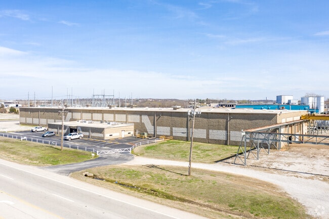
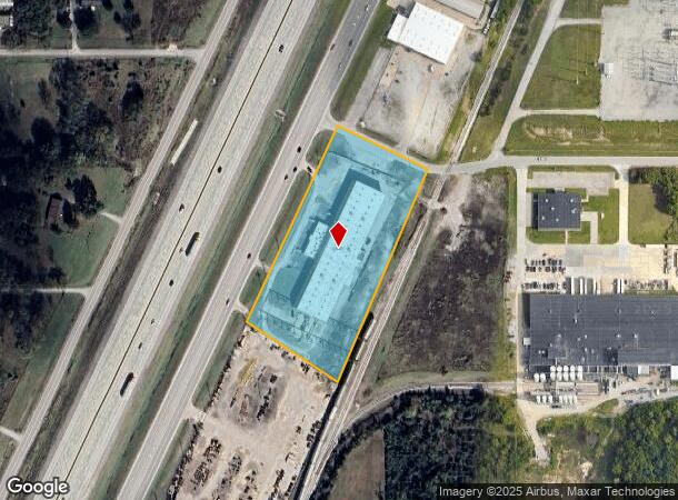
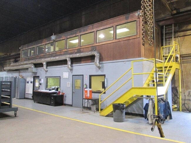
Property Record
7631 State Highway 66, Tulsa, OK 74131
NEARBY LISTINGS FOR SALE OR LEASE
Property Detail
7631 State Highway 66
0000-07-018-012-0-028-00
7-18-12 BEG 110.44 S89'42 10 E OF CENTER OF SEC N2 5'15 13 E131.57 S64'44 47 E282.72 S23'03 50 W656.7 7 N57'16 28 W310.46 N25
Commercialnec
Creek
X
Oklahoma
40037C0190D
4.33 AC
2024
Creek County
2025
Tulsa
020101
Tulsa, OK
39,610 SF
DEMOGRAPHICS near 7631 State Highway 66
1 Mile
3 Mile
5 Mile
2024 Total Population
1,079
14,596
60,988
2029 Population
1,097
15,193
63,349
Pop Growth 2024-2029
+ 1.67%
+ 4.09%
+ 3.87%
Average Age
40
41
40
2024 Total Households
410
5,579
23,746
HH Growth 2024-2029
+ 1.71%
+ 4.05%
+ 3.84%
Median Household Inc
$60,268
$64,000
$61,271
Avg Household Size
2.50
2.50
2.50
2024 Avg HH Vehicles
2.00
2.00
2.00
Median Home Value
$165,137
$195,905
$177,459
Median Year Built
1985
1986
1981
Nearby Places
Map Layers
Map Styles
 Street
 Aerial
- Restaurants
- Banks
- Shops
- Fitness
- Groceries
PUBLIC TRANSPORTATION
AIRPORT
Tulsa International
DRIVE
WALK
Distance
Tulsa International
26 min
18.0 mi
Freight Ports
Tulsa Port Of Catoosa
DRIVE
WALK
Distance
Tulsa Port Of Catoosa
35 min
27.2 mi
SALE & LEASE HISTORY
LISTING DATE
SALE/LEASE

Oct 09, 2018
For Lease
Aug 17, 2020
For Sale
Nearby Properties
Address
Land Use
TOTAL SIZE
Lot Size
Zoning
Address
Land Use
TOTAL SIZE
Lot Size
Zoning
1,134,776 SF
35.85 AC
CN
Address
Land Use
TOTAL SIZE
Lot Size
Zoning
143,520 SF
25.14 AC
IM
Address
Land Use
TOTAL SIZE
Lot Size
Zoning
47,670 SF
10.05 AC
RS
Address
Land Use
TOTAL SIZE
Lot Size
Zoning
251,601 SF
16.75 AC
RM1
Address
Land Use
TOTAL SIZE
Lot Size
Zoning
117,372 SF
11.87 AC
CN
Address
Land Use
TOTAL SIZE
Lot Size
Zoning
20,771 SF
1.11 AC
RS3
Address
Land Use
TOTAL SIZE
Lot Size
Zoning
370,891 SF
26.43 AC
IM
Address
Land Use
TOTAL SIZE
Lot Size
Zoning
38,940 SF
16.24 AC
Address
Land Use
TOTAL SIZE
Lot Size
Zoning
2,152 SF
8.88 AC
Address
Land Use
TOTAL SIZE
Lot Size
Zoning
31,600 SF
13.46 AC
Address
Land Use
TOTAL SIZE
Lot Size
Zoning
41,444 SF
4.71 AC
CG
Address
Land Use
TOTAL SIZE
Lot Size
Zoning
4,785 SF
7.34 AC
Address
Land Use
TOTAL SIZE
Lot Size
Zoning
23,100 SF
30 AC
IM
Address
Land Use
TOTAL SIZE
Lot Size
Zoning
9,282 SF
4.83 AC
Address
Land Use
TOTAL SIZE
Lot Size
Zoning
52,050 SF
16.29 AC
Address
Land Use
TOTAL SIZE
Lot Size
Zoning
15,230 SF
8.65 AC
Address
Land Use
TOTAL SIZE
Lot Size
Zoning
86,700 SF
22.68 AC
Address
Land Use
TOTAL SIZE
Lot Size
Zoning
66,975 SF
7.80 AC
Address
Land Use
TOTAL SIZE
Lot Size
Zoning
172,256 SF
10.76 AC
Address
Land Use
TOTAL SIZE
Lot Size
Zoning
20,625 SF
13.39 AC
TM
Address
Land Use
TOTAL SIZE
Lot Size
Zoning
22,721 SF
13.12 AC
Address
Land Use
TOTAL SIZE
Lot Size
Zoning
59,780 SF
10.01 AC
IM
Address
Land Use
TOTAL SIZE
Lot Size
Zoning
8,250 SF
Address
Land Use
TOTAL SIZE
Lot Size
Zoning
8,240 SF
8.45 AC
Address
Land Use
TOTAL SIZE
Lot Size
Zoning
9,600 SF
3.02 AC
Address
Land Use
TOTAL SIZE
Lot Size
Zoning
9,360 SF
3.85 AC
C2
Address
Land Use
TOTAL SIZE
Lot Size
Zoning
1,360 SF
11.70 AC
Address
Land Use
TOTAL SIZE
Lot Size
Zoning
117,020 SF
8.46 AC
IL
Address
Land Use
TOTAL SIZE
Lot Size
Zoning
80,800 SF
11.94 AC
The World's #1 Commercial Real Estate Marketplace
Connect with us
© 2025 CoStar Group
The information above has been obtained from sources believed reliable. While we do not doubt its accuracy we have not verified it and make no guarantee, warranty or representation about it. It is your responsibility to independently confirm its accuracy and completeness. Any projections, opinions, assumptions, or estimates used are for example only and do not represent the current or future performance of the property. The value of this transaction to you depends on tax and other factors which should be evaluated by your tax, financial, and legal advisors. You and your advisors should conduct a careful, independent investigation of the property to determine to your satisfaction the suitability of the property for your needs.