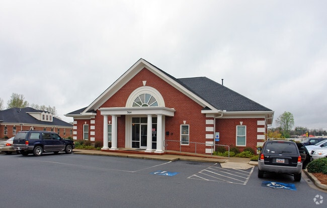
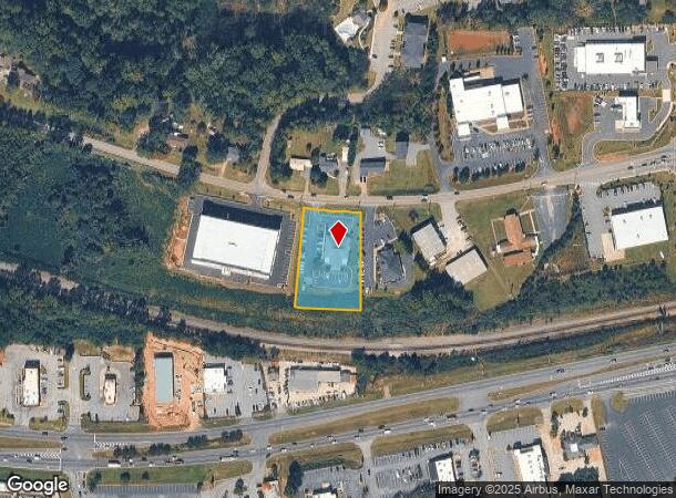
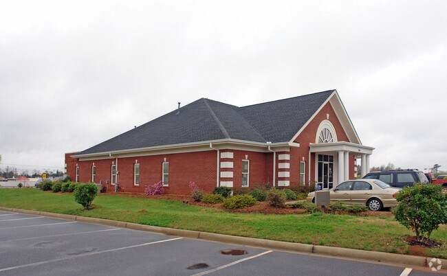
Property Record
764 Saco Lowell Rd, Easley, SC 29640
NEARBY LISTINGS FOR SALE OR LEASE
Property Detail
764 Saco Lowell Rd
5039-18-32-3379
Survey For Grace Office Park Llc
Medicalbuilding
S/SIDE SACO LOWELL RD TRACT 2 PLAT 472/15
X
Pickens
45007C0035E
South Carolina
2025
1.17 AC
2024
Outlying Pickens County
010802
Greenville/Spartanburg
5,073 SF
Greenville-Anderson-Mauldin, SC
DEMOGRAPHICS near 764 Saco Lowell Rd
1 Mile
3 Mile
5 Mile
2024 Total Population
3,745
26,810
58,686
2029 Population
3,866
28,024
61,691
Pop Growth 2024-2029
+ 3.23%
+ 4.53%
+ 5.12%
Average Age
42
42
41
2024 Total Households
1,694
11,133
23,305
HH Growth 2024-2029
+ 3.25%
+ 4.57%
+ 5.17%
Median Household Inc
$56,989
$58,970
$58,991
Avg Household Size
2.20
2.40
2.50
2024 Avg HH Vehicles
2.00
2.00
2.00
Median Home Value
$234,829
$199,868
$199,292
Median Year Built
1990
1990
1990
Nearby Places
Map Layers
Map Styles
 Street
 Aerial
- Restaurants
- Banks
- Shops
- Fitness
- Groceries
PUBLIC TRANSPORTATION
COMMUTER RAIL
DRIVE
WALK
Distance
18 min
9.6 mi
AIRPORT
Greenville Spartanburg International
DRIVE
WALK
Distance
Greenville Spartanburg International
37 min
25.5 mi
Nearby Properties
Address
Land Use
TOTAL SIZE
Lot Size
Zoning
Address
Land Use
TOTAL SIZE
Lot Size
Zoning
81,245 SF
8.49 AC
GC
Address
Land Use
TOTAL SIZE
Lot Size
Zoning
162.06 AC
R10
Address
Land Use
TOTAL SIZE
Lot Size
Zoning
16.29 AC
GENERAL CO
Address
Land Use
TOTAL SIZE
Lot Size
Zoning
10,906 SF
2.59 AC
CORE COMME
Address
Land Use
TOTAL SIZE
Lot Size
Zoning
19,164 SF
3.22 AC
GC
Address
Land Use
TOTAL SIZE
Lot Size
Zoning
13.75 AC
GC
Address
Land Use
TOTAL SIZE
Lot Size
Zoning
24,362 SF
3.84 AC
GENERAL CO
Address
Land Use
TOTAL SIZE
Lot Size
Zoning
21.71 AC
GR2
Address
Land Use
TOTAL SIZE
Lot Size
Zoning
3,344 SF
3.04 AC
GR2
Address
Land Use
TOTAL SIZE
Lot Size
Zoning
3.60 AC
CORE COMME
Address
Land Use
TOTAL SIZE
Lot Size
Zoning
49,803 SF
18.36 AC
GC
Address
Land Use
TOTAL SIZE
Lot Size
Zoning
4,200 SF
0.98 AC
GC
Address
Land Use
TOTAL SIZE
Lot Size
Zoning
220,956 SF
16.80 AC
GENERAL CO
Address
Land Use
TOTAL SIZE
Lot Size
Zoning
36.37 AC
Address
Land Use
TOTAL SIZE
Lot Size
Zoning
20,406 SF
1.26 AC
CORE COMME
Address
Land Use
TOTAL SIZE
Lot Size
Zoning
5,321 SF
3.38 AC
Address
Land Use
TOTAL SIZE
Lot Size
Zoning
5,427 SF
1.34 AC
Address
Land Use
TOTAL SIZE
Lot Size
Zoning
8.96 AC
R 10 ONE F
Address
Land Use
TOTAL SIZE
Lot Size
Zoning
7.30 AC
R 10 ONE F
Address
Land Use
TOTAL SIZE
Lot Size
Zoning
187,150 SF
19.38 AC
GC
Address
Land Use
TOTAL SIZE
Lot Size
Zoning
4,450 SF
1.28 AC
MED MEDICA
Address
Land Use
TOTAL SIZE
Lot Size
Zoning
42.26 AC
OFFICE INS
Address
Land Use
TOTAL SIZE
Lot Size
Zoning
7.09 AC
GC
Address
Land Use
TOTAL SIZE
Lot Size
Zoning
21,258 SF
15 AC
GR2
Address
Land Use
TOTAL SIZE
Lot Size
Zoning
135,439 SF
13.80 AC
GC
Address
Land Use
TOTAL SIZE
Lot Size
Zoning
41.39 AC
Address
Land Use
TOTAL SIZE
Lot Size
Zoning
54.93 AC
GC
Address
Land Use
TOTAL SIZE
Lot Size
Zoning
104,889 SF
10.68 AC
GC
Address
Land Use
TOTAL SIZE
Lot Size
Zoning
140,718 SF
18.32 AC
PUD
The World's #1 Commercial Real Estate Marketplace
Connect with us
© 2025 CoStar Group
The information above has been obtained from sources believed reliable. While we do not doubt its accuracy we have not verified it and make no guarantee, warranty or representation about it. It is your responsibility to independently confirm its accuracy and completeness. Any projections, opinions, assumptions, or estimates used are for example only and do not represent the current or future performance of the property. The value of this transaction to you depends on tax and other factors which should be evaluated by your tax, financial, and legal advisors. You and your advisors should conduct a careful, independent investigation of the property to determine to your satisfaction the suitability of the property for your needs.