Property Record
7643 Dean Rd, Nesbit, MS 38651


Property Detail
7643 Dean Rd
Memphis, TN-MS-AR
PT NW1/4 PT NW 1/4
2097350000001800
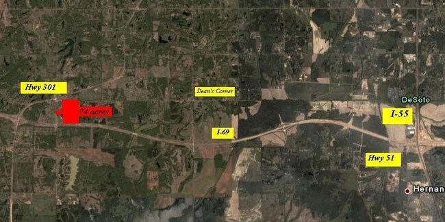
DESOTO
Vacantlandnec
Mississippi
A-R
18
A Areas with a 1% annual chance of flooding and a 26% chance of flooding over the life of a 30-year mortgage.
39.65 AC
2025
DeSoto County
2025
Memphis
070634
NEARBY LISTINGS FOR SALE OR LEASE
-
-
View all Nesbit listings for sale on LoopNet.com
DEMOGRAPHICS near 7643 Dean Rd
1 mile
3 mile
5 mile
2024 Total Population
336
1,928
6,175
2029 Population
353
2,025
6,495
Pop Growth 2024-2029
+ 5.06%
+ 5.03%
+ 5.18%
Average Age
41
41
42
2024 Total Households
123
727
2,374
HH Growth 2024-2029
+ 5.69%
+ 5.23%
+ 5.31%
Median Household Inc
$76,894
$80,696
$82,167
Avg Household Size
2.60
2.60
2.60
2024 Avg HH Vehicles
2.00
2.00
2.00
Median Home Value
$221,052
$235,333
$249,165
Median Year Built
1995
1996
1994
Nearby Places
Map Layers
Map Styles
 Street
 Aerial
Transit
 Traffic
 Biking
Places
Listings with unknown addresses are not visible on the map
- Restaurants
- Banks
- Shops
- Fitness
- Groceries
PUBLIC TRANSPORTATION
AIRPORT
Memphis International
Drive
Walk
Distance
Memphis International
36 min
26.4 mi
Freight Ports
Port of Shreveport
Drive
Walk
Distance
Port of Shreveport
427 min
354.9 mi
Nearby Properties
Address
Land Use
TOTAL SIZE
Lot Size
Zoning
Address
Land Use
TOTAL SIZE
Lot Size
Zoning
5,051 SF
1.61 AC
C-4
Address
Land Use
TOTAL SIZE
Lot Size
Zoning
5,100 SF
2 AC
C-4
Address
Land Use
TOTAL SIZE
Lot Size
Zoning
1,150 SF
328 AC
A
Address
Land Use
TOTAL SIZE
Lot Size
Zoning
1,840 SF
0.47 AC
C-4
Address
Land Use
TOTAL SIZE
Lot Size
Zoning
3,469 SF
1.25 AC
A-R
Address
Land Use
TOTAL SIZE
Lot Size
Zoning
119.11 AC
A
Address
Land Use
TOTAL SIZE
Lot Size
Zoning
0.93 AC
A-R OVERLA
Address
Land Use
TOTAL SIZE
Lot Size
Zoning
838 SF
386.20 AC
A
Address
Land Use
TOTAL SIZE
Lot Size
Zoning
254.44 AC
A-R
Address
Land Use
TOTAL SIZE
Lot Size
Zoning
494 AC
A
Address
Land Use
TOTAL SIZE
Lot Size
Zoning
0.71 AC
A-R OVERLA
Address
Land Use
TOTAL SIZE
Lot Size
Zoning
0.88 AC
A-R OVERLA
Address
Land Use
TOTAL SIZE
Lot Size
Zoning
2,178 SF
1 AC
A
Address
Land Use
TOTAL SIZE
Lot Size
Zoning
11.18 AC
A
Address
Land Use
TOTAL SIZE
Lot Size
Zoning
20 AC
A
Address
Land Use
TOTAL SIZE
Lot Size
Zoning
3 AC
A-R
Address
Land Use
TOTAL SIZE
Lot Size
Zoning
941 SF
1 AC
A-R
Address
Land Use
TOTAL SIZE
Lot Size
Zoning
11.16 AC
A
Address
Land Use
TOTAL SIZE
Lot Size
Zoning
318 AC
A-R
Address
Land Use
TOTAL SIZE
Lot Size
Zoning
1,475 SF
12.60 AC
A-R
Address
Land Use
TOTAL SIZE
Lot Size
Zoning
20 AC
A-R
Address
Land Use
TOTAL SIZE
Lot Size
Zoning
5.77 AC
A-R
Address
Land Use
TOTAL SIZE
Lot Size
Zoning
146.31 AC
A-R
Address
Land Use
TOTAL SIZE
Lot Size
Zoning
210 AC
A
Address
Land Use
TOTAL SIZE
Lot Size
Zoning
13.48 AC
A
Address
Land Use
TOTAL SIZE
Lot Size
Zoning
8.84 AC
A-R
Address
Land Use
TOTAL SIZE
Lot Size
Zoning
17.50 AC
A-R
Address
Land Use
TOTAL SIZE
Lot Size
Zoning
0.70 AC
A-R OVERLA
Address
Land Use
TOTAL SIZE
Lot Size
Zoning
0.96 AC
A-R OVERLA
Address
Land Use
TOTAL SIZE
Lot Size
Zoning
10.01 AC
A
The World's #1 Commercial Real Estate Marketplace
Connect with us
© 2026 CoStar Group
The information above has been obtained from sources believed reliable. While we do not doubt its accuracy we have not verified it and make no guarantee, warranty or representation about it. It is your responsibility to independently confirm its accuracy and completeness. Any projections, opinions, assumptions, or estimates used are for example only and do not represent the current or future performance of the property. The value of this transaction to you depends on tax and other factors which should be evaluated by your tax, financial, and legal advisors. You and your advisors should conduct a careful, independent investigation of the property to determine to your satisfaction the suitability of the property for your needs.