Property Record
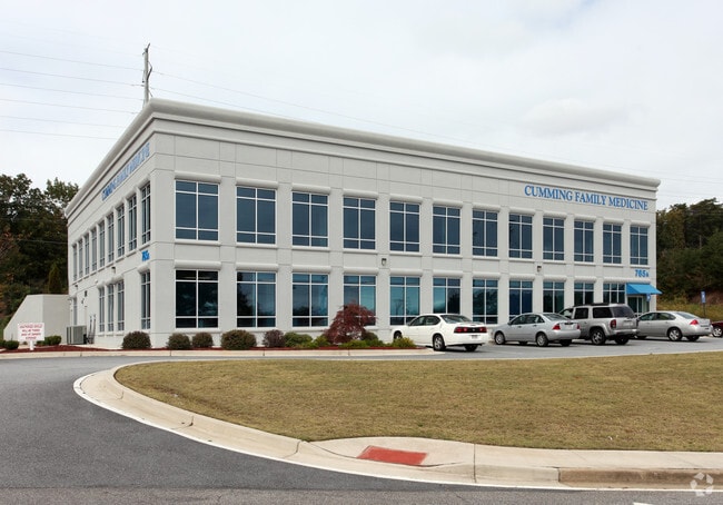
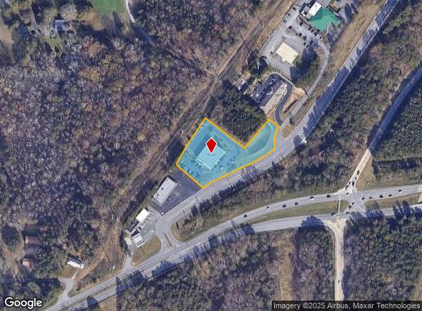
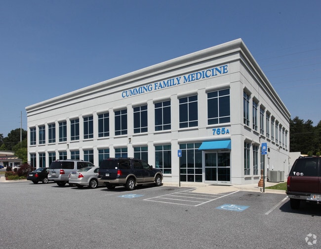
765 Lanier 400 Pky, Cumming, GA 30040
Current Lease Availabilities
NEARBY LISTINGS FOR SALE OR LEASE
Property Detail
765 Lanier 400 Pky
C35-006
Bald Ridge & Hwy 400
Commercialnec
3-1 1254-1255 TRCT 2
X
Forsyth
13117C0134F
Georgia
2024
1.78 AC
2025
N Fulton/Forsyth County
130409
Atlanta
16,000 SF
Atlanta-Sandy Springs-Roswell, GA
DEMOGRAPHICS near 765 Lanier 400 Pky
1 Mile
3 Mile
5 Mile
2024 Total Population
2,830
37,137
95,697
2029 Population
3,338
43,375
111,493
Pop Growth 2024-2029
+ 17.95%
+ 16.80%
+ 16.51%
Average Age
42
41
39
2024 Total Households
1,055
13,675
33,005
HH Growth 2024-2029
+ 18.29%
+ 16.90%
+ 16.60%
Median Household Inc
$86,019
$91,421
$109,966
Avg Household Size
2.60
2.60
2.80
2024 Avg HH Vehicles
2.00
2.00
2.00
Median Home Value
$302,315
$367,083
$420,566
Median Year Built
1994
1999
2002
Nearby Places
- Restaurants
- Banks
- Shops
- Fitness
- Groceries
Nearby Properties
Address
Land Use
TOTAL SIZE
Lot Size
Zoning
Address
Land Use
TOTAL SIZE
Lot Size
Zoning
581,433 SF
31.45 AC
INST
Address
Land Use
TOTAL SIZE
Lot Size
Zoning
8,848 SF
15.75 AC
PUD
Address
Land Use
TOTAL SIZE
Lot Size
Zoning
10.82 AC
PUD
Address
Land Use
TOTAL SIZE
Lot Size
Zoning
10.57 AC
PUD
Address
Land Use
TOTAL SIZE
Lot Size
Zoning
15,081 SF
27.53 AC
R3
Address
Land Use
TOTAL SIZE
Lot Size
Zoning
208,496 SF
23.61 AC
R3
Address
Land Use
TOTAL SIZE
Lot Size
Zoning
312,095 SF
28.86 AC
PSC
Address
Land Use
TOTAL SIZE
Lot Size
Zoning
305,332 SF
23.75 AC
CBD
Address
Land Use
TOTAL SIZE
Lot Size
Zoning
302,599 SF
35.89 AC
R3
Address
Land Use
TOTAL SIZE
Lot Size
Zoning
15,600 SF
21.98 AC
R3
Address
Land Use
TOTAL SIZE
Lot Size
Zoning
173,374 SF
32.90 AC
CBD
Address
Land Use
TOTAL SIZE
Lot Size
Zoning
6.49 AC
PUD
Address
Land Use
TOTAL SIZE
Lot Size
Zoning
171,065 SF
16.22 AC
CBD
Address
Land Use
TOTAL SIZE
Lot Size
Zoning
149,540 SF
43.76 AC
INST
Address
Land Use
TOTAL SIZE
Lot Size
Zoning
24.78 AC
INST
Address
Land Use
TOTAL SIZE
Lot Size
Zoning
62,085 SF
28.70 AC
INST
Address
Land Use
TOTAL SIZE
Lot Size
Zoning
120,750 SF
9.37 AC
INST
Address
Land Use
TOTAL SIZE
Lot Size
Zoning
65,364 SF
15.29 AC
PSC
Address
Land Use
TOTAL SIZE
Lot Size
Zoning
152,562 SF
12.80 AC
R3
Address
Land Use
TOTAL SIZE
Lot Size
Zoning
159,291 SF
29.19 AC
MU
Address
Land Use
TOTAL SIZE
Lot Size
Zoning
127,940 SF
14.30 AC
HB
Address
Land Use
TOTAL SIZE
Lot Size
Zoning
99,232 SF
Address
Land Use
TOTAL SIZE
Lot Size
Zoning
109,856 SF
12.94 AC
CBD
Address
Land Use
TOTAL SIZE
Lot Size
Zoning
267,180 SF
31.01 AC
INST
Address
Land Use
TOTAL SIZE
Lot Size
Zoning
111,194 SF
13.53 AC
NS
Address
Land Use
TOTAL SIZE
Lot Size
Zoning
85,398 SF
Address
Land Use
TOTAL SIZE
Lot Size
Zoning
268,761 SF
55.50 AC
INST
Address
Land Use
TOTAL SIZE
Lot Size
Zoning
60,392 SF
1.66 AC
CBD
Address
Land Use
TOTAL SIZE
Lot Size
Zoning
95,926 SF
34.26 AC
HB
Address
Land Use
TOTAL SIZE
Lot Size
Zoning
175,237 SF
2.13 AC
CBD
The World's #1 Commercial Real Estate Marketplace
Connect with us
© 2025 CoStar Group
The information above has been obtained from sources believed reliable. While we do not doubt its accuracy we have not verified it and make no guarantee, warranty or representation about it. It is your responsibility to independently confirm its accuracy and completeness. Any projections, opinions, assumptions, or estimates used are for example only and do not represent the current or future performance of the property. The value of this transaction to you depends on tax and other factors which should be evaluated by your tax, financial, and legal advisors. You and your advisors should conduct a careful, independent investigation of the property to determine to your satisfaction the suitability of the property for your needs.