Property Record
7650 Ne Shaleen St, Beaverton, OR 97006


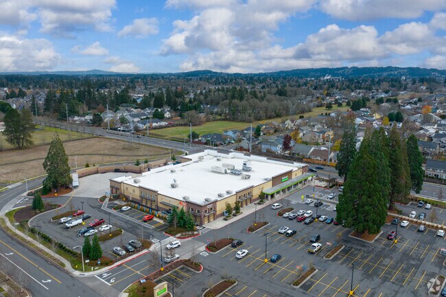
Property Detail
7650 Ne Shaleen St
R2192591
SEQUOIA VILLAGE, LOT 1, ACRES 5.23
Commercialbuilding
WASHINGTON
SCC-MM
Oregon
B and X Area of moderate flood hazard, usually the area between the limits of the 100-year and 500-year floods.
1
2024
5.23 AC
2026
Sunset Corridor/Hillsboro
031618
Portland
49,887 SF
Portland-Vancouver-Hillsboro, OR-WA
NEARBY LISTINGS FOR SALE OR LEASE
DEMOGRAPHICS near 7650 Ne Shaleen St
1 mile
3 mile
5 mile
2024 Total Population
25,507
143,737
298,404
2029 Population
25,572
145,649
301,965
Pop Growth 2024-2029
+ 0.25%
+ 1.33%
+ 1.19%
Average Age
37
38
39
2024 Total Households
9,357
55,280
111,892
HH Growth 2024-2029
+ 0.29%
+ 1.49%
+ 1.32%
Median Household Inc
$106,259
$101,951
$104,706
Avg Household Size
2.70
2.50
2.60
2024 Avg HH Vehicles
2.00
2.00
2.00
Median Home Value
$526,928
$529,137
$600,157
Median Year Built
1999
1995
1992
Nearby Places
Map Layers
Map Styles
 Street
 Aerial
Transit
 Traffic
 Biking
Places
Listings with unknown addresses are not visible on the map
- Restaurants
- Banks
- Shops
- Fitness
- Groceries
PUBLIC TRANSPORTATION
COMMUTER RAIL
Beaverton Transit Center (West Side Express) (Westside Express Service - Tri-County Metropolitan Transportation District of Oregon Rail (TriMet Rail))
Drive
Walk
Distance
Beaverton Transit Center (West Side Express) (Westside Express Service - Tri-County Metropolitan Transportation District of Oregon Rail (TriMet Rail))
12 min
5.9 mi
Hall/Nimbus (Westside Express Service - Tri-County Metropolitan Transportation District of Oregon Rail (TriMet Rail))
Drive
Walk
Distance
Hall/Nimbus (Westside Express Service - Tri-County Metropolitan Transportation District of Oregon Rail (TriMet Rail))
16 min
8.8 mi
AIRPORT
Portland International
Drive
Walk
Distance
Portland International
42 min
25.8 mi
Freight Ports
Port of Portland
Drive
Walk
Distance
Port of Portland
25 min
14.8 mi
Nearby Properties
Address
Land Use
TOTAL SIZE
Lot Size
Zoning
Address
Land Use
TOTAL SIZE
Lot Size
Zoning
21.21 AC
I-P
Address
Land Use
TOTAL SIZE
Lot Size
Zoning
0.13 AC
I-P
Address
Land Use
TOTAL SIZE
Lot Size
Zoning
337.91 AC
I-P
Address
Land Use
TOTAL SIZE
Lot Size
Zoning
35.87 AC
SSID
Address
Land Use
TOTAL SIZE
Lot Size
Zoning
373,884 SF
153.56 AC
UC-RP
Address
Land Use
TOTAL SIZE
Lot Size
Zoning
1,004,655 SF
24.55 AC
SCR-V
Address
Land Use
TOTAL SIZE
Lot Size
Zoning
47.85 AC
I-P
Address
Land Use
TOTAL SIZE
Lot Size
Zoning
60.97 AC
INST
Address
Land Use
TOTAL SIZE
Lot Size
Zoning
5.83 AC
INST
Address
Land Use
TOTAL SIZE
Lot Size
Zoning
Address
Land Use
TOTAL SIZE
Lot Size
Zoning
0.17 AC
I-P
Address
Land Use
TOTAL SIZE
Lot Size
Zoning
Address
Land Use
TOTAL SIZE
Lot Size
Zoning
194.52 AC
R1
Address
Land Use
TOTAL SIZE
Lot Size
Zoning
0.03 AC
I-P
Address
Land Use
TOTAL SIZE
Lot Size
Zoning
316,321 SF
0.11 AC
I-P
Address
Land Use
TOTAL SIZE
Lot Size
Zoning
37.66 AC
IND
Address
Land Use
TOTAL SIZE
Lot Size
Zoning
791,581 SF
22.58 AC
MFR-3
Address
Land Use
TOTAL SIZE
Lot Size
Zoning
53.13 AC
SC-BP
Address
Land Use
TOTAL SIZE
Lot Size
Zoning
53.49 AC
SCFI
Address
Land Use
TOTAL SIZE
Lot Size
Zoning
281,695 SF
7.41 AC
SC-HDR
Address
Land Use
TOTAL SIZE
Lot Size
Zoning
482,173 SF
14.99 AC
C-G
Address
Land Use
TOTAL SIZE
Lot Size
Zoning
281,183 SF
44.96 AC
R-5
Address
Land Use
TOTAL SIZE
Lot Size
Zoning
38.36 AC
I-P
Address
Land Use
TOTAL SIZE
Lot Size
Zoning
260,677 SF
16.86 AC
INST
Address
Land Use
TOTAL SIZE
Lot Size
Zoning
152,339 SF
28.70 AC
R1
Address
Land Use
TOTAL SIZE
Lot Size
Zoning
270,000 SF
37.85 AC
SFR-6
Address
Land Use
TOTAL SIZE
Lot Size
Zoning
Address
Land Use
TOTAL SIZE
Lot Size
Zoning
0.68 AC
SCR-V
Address
Land Use
TOTAL SIZE
Lot Size
Zoning
22.13 AC
R-15
The World's #1 Commercial Real Estate Marketplace
Connect with us
© 2026 CoStar Group
The information above has been obtained from sources believed reliable. While we do not doubt its accuracy we have not verified it and make no guarantee, warranty or representation about it. It is your responsibility to independently confirm its accuracy and completeness. Any projections, opinions, assumptions, or estimates used are for example only and do not represent the current or future performance of the property. The value of this transaction to you depends on tax and other factors which should be evaluated by your tax, financial, and legal advisors. You and your advisors should conduct a careful, independent investigation of the property to determine to your satisfaction the suitability of the property for your needs.