Property Record
7657 103Rd St, Jacksonville, FL 32210

Property Detail
7657 103Rd St
013841-0000
5-93 11-3S-25E JACKSONVILLE HEIGHTS W1/2 TRACT 16(EX W 116FT,PT IN ST RD) BLK 3
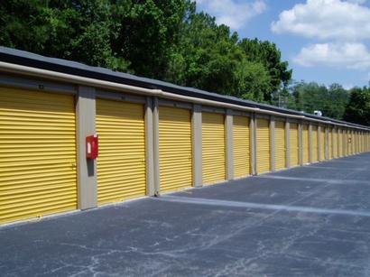
Warehouse
Duval
CCG-2
Florida
B and X Area of moderate flood hazard, usually the area between the limits of the 100-year and 500-year floods.
2.47 AC
2025
Riverside
2026
Jacksonville (Florida)
012704
Jacksonville, FL
33,012 SF
NEARBY LISTINGS FOR SALE OR LEASE
DEMOGRAPHICS near 7657 103Rd St
1 mile
3 mile
5 mile
2025 Total Population
16,064
83,399
201,598
2030 Population
16,989
88,448
214,038
Pop Growth 2025-2030
+ 5.76%
+ 6.05%
+ 6.17%
Average Age
37
38
38
2025 Total Households
5,991
31,068
77,459
HH Growth 2025-2030
+ 6.04%
+ 6.35%
+ 6.46%
Median Household Inc
$51,713
$58,278
$65,540
Avg Household Size
2.60
2.60
2.50
2025 Avg HH Vehicles
2.00
2.00
2.00
Median Home Value
$190,072
$223,343
$264,639
Median Year Built
1984
1985
1986
Nearby Places
Map Layers
Map Styles
 Street
 Aerial
Layers
 Traffic
 Biking
Places
Listings with unknown addresses are not visible on the map
- Restaurants
- Banks
- Shops
- Fitness
- Groceries
PUBLIC TRANSPORTATION
AIRPORT
Jacksonville International
Drive
Walk
Distance
Jacksonville International
32 min
22.4 mi
Freight Ports
Jacksonville Port
Drive
Walk
Distance
Jacksonville Port
26 min
16.2 mi
Nearby Properties
Address
Land Use
TOTAL SIZE
Lot Size
Zoning
Address
Land Use
TOTAL SIZE
Lot Size
Zoning
307,960 SF
18.52 AC
PUD
Address
Land Use
TOTAL SIZE
Lot Size
Zoning
375,127 SF
18.65 AC
PUD
Address
Land Use
TOTAL SIZE
Lot Size
Zoning
179,916 SF
12.19 AC
RMD-D
Address
Land Use
TOTAL SIZE
Lot Size
Zoning
188,666 SF
17.76 AC
PUD
Address
Land Use
TOTAL SIZE
Lot Size
Zoning
416,674 SF
18.38 AC
RMD-D
Address
Land Use
TOTAL SIZE
Lot Size
Zoning
309,137 SF
20.09 AC
RMD-D
Address
Land Use
TOTAL SIZE
Lot Size
Zoning
64,013 SF
8.37 AC
PUD
Address
Land Use
TOTAL SIZE
Lot Size
Zoning
272,076 SF
54.84 AC
PUD
Address
Land Use
TOTAL SIZE
Lot Size
Zoning
276,281 SF
11.72 AC
RMD-D
Address
Land Use
TOTAL SIZE
Lot Size
Zoning
206,513 SF
9.83 AC
RMD-D
Address
Land Use
TOTAL SIZE
Lot Size
Zoning
231,044 SF
10.94 AC
RMD-D
Address
Land Use
TOTAL SIZE
Lot Size
Zoning
137,636 SF
9.73 AC
RMD-D
Address
Land Use
TOTAL SIZE
Lot Size
Zoning
171,412 SF
16.44 AC
RMD-D
Address
Land Use
TOTAL SIZE
Lot Size
Zoning
229,441 SF
17.48 AC
PUD
Address
Land Use
TOTAL SIZE
Lot Size
Zoning
169,084 SF
13 AC
CCG-1
Address
Land Use
TOTAL SIZE
Lot Size
Zoning
67,581 SF
24.24 AC
PUD
Address
Land Use
TOTAL SIZE
Lot Size
Zoning
209,238 SF
10.31 AC
RMD-D
Address
Land Use
TOTAL SIZE
Lot Size
Zoning
193,478 SF
10.13 AC
RMD-D
Address
Land Use
TOTAL SIZE
Lot Size
Zoning
160,514 SF
16.36 AC
RMD-D
Address
Land Use
TOTAL SIZE
Lot Size
Zoning
59,810 SF
11.90 AC
CCG-2
Address
Land Use
TOTAL SIZE
Lot Size
Zoning
74,046 SF
7.21 AC
PUD
Address
Land Use
TOTAL SIZE
Lot Size
Zoning
73,769 SF
8.87 AC
CCG-1
Address
Land Use
TOTAL SIZE
Lot Size
Zoning
141,403 SF
11.36 AC
PUD
Address
Land Use
TOTAL SIZE
Lot Size
Zoning
52,696 SF
10.11 AC
PUD
Address
Land Use
TOTAL SIZE
Lot Size
Zoning
197,792 SF
17.56 AC
RMD-D
Address
Land Use
TOTAL SIZE
Lot Size
Zoning
131,247 SF
5.68 AC
PBF-2
Address
Land Use
TOTAL SIZE
Lot Size
Zoning
136,029 SF
4.96 AC
RMD-D
Address
Land Use
TOTAL SIZE
Lot Size
Zoning
89,408 SF
11.24 AC
CCG-1
Address
Land Use
TOTAL SIZE
Lot Size
Zoning
135,421 SF
9.35 AC
CCG-1
Address
Land Use
TOTAL SIZE
Lot Size
Zoning
80,512 SF
4.05 AC
PUD
The World's #1 Commercial Real Estate Marketplace
Connect with us
© 2026 CoStar Group
The information above has been obtained from sources believed reliable. While we do not doubt its accuracy we have not verified it and make no guarantee, warranty or representation about it. It is your responsibility to independently confirm its accuracy and completeness. Any projections, opinions, assumptions, or estimates used are for example only and do not represent the current or future performance of the property. The value of this transaction to you depends on tax and other factors which should be evaluated by your tax, financial, and legal advisors. You and your advisors should conduct a careful, independent investigation of the property to determine to your satisfaction the suitability of the property for your needs.