Property Record
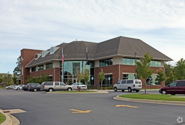
7665 Merriman Rd, Romulus, MI 48174


Property Detail
7665 Merriman Rd
80-042-02-0003-301
11D1B 11D3 TO 11D8 PT OF LOT 1 AND ALL OF LOTS 3 THRU LOT 8 MERRIMAN PARK SUB T3S R9E L73 P42 WCR MORE PARTICULARLY DESC AS BEG AT THE NW COR OF SAID SEC 11 TH S 01D 48M 24S E 1499.37 FT ALONG THE WEST LINE OF SAID SEC 11 AND THE CENTERLINE OF MERRIM
Commercialnec
WAYNE
RC-REG
Michigan
C and X Area of minimal flood hazard, usually depicted on FIRMs as above the 500-year flood level.
1,3,8
2025
4.60 AC
2025
Airport District
585500
Detroit
20,935 SF
Detroit-Warren-Dearborn, MI
NEARBY LISTINGS FOR SALE OR LEASE
DEMOGRAPHICS near 7665 Merriman Rd
1 mile
3 mile
5 mile
2025 Total Population
1,247
37,496
161,691
2030 Population
1,241
37,300
159,576
Pop Growth 2025-2030
(0.48%)
(0.52%)
(1.31%)
Average Age
41
39
40
2025 Total Households
551
14,802
64,267
HH Growth 2025-2030
(0.36%)
(0.62%)
(1.38%)
Median Household Inc
$55,131
$58,390
$60,509
Avg Household Size
2.20
2.50
2.40
2025 Avg HH Vehicles
2.00
2.00
2.00
Median Home Value
$166,831
$145,147
$154,024
Median Year Built
1962
1964
1960
Nearby Places
Map Layers
Map Styles
 Street
 Aerial
Layers
 Traffic
 Biking
Places
Listings with unknown addresses are not visible on the map
- Restaurants
- Banks
- Shops
- Fitness
- Groceries
PUBLIC TRANSPORTATION
COMMUTER RAIL
Dearborn (Wolverine - Amtrak)
Drive
Walk
Distance
Dearborn (Wolverine - Amtrak)
16 min
9.0 mi
AIRPORT
Detroit Metro Wayne County
Drive
Walk
Distance
Detroit Metro Wayne County
10 min
4.5 mi
Windsor International
Drive
Walk
Distance
Windsor International
47 min
29.5 mi
Freight Ports
Port of Toledo
Drive
Walk
Distance
Port of Toledo
66 min
52.3 mi
Nearby Properties
Address
Land Use
TOTAL SIZE
Lot Size
Zoning
Address
Land Use
TOTAL SIZE
Lot Size
Zoning
857,173 SF
84.70 AC
M-1/COND
Address
Land Use
TOTAL SIZE
Lot Size
Zoning
307,524 SF
63.94 AC
AP-AIRPORT
Address
Land Use
TOTAL SIZE
Lot Size
Zoning
108,809 SF
AP-AIRPORT
Address
Land Use
TOTAL SIZE
Lot Size
Zoning
354,968 SF
25.72 AC
RC/M-1
Address
Land Use
TOTAL SIZE
Lot Size
Zoning
366,820 SF
20.83 AC
RC/M-1
Address
Land Use
TOTAL SIZE
Lot Size
Zoning
366,820 SF
20.72 AC
RC/M-1
Address
Land Use
TOTAL SIZE
Lot Size
Zoning
268,272 SF
22.70 AC
M-1/COND
Address
Land Use
TOTAL SIZE
Lot Size
Zoning
920,139 SF
56.56 AC
M2-GEN
Address
Land Use
TOTAL SIZE
Lot Size
Zoning
250,263 SF
18.81 AC
RM-MLTI
Address
Land Use
TOTAL SIZE
Lot Size
Zoning
244,760 SF
22.63 AC
M-1/COND
Address
Land Use
TOTAL SIZE
Lot Size
Zoning
260,000 SF
20.50 AC
M-T
Address
Land Use
TOTAL SIZE
Lot Size
Zoning
186,738 SF
15.89 AC
RM-MLTI
Address
Land Use
TOTAL SIZE
Lot Size
Zoning
240,355 SF
26.05 AC
M2-GEN
Address
Land Use
TOTAL SIZE
Lot Size
Zoning
302,868 SF
19.94 AC
M-T
Address
Land Use
TOTAL SIZE
Lot Size
Zoning
6,128 SF
50.14 AC
RC-REG
Address
Land Use
TOTAL SIZE
Lot Size
Zoning
312,000 SF
21.91 AC
M-T
Address
Land Use
TOTAL SIZE
Lot Size
Zoning
1,619,168 SF
150.49 AC
M2-GEN
Address
Land Use
TOTAL SIZE
Lot Size
Zoning
299,904 SF
20.13 AC
M-T
Address
Land Use
TOTAL SIZE
Lot Size
Zoning
299,904 SF
18.68 AC
M-T
Address
Land Use
TOTAL SIZE
Lot Size
Zoning
165,200 SF
14.85 AC
M-1/COND
Address
Land Use
TOTAL SIZE
Lot Size
Zoning
1,278 SF
17.59 AC
M-T
Address
Land Use
TOTAL SIZE
Lot Size
Zoning
960 SF
62.42 AC
RC-REG
Address
Land Use
TOTAL SIZE
Lot Size
Zoning
280,510 SF
32.49 AC
M-T
Address
Land Use
TOTAL SIZE
Lot Size
Zoning
132,248 SF
5.96 AC
RC-REG
Address
Land Use
TOTAL SIZE
Lot Size
Zoning
413,000 SF
25 AC
M2-GEN
Address
Land Use
TOTAL SIZE
Lot Size
Zoning
129,260 SF
5.25 AC
AP-AIRPORT
Address
Land Use
TOTAL SIZE
Lot Size
Zoning
261,835 SF
45.99 AC
M-T
Address
Land Use
TOTAL SIZE
Lot Size
Zoning
268,800 SF
17.47 AC
M1-LIG
Address
Land Use
TOTAL SIZE
Lot Size
Zoning
235,200 SF
21.93 AC
M-T
Address
Land Use
TOTAL SIZE
Lot Size
Zoning
207,205 SF
28.02 AC
I-1
The World's #1 Commercial Real Estate Marketplace
Connect with us
© 2026 CoStar Group
The information above has been obtained from sources believed reliable. While we do not doubt its accuracy we have not verified it and make no guarantee, warranty or representation about it. It is your responsibility to independently confirm its accuracy and completeness. Any projections, opinions, assumptions, or estimates used are for example only and do not represent the current or future performance of the property. The value of this transaction to you depends on tax and other factors which should be evaluated by your tax, financial, and legal advisors. You and your advisors should conduct a careful, independent investigation of the property to determine to your satisfaction the suitability of the property for your needs.