Property Record
767 South Dr, Brick, NJ 08724

NEARBY LISTINGS FOR SALE OR LEASE
Property Detail
767 South Dr
New York-Jersey City-White Plains, NY-NJ
Metedeconk Company Inc Map E
07-00945-0000-00006
.2554AC 7
Vacantlandnec
Ocean
AE
New Jersey
34029C0212F
6
2024
0.26 AC
2025
Ocean County
713700
Northern New Jersey
893 SF
DEMOGRAPHICS near 767 South Dr
1 Mile
3 Mile
5 Mile
2024 Total Population
6,569
55,710
131,510
2029 Population
7,094
59,978
140,709
Pop Growth 2024-2029
+ 7.99%
+ 7.66%
+ 6.99%
Average Age
43
43
44
2024 Total Households
2,559
22,124
53,164
HH Growth 2024-2029
+ 7.58%
+ 7.44%
+ 6.87%
Median Household Inc
$107,054
$104,100
$96,422
Avg Household Size
2.50
2.40
2.40
2024 Avg HH Vehicles
2.00
2.00
2.00
Median Home Value
$464,158
$419,630
$401,306
Median Year Built
1970
1968
1973
Nearby Places
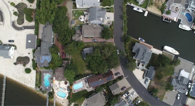
Map Layers
Map Styles
 Street
 Aerial
- Restaurants
- Banks
- Shops
- Fitness
- Groceries
PUBLIC TRANSPORTATION
COMMUTER RAIL
Bay Head (North Jersey Coast Line - NJ Transit Commuter Rail (NJ Transit))
DRIVE
WALK
Distance
Bay Head (North Jersey Coast Line - NJ Transit Commuter Rail (NJ Transit))
7 min
3.3 mi
Point Pleasant Beach (North Jersey Coast Line - NJ Transit Commuter Rail (NJ Transit))
DRIVE
WALK
Distance
Point Pleasant Beach (North Jersey Coast Line - NJ Transit Commuter Rail (NJ Transit))
8 min
4.0 mi
Freight Ports
New York Container Terminal
DRIVE
WALK
Distance
New York Container Terminal
71 min
53.4 mi
SALE & LEASE HISTORY
LISTING DATE
SALE/LEASE

Aug 16, 2018
For Sale
Nearby Properties
Address
Land Use
TOTAL SIZE
Lot Size
Zoning
Address
Land Use
TOTAL SIZE
Lot Size
Zoning
50.10 AC
C
Address
Land Use
TOTAL SIZE
Lot Size
Zoning
117 AC
RR1
Address
Land Use
TOTAL SIZE
Lot Size
Zoning
21,850 SF
30.98 AC
R-1A
Address
Land Use
TOTAL SIZE
Lot Size
Zoning
26.37 AC
R75
Address
Land Use
TOTAL SIZE
Lot Size
Zoning
26.43 AC
B3
Address
Land Use
TOTAL SIZE
Lot Size
Zoning
3,792 SF
7.64 AC
R-1A
Address
Land Use
TOTAL SIZE
Lot Size
Zoning
63,136 SF
10.31 AC
R-1A
Address
Land Use
TOTAL SIZE
Lot Size
Zoning
18,058 SF
6.09 AC
R-50
Address
Land Use
TOTAL SIZE
Lot Size
Zoning
32.50 AC
RM
Address
Land Use
TOTAL SIZE
Lot Size
Zoning
32.80 AC
RM
Address
Land Use
TOTAL SIZE
Lot Size
Zoning
2,408 SF
4.84 AC
B-2
Address
Land Use
TOTAL SIZE
Lot Size
Zoning
21 AC
ROS
Address
Land Use
TOTAL SIZE
Lot Size
Zoning
16.85 AC
B2
Address
Land Use
TOTAL SIZE
Lot Size
Zoning
2.73 AC
RC
Address
Land Use
TOTAL SIZE
Lot Size
Zoning
40.43 AC
R-1
Address
Land Use
TOTAL SIZE
Lot Size
Zoning
17,450 SF
7.50 AC
HR
Address
Land Use
TOTAL SIZE
Lot Size
Zoning
1,140 SF
14 AC
GC
Address
Land Use
TOTAL SIZE
Lot Size
Zoning
1,976 SF
8.42 AC
R50
Address
Land Use
TOTAL SIZE
Lot Size
Zoning
1,702 SF
2.90 AC
C
Address
Land Use
TOTAL SIZE
Lot Size
Zoning
7,988 SF
4.55 AC
W
Address
Land Use
TOTAL SIZE
Lot Size
Zoning
3.05 AC
HC
Address
Land Use
TOTAL SIZE
Lot Size
Zoning
86,484 SF
7.25 AC
GC
Address
Land Use
TOTAL SIZE
Lot Size
Zoning
1,677 SF
3 AC
R-3A
Address
Land Use
TOTAL SIZE
Lot Size
Zoning
10.69 AC
B3
Address
Land Use
TOTAL SIZE
Lot Size
Zoning
10,003 SF
0.32 AC
PU
Address
Land Use
TOTAL SIZE
Lot Size
Zoning
18,240 SF
1.51 AC
RR3
Address
Land Use
TOTAL SIZE
Lot Size
Zoning
2.10 AC
ROS
Address
Land Use
TOTAL SIZE
Lot Size
Zoning
19,248 SF
5.75 AC
W
Address
Land Use
TOTAL SIZE
Lot Size
Zoning
31,412 SF
2.29 AC
RM
Address
Land Use
TOTAL SIZE
Lot Size
Zoning
14 AC
R10
The World's #1 Commercial Real Estate Marketplace
Connect with us
© 2026 CoStar Group
The information above has been obtained from sources believed reliable. While we do not doubt its accuracy we have not verified it and make no guarantee, warranty or representation about it. It is your responsibility to independently confirm its accuracy and completeness. Any projections, opinions, assumptions, or estimates used are for example only and do not represent the current or future performance of the property. The value of this transaction to you depends on tax and other factors which should be evaluated by your tax, financial, and legal advisors. You and your advisors should conduct a careful, independent investigation of the property to determine to your satisfaction the suitability of the property for your needs.