Property Record
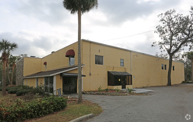
768 W Granada Blvd, Ormond Beach, FL 32174


Property Detail
768 W Granada Blvd
Deltona-Daytona Beach-Ormond Beach, FL
41-14-32 UNIT 1 ORMOND CENTRAL COMMERCIAL CONDOMINIUM MB 65 PGS 44-46 INC PER OR 8453 PG 1695 PER OR 8470 PG 0564
4241-50-00-0010
VOLUSIA
Warehouse
Florida
2025
2.74 AC
2026
Ormond Beach
080807
Deltona/Daytona Beach
102,345 SF
NEARBY LISTINGS FOR SALE OR LEASE
DEMOGRAPHICS near 768 W Granada Blvd
1 mile
3 mile
5 mile
2025 Total Population
7,858
54,682
109,992
2030 Population
8,432
58,782
119,273
Pop Growth 2025-2030
+ 7.30%
+ 7.50%
+ 8.44%
Average Age
48
47
46
2025 Total Households
3,650
24,479
49,059
HH Growth 2025-2030
+ 7.26%
+ 7.53%
+ 8.57%
Median Household Inc
$44,211
$58,064
$59,729
Avg Household Size
2.00
2.10
2.10
2025 Avg HH Vehicles
2.00
2.00
2.00
Median Home Value
$311,330
$328,404
$342,365
Median Year Built
1985
1981
1980
Nearby Places
Map Layers
Map Styles
 Street
 Aerial
Transit
 Traffic
 Biking
Places
Listings with unknown addresses are not visible on the map
- Restaurants
- Banks
- Shops
- Fitness
- Groceries
PUBLIC TRANSPORTATION
AIRPORT
Daytona Beach International
Drive
Walk
Distance
Daytona Beach International
20 min
11.5 mi
Orlando Sanford International
Drive
Walk
Distance
Orlando Sanford International
65 min
47.6 mi
SALE & LEASE HISTORY
LISTING DATE
SALE/LEASE

Sep 26, 2016
For Lease
Sep 25, 2016
For Lease
Nearby Properties
Address
Land Use
TOTAL SIZE
Lot Size
Zoning
Address
Land Use
TOTAL SIZE
Lot Size
Zoning
849,735 SF
140.62 AC
01A2
Address
Land Use
TOTAL SIZE
Lot Size
Zoning
12,394 SF
139.59 AC
Address
Land Use
TOTAL SIZE
Lot Size
Zoning
470,843 SF
1.78 AC
RC
Address
Land Use
TOTAL SIZE
Lot Size
Zoning
10,637 SF
0.15 AC
R2
Address
Land Use
TOTAL SIZE
Lot Size
Zoning
409,718 SF
12.86 AC
Address
Land Use
TOTAL SIZE
Lot Size
Zoning
375,572 SF
0.13 AC
R2
Address
Land Use
TOTAL SIZE
Lot Size
Zoning
359,180 SF
29.73 AC
01A2
Address
Land Use
TOTAL SIZE
Lot Size
Zoning
13,846 SF
126.83 AC
13T1
Address
Land Use
TOTAL SIZE
Lot Size
Zoning
333,708 SF
0.24 AC
01A2
Address
Land Use
TOTAL SIZE
Lot Size
Zoning
180,767 SF
27.05 AC
13R6
Address
Land Use
TOTAL SIZE
Lot Size
Zoning
16.50 AC
Address
Land Use
TOTAL SIZE
Lot Size
Zoning
Address
Land Use
TOTAL SIZE
Lot Size
Zoning
Address
Land Use
TOTAL SIZE
Lot Size
Zoning
184,301 SF
50.28 AC
Address
Land Use
TOTAL SIZE
Lot Size
Zoning
5,426 SF
6.28 AC
09R9
Address
Land Use
TOTAL SIZE
Lot Size
Zoning
184,829 SF
9.71 AC
01A2
Address
Land Use
TOTAL SIZE
Lot Size
Zoning
168,456 SF
15.74 AC
Address
Land Use
TOTAL SIZE
Lot Size
Zoning
4,182 SF
0.16 AC
MH1
Address
Land Use
TOTAL SIZE
Lot Size
Zoning
144,576 SF
11.19 AC
13R6
Address
Land Use
TOTAL SIZE
Lot Size
Zoning
149,872 SF
20 AC
09R6
Address
Land Use
TOTAL SIZE
Lot Size
Zoning
162,450 SF
1.42 AC
13B9
Address
Land Use
TOTAL SIZE
Lot Size
Zoning
5,350 SF
36.42 AC
13T1
Address
Land Use
TOTAL SIZE
Lot Size
Zoning
152,621 SF
18.26 AC
C
Address
Land Use
TOTAL SIZE
Lot Size
Zoning
219,381 SF
25.44 AC
13B8
Address
Land Use
TOTAL SIZE
Lot Size
Zoning
179,868 SF
0.33 AC
Address
Land Use
TOTAL SIZE
Lot Size
Zoning
61,570 SF
23.04 AC
Address
Land Use
TOTAL SIZE
Lot Size
Zoning
148,966 SF
5.54 AC
13B10
Address
Land Use
TOTAL SIZE
Lot Size
Zoning
Address
Land Use
TOTAL SIZE
Lot Size
Zoning
135,886 SF
1.18 AC
Address
Land Use
TOTAL SIZE
Lot Size
Zoning
119,331 SF
9.09 AC
The World's #1 Commercial Real Estate Marketplace
Connect with us
© 2026 CoStar Group
The information above has been obtained from sources believed reliable. While we do not doubt its accuracy we have not verified it and make no guarantee, warranty or representation about it. It is your responsibility to independently confirm its accuracy and completeness. Any projections, opinions, assumptions, or estimates used are for example only and do not represent the current or future performance of the property. The value of this transaction to you depends on tax and other factors which should be evaluated by your tax, financial, and legal advisors. You and your advisors should conduct a careful, independent investigation of the property to determine to your satisfaction the suitability of the property for your needs.