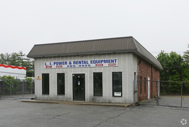
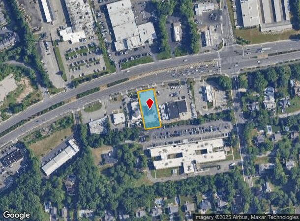
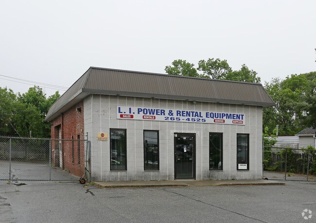
Property Record
769 Nesconset-Port Jefferson Hwy, Nesconset, NY 11767
NEARBY LISTINGS FOR SALE OR LEASE
Property Detail
769 Nesconset-Port Jefferson Hwy
Nassau County-Suffolk County, NY
10-410376 TC-53 *580 PT LOT 1095 HOUSE & HOME MAP 20
0800-107-00-03-00-004-000
Suffolk
Commercialnec
New York
X
4
36103C0656H
0.55 AC
2024
Central Suffolk
2024
Long Island (New York)
135402
DEMOGRAPHICS near 769 Nesconset-Port Jefferson Hwy
1 Mile
3 Mile
5 Mile
2024 Total Population
8,767
79,788
197,803
2029 Population
8,634
78,729
194,696
Pop Growth 2024-2029
(1.52%)
(1.33%)
(1.57%)
Average Age
42
43
41
2024 Total Households
2,946
27,338
64,372
HH Growth 2024-2029
(1.80%)
(1.56%)
(1.77%)
Median Household Inc
$142,387
$133,044
$125,260
Avg Household Size
2.80
2.80
2.90
2024 Avg HH Vehicles
2.00
2.00
2.00
Median Home Value
$611,459
$566,497
$496,621
Median Year Built
1974
1969
1968
Nearby Places
- Restaurants
- Banks
- Shops
- Fitness
- Groceries
PUBLIC TRANSPORTATION
COMMUTER RAIL
St James Station (Port Jefferson Branch - Long Island Rail Road)
DRIVE
WALK
Distance
St James Station (Port Jefferson Branch - Long Island Rail Road)
6 min
2.6 mi
Smithtown Station (Port Jefferson Branch - Long Island Rail Road)
DRIVE
WALK
Distance
Smithtown Station (Port Jefferson Branch - Long Island Rail Road)
5 min
2.6 mi
AIRPORT
Long Island MacArthur
DRIVE
WALK
Distance
Long Island MacArthur
16 min
7.2 mi
Freight Ports
Port of New Haven
DRIVE
WALK
Distance
Port of New Haven
122 min
47.5 mi
Nearby Properties
Address
Land Use
TOTAL SIZE
Lot Size
Zoning
Address
Land Use
TOTAL SIZE
Lot Size
Zoning
57.30 AC
AAA
Address
Land Use
TOTAL SIZE
Lot Size
Zoning
8.05 AC
NULL
Address
Land Use
TOTAL SIZE
Lot Size
Zoning
24.70 AC
AAA
Address
Land Use
TOTAL SIZE
Lot Size
Zoning
13.06 AC
BUS3
Address
Land Use
TOTAL SIZE
Lot Size
Zoning
23.08 AC
AA
Address
Land Use
TOTAL SIZE
Lot Size
Zoning
45.71 AC
NULL
Address
Land Use
TOTAL SIZE
Lot Size
Zoning
5.32 AC
BUS3
Address
Land Use
TOTAL SIZE
Lot Size
Zoning
12.80 AC
AAA
Address
Land Use
TOTAL SIZE
Lot Size
Zoning
8.35 AC
IND1
Address
Land Use
TOTAL SIZE
Lot Size
Zoning
11.86 AC
NULL
Address
Land Use
TOTAL SIZE
Lot Size
Zoning
60.30 AC
Address
Land Use
TOTAL SIZE
Lot Size
Zoning
0.28 AC
VILLA
Address
Land Use
TOTAL SIZE
Lot Size
Zoning
4.91 AC
AAA
Address
Land Use
TOTAL SIZE
Lot Size
Zoning
16.30 AC
Address
Land Use
TOTAL SIZE
Lot Size
Zoning
7.92 AC
NULL
Address
Land Use
TOTAL SIZE
Lot Size
Zoning
5.70 AC
NULL
Address
Land Use
TOTAL SIZE
Lot Size
Zoning
7.86 AC
BUS2
Address
Land Use
TOTAL SIZE
Lot Size
Zoning
21.20 AC
AA
Address
Land Use
TOTAL SIZE
Lot Size
Zoning
4.80 AC
CA
Address
Land Use
TOTAL SIZE
Lot Size
Zoning
17.52 AC
NULL
Address
Land Use
TOTAL SIZE
Lot Size
Zoning
18.20 AC
Address
Land Use
TOTAL SIZE
Lot Size
Zoning
1,755 SF
0.11 AC
VILLA
Address
Land Use
TOTAL SIZE
Lot Size
Zoning
3.13 AC
Address
Land Use
TOTAL SIZE
Lot Size
Zoning
35.49 AC
AAA
Address
Land Use
TOTAL SIZE
Lot Size
Zoning
38.10 AC
NULL
Address
Land Use
TOTAL SIZE
Lot Size
Zoning
128.70 AC
AA278
Address
Land Use
TOTAL SIZE
Lot Size
Zoning
3.80 AC
BUS1
Address
Land Use
TOTAL SIZE
Lot Size
Zoning
2.60 AC
NULL
Address
Land Use
TOTAL SIZE
Lot Size
Zoning
4.06 AC
NULL
The World's #1 Commercial Real Estate Marketplace
Connect with us
© 2025 CoStar Group
The information above has been obtained from sources believed reliable. While we do not doubt its accuracy we have not verified it and make no guarantee, warranty or representation about it. It is your responsibility to independently confirm its accuracy and completeness. Any projections, opinions, assumptions, or estimates used are for example only and do not represent the current or future performance of the property. The value of this transaction to you depends on tax and other factors which should be evaluated by your tax, financial, and legal advisors. You and your advisors should conduct a careful, independent investigation of the property to determine to your satisfaction the suitability of the property for your needs.