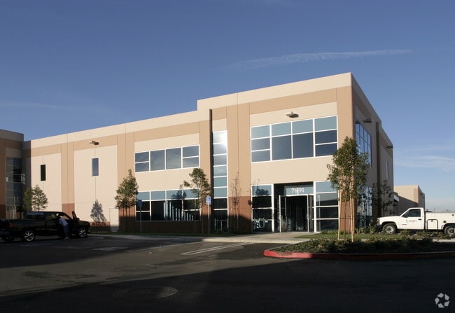
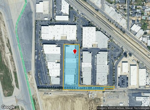
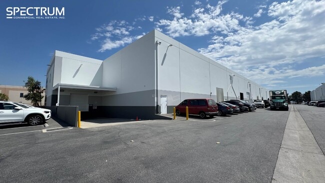
Property Record
7691 N San Fernando Rd, Burbank, CA 91505

Current Lease Availabilities
NEARBY LISTINGS FOR SALE OR LEASE
Property Detail
7691 N San Fernando Rd
Los Angeles-Long Beach-Glendale, CA
53977
2466-036-026
TR=53977 LOT 1 CONDOUNIT 9A (AIRSPACE AND 1/6 INT IN COMMON AREA)
Industrialcondominium
Los Angeles
X
California
06037C1328F
1
2024
3.29 AC
2025
Burbank
122200
Los Angeles
14,028 SF
DEMOGRAPHICS near 7691 N San Fernando Rd
1 Mile
3 Mile
5 Mile
2024 Total Population
17,101
181,175
504,025
2029 Population
16,446
175,756
488,627
Pop Growth 2024-2029
(3.83%)
(2.99%)
(3.06%)
Average Age
39
39
40
2024 Total Households
4,558
60,437
184,724
HH Growth 2024-2029
(4.10%)
(3.22%)
(3.21%)
Median Household Inc
$75,697
$68,378
$74,417
Avg Household Size
3.50
2.90
2.60
2024 Avg HH Vehicles
2.00
2.00
2.00
Median Home Value
$726,101
$775,351
$805,484
Median Year Built
1959
1961
1964
Nearby Places
Map Layers
Map Styles
 Street
 Aerial
- Restaurants
- Banks
- Shops
- Fitness
- Groceries
PUBLIC TRANSPORTATION
COMMUTER RAIL
Burbank Airport - North (Av Line) Metrolink Station (Metrolink Antelope Valley Line - Metrolink Trains)
DRIVE
WALK
Distance
Burbank Airport - North (Av Line) Metrolink Station (Metrolink Antelope Valley Line - Metrolink Trains)
1 min
13 min
0.5 mi
Burbank-Bob Hope Airport (Ventura County Line - Southern California Regional Rail Authority (Metrolink))
DRIVE
WALK
Distance
Burbank-Bob Hope Airport (Ventura County Line - Southern California Regional Rail Authority (Metrolink))
4 min
1.7 mi
AIRPORT
Bob Hope
DRIVE
WALK
Distance
Bob Hope
4 min
2.0 mi
Los Angeles International
DRIVE
WALK
Distance
Los Angeles International
42 min
28.0 mi
Long Beach (Daugherty Field)
DRIVE
WALK
Distance
Long Beach (Daugherty Field)
49 min
35.1 mi
Freight Ports
Port of Long Beach
DRIVE
WALK
Distance
Port of Long Beach
51 min
37.9 mi
Nearby Properties
Address
Land Use
TOTAL SIZE
Lot Size
Zoning
Address
Land Use
TOTAL SIZE
Lot Size
Zoning
849,801 SF
59.25 AC
BUM2
Address
Land Use
TOTAL SIZE
Lot Size
Zoning
518,067 SF
17.27 AC
LAC4
Address
Land Use
TOTAL SIZE
Lot Size
Zoning
690,600 SF
6.57 AC
LACM
Address
Land Use
TOTAL SIZE
Lot Size
Zoning
1,328,547 SF
39.36 AC
BUPD
Address
Land Use
TOTAL SIZE
Lot Size
Zoning
529,249 SF
5.42 AC
LAC4
Address
Land Use
TOTAL SIZE
Lot Size
Zoning
432,232 SF
7.17 AC
BUM2
Address
Land Use
TOTAL SIZE
Lot Size
Zoning
362,863 SF
1.82 AC
BUMZ
Address
Land Use
TOTAL SIZE
Lot Size
Zoning
346,186 SF
11.72 AC
BUM2*
Address
Land Use
TOTAL SIZE
Lot Size
Zoning
232,965 SF
3.78 AC
LAC4
Address
Land Use
TOTAL SIZE
Lot Size
Zoning
182,061 SF
1.99 AC
LAC4
Address
Land Use
TOTAL SIZE
Lot Size
Zoning
558,532 SF
5.20 AC
BUC4*
Address
Land Use
TOTAL SIZE
Lot Size
Zoning
227,746 SF
4.03 AC
LAC4
Address
Land Use
TOTAL SIZE
Lot Size
Zoning
BURAILROAD
Address
Land Use
TOTAL SIZE
Lot Size
Zoning
279,574 SF
4.01 AC
BUM2*
Address
Land Use
TOTAL SIZE
Lot Size
Zoning
132,652 SF
0.76 AC
LAC2
Address
Land Use
TOTAL SIZE
Lot Size
Zoning
162,506 SF
2.28 AC
LAC2
Address
Land Use
TOTAL SIZE
Lot Size
Zoning
BURAILROAD
Address
Land Use
TOTAL SIZE
Lot Size
Zoning
108,649 SF
3.33 AC
BUPD
Address
Land Use
TOTAL SIZE
Lot Size
Zoning
86,190 SF
3.07 AC
BUM2
Address
Land Use
TOTAL SIZE
Lot Size
Zoning
116,297 SF
1.60 AC
LAC4
Address
Land Use
TOTAL SIZE
Lot Size
Zoning
169,740 SF
1.74 AC
BUM2*
Address
Land Use
TOTAL SIZE
Lot Size
Zoning
474,155 SF
8.45 AC
LAM2
Address
Land Use
TOTAL SIZE
Lot Size
Zoning
229,983 SF
7.90 AC
BUM2YY*
Address
Land Use
TOTAL SIZE
Lot Size
Zoning
260,417 SF
2.35 AC
BUC4*
Address
Land Use
TOTAL SIZE
Lot Size
Zoning
214,664 SF
2.23 AC
BUM2*
Address
Land Use
TOTAL SIZE
Lot Size
Zoning
144,626 SF
5.15 AC
LAM2
Address
Land Use
TOTAL SIZE
Lot Size
Zoning
371,907 SF
5.08 AC
BUM2*
Address
Land Use
TOTAL SIZE
Lot Size
Zoning
273,366 SF
13.46 AC
LAM2
Address
Land Use
TOTAL SIZE
Lot Size
Zoning
134,784 SF
0.77 AC
BUMZ
The World's #1 Commercial Real Estate Marketplace
Connect with us
© 2026 CoStar Group
The information above has been obtained from sources believed reliable. While we do not doubt its accuracy we have not verified it and make no guarantee, warranty or representation about it. It is your responsibility to independently confirm its accuracy and completeness. Any projections, opinions, assumptions, or estimates used are for example only and do not represent the current or future performance of the property. The value of this transaction to you depends on tax and other factors which should be evaluated by your tax, financial, and legal advisors. You and your advisors should conduct a careful, independent investigation of the property to determine to your satisfaction the suitability of the property for your needs.