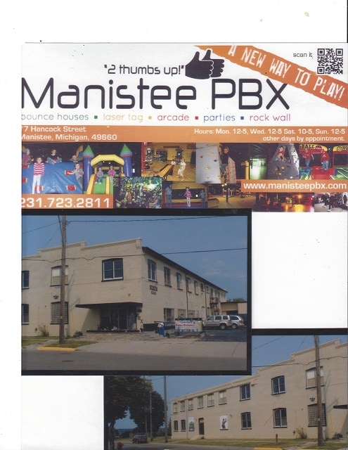
Property Record
77 Hancock St, Manistee, MI 49660

Save to a Folder
{{folder.Name}}
{{folder.ListingIds.length}} Properties
{{folder.ListingIds.length}} Property
Create a New Folder
Property Detail
77 Hancock St
Other Market Areas
FILER & SMITH ADD ALL OF LOTS 1, 2 & 6 THRU 8 BLK 16. ALSO PT OF RESERVATION COM ON E LI OF HANCOCK ST AT NW COR LOT 1 BLK 16
51-448-732-15
Manistee
Taxexempt
Michigan
B and X Area of moderate flood hazard, usually the area between the limits of the 100-year and 500-year floods.
1-66
0
2.91 AC
2026
Michigan Northwest Area
000700
NEARBY LISTINGS FOR SALE OR LEASE
DEMOGRAPHICS near 77 Hancock St
1 mile
3 mile
5 mile
2025 Total Population
4,955
8,815
10,603
2030 Population
4,906
8,697
10,488
Pop Growth 2025-2030
(0.99%)
(1.34%)
(1.08%)
Average Age
44
45
46
2025 Total Households
2,299
4,010
4,752
HH Growth 2025-2030
(0.91%)
(1.30%)
(1.09%)
Median Household Inc
$61,406
$61,918
$62,472
Avg Household Size
2.10
2.10
2.10
2025 Avg HH Vehicles
2.00
2.00
2.00
Median Home Value
$160,395
$174,309
$185,779
Median Year Built
1949
1958
1962
Nearby Places
Map Layers
Map Styles
 Street
 Aerial
Layers
 Traffic
 Biking
Places
Listings with unknown addresses are not visible on the map
- Restaurants
- Banks
- Shops
- Fitness
- Groceries
SALE & LEASE HISTORY
LISTING DATE
SALE/LEASE

Sep 23, 2016
For Sale
Nearby Properties
Address
Land Use
TOTAL SIZE
Lot Size
Zoning
Address
Land Use
TOTAL SIZE
Lot Size
Zoning
649,188 SF
179.33 AC
Address
Land Use
TOTAL SIZE
Lot Size
Zoning
21.25 AC
Address
Land Use
TOTAL SIZE
Lot Size
Zoning
8.54 AC
Address
Land Use
TOTAL SIZE
Lot Size
Zoning
Address
Land Use
TOTAL SIZE
Lot Size
Zoning
Address
Land Use
TOTAL SIZE
Lot Size
Zoning
3.88 AC
Address
Land Use
TOTAL SIZE
Lot Size
Zoning
37.88 AC
Address
Land Use
TOTAL SIZE
Lot Size
Zoning
12.01 AC
Address
Land Use
TOTAL SIZE
Lot Size
Zoning
7.10 AC
Address
Land Use
TOTAL SIZE
Lot Size
Zoning
8.80 AC
Address
Land Use
TOTAL SIZE
Lot Size
Zoning
Address
Land Use
TOTAL SIZE
Lot Size
Zoning
Address
Land Use
TOTAL SIZE
Lot Size
Zoning
Address
Land Use
TOTAL SIZE
Lot Size
Zoning
Address
Land Use
TOTAL SIZE
Lot Size
Zoning
3.98 AC
Address
Land Use
TOTAL SIZE
Lot Size
Zoning
Address
Land Use
TOTAL SIZE
Lot Size
Zoning
Address
Land Use
TOTAL SIZE
Lot Size
Zoning
8.13 AC
Address
Land Use
TOTAL SIZE
Lot Size
Zoning
4.12 AC
Address
Land Use
TOTAL SIZE
Lot Size
Zoning
3.92 AC
Address
Land Use
TOTAL SIZE
Lot Size
Zoning
Address
Land Use
TOTAL SIZE
Lot Size
Zoning
Address
Land Use
TOTAL SIZE
Lot Size
Zoning
3.85 AC
Address
Land Use
TOTAL SIZE
Lot Size
Zoning
Address
Land Use
TOTAL SIZE
Lot Size
Zoning
3.64 AC
Address
Land Use
TOTAL SIZE
Lot Size
Zoning
1.02 AC
Address
Land Use
TOTAL SIZE
Lot Size
Zoning
2.92 AC
Address
Land Use
TOTAL SIZE
Lot Size
Zoning
8.37 AC
Address
Land Use
TOTAL SIZE
Lot Size
Zoning
30.96 AC
The World's #1 Commercial Real Estate Marketplace
Connect with us
© 2026 CoStar Group
The information above has been obtained from sources believed reliable. While we do not doubt its accuracy we have not verified it and make no guarantee, warranty or representation about it. It is your responsibility to independently confirm its accuracy and completeness. Any projections, opinions, assumptions, or estimates used are for example only and do not represent the current or future performance of the property. The value of this transaction to you depends on tax and other factors which should be evaluated by your tax, financial, and legal advisors. You and your advisors should conduct a careful, independent investigation of the property to determine to your satisfaction the suitability of the property for your needs.