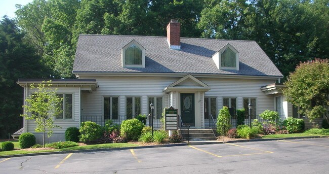
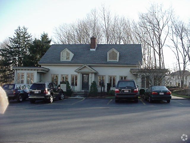
Property Record
77 Main St, Dover, MA 02030

NEARBY LISTINGS FOR SALE OR LEASE
Property Detail
77 Main St
Sfr
Norfolk
X
Massachusetts
25021C0018F
0.70 AC
2025
I-95 Corridor South
2025
Boston
408102
Boston-Cambridge-Newton, MA-NH
1,687 SF
DOVE-000002-000064
DEMOGRAPHICS near 77 Main St
1 Mile
3 Mile
5 Mile
2024 Total Population
5,194
29,204
72,982
2029 Population
5,188
29,114
72,688
Pop Growth 2024-2029
(0.12%)
(0.31%)
(0.40%)
Average Age
41
41
41
2024 Total Households
1,931
10,390
26,263
HH Growth 2024-2029
(0.21%)
(0.37%)
(0.48%)
Median Household Inc
$143,382
$155,460
$146,748
Avg Household Size
2.70
2.80
2.70
2024 Avg HH Vehicles
2.00
2.00
2.00
Median Home Value
$478,571
$565,333
$532,796
Median Year Built
1965
1979
1977
Nearby Places
Map Layers
Map Styles
 Street
 Aerial
- Restaurants
- Banks
- Shops
- Fitness
- Groceries
PUBLIC TRANSPORTATION
COMMUTER RAIL
Natick (Framingham/Worcester Line - Massachusetts Bay Transportation Authority Commuter Rail (Purple Line))
DRIVE
WALK
Distance
Natick (Framingham/Worcester Line - Massachusetts Bay Transportation Authority Commuter Rail (Purple Line))
8 min
3.4 mi
Wellesley Square (Framingham/Worcester Line - Massachusetts Bay Transportation Authority Commuter Rail (Purple Line))
DRIVE
WALK
Distance
Wellesley Square (Framingham/Worcester Line - Massachusetts Bay Transportation Authority Commuter Rail (Purple Line))
8 min
3.8 mi
AIRPORT
General Edward Lawrence Logan International
DRIVE
WALK
Distance
General Edward Lawrence Logan International
36 min
21.3 mi
Worcester Regional
DRIVE
WALK
Distance
Worcester Regional
58 min
33.1 mi
Freight Ports
Port of Boston
DRIVE
WALK
Distance
Port of Boston
35 min
19.6 mi
SALE & LEASE HISTORY
LISTING DATE
SALE/LEASE

Apr 05, 2022
For Sale
Nearby Properties
Address
Land Use
TOTAL SIZE
Lot Size
Zoning
Address
Land Use
TOTAL SIZE
Lot Size
Zoning
522,600 SF
59.54 AC
A2
Address
Land Use
TOTAL SIZE
Lot Size
Zoning
10.87 AC
SRD 10
Address
Land Use
TOTAL SIZE
Lot Size
Zoning
15,974 SF
2.45 AC
ED
Address
Land Use
TOTAL SIZE
Lot Size
Zoning
6.33 AC
SR10
Address
Land Use
TOTAL SIZE
Lot Size
Zoning
15.08 AC
SR10
Address
Land Use
TOTAL SIZE
Lot Size
Zoning
1,683 SF
46.10 AC
SR15
Address
Land Use
TOTAL SIZE
Lot Size
Zoning
3.80 AC
Address
Land Use
TOTAL SIZE
Lot Size
Zoning
25.70 AC
SR10
Address
Land Use
TOTAL SIZE
Lot Size
Zoning
80.85 AC
SR40
Address
Land Use
TOTAL SIZE
Lot Size
Zoning
13,244 SF
12.72 AC
SR10
Address
Land Use
TOTAL SIZE
Lot Size
Zoning
7.15 AC
Address
Land Use
TOTAL SIZE
Lot Size
Zoning
1,592 SF
10.65 AC
ED
Address
Land Use
TOTAL SIZE
Lot Size
Zoning
139,710 SF
60.70 AC
SRA
Address
Land Use
TOTAL SIZE
Lot Size
Zoning
1.43 AC
Address
Land Use
TOTAL SIZE
Lot Size
Zoning
182.10 AC
O
Address
Land Use
TOTAL SIZE
Lot Size
Zoning
28.45 AC
Address
Land Use
TOTAL SIZE
Lot Size
Zoning
529.60 AC
R2
Address
Land Use
TOTAL SIZE
Lot Size
Zoning
81,685 SF
5.53 AC
RSC
Address
Land Use
TOTAL SIZE
Lot Size
Zoning
1.55 AC
Address
Land Use
TOTAL SIZE
Lot Size
Zoning
64,225 SF
5.19 AC
RSC
Address
Land Use
TOTAL SIZE
Lot Size
Zoning
4,508 SF
87.96 AC
SR20
Address
Land Use
TOTAL SIZE
Lot Size
Zoning
95,042 SF
43.95 AC
R1
Address
Land Use
TOTAL SIZE
Lot Size
Zoning
2.49 AC
SR10
Address
Land Use
TOTAL SIZE
Lot Size
Zoning
78.34 AC
SR10
Address
Land Use
TOTAL SIZE
Lot Size
Zoning
2.10 AC
Address
Land Use
TOTAL SIZE
Lot Size
Zoning
64,362 SF
11.79 AC
SRB
Address
Land Use
TOTAL SIZE
Lot Size
Zoning
8.95 AC
SR10
Address
Land Use
TOTAL SIZE
Lot Size
Zoning
30.60 AC
SR15
Address
Land Use
TOTAL SIZE
Lot Size
Zoning
53,878 SF
24.98 AC
RSB
Address
Land Use
TOTAL SIZE
Lot Size
Zoning
189.70 AC
RSB
The World's #1 Commercial Real Estate Marketplace
Connect with us
© 2025 CoStar Group
The information above has been obtained from sources believed reliable. While we do not doubt its accuracy we have not verified it and make no guarantee, warranty or representation about it. It is your responsibility to independently confirm its accuracy and completeness. Any projections, opinions, assumptions, or estimates used are for example only and do not represent the current or future performance of the property. The value of this transaction to you depends on tax and other factors which should be evaluated by your tax, financial, and legal advisors. You and your advisors should conduct a careful, independent investigation of the property to determine to your satisfaction the suitability of the property for your needs.