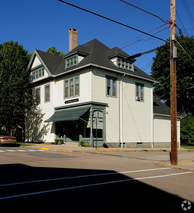
Property Record
77 Main St, Stonington, CT 06378


Property Detail
77 Main St
STON-000101-000029-000002
NEW LONDON
Commercialbuilding
Connecticut
RP
2
B and X Area of moderate flood hazard, usually the area between the limits of the 100-year and 500-year floods.
0.11 AC
2024
SE New London
2025
Hartford
705200
Norwich-New London-Willimantic, CT
3,590 SF
NEARBY LISTINGS FOR SALE OR LEASE
-
-
View all Stonington listings for sale on LoopNet.com
DEMOGRAPHICS near 77 Main St
1 mile
3 mile
5 mile
2025 Total Population
1,887
5,780
31,351
2030 Population
1,960
5,976
32,020
Pop Growth 2025-2030
+ 3.87%
+ 3.39%
+ 2.13%
Average Age
53
51
49
2025 Total Households
1,007
2,747
14,367
HH Growth 2025-2030
+ 3.77%
+ 3.35%
+ 2.18%
Median Household Inc
$104,741
$115,089
$106,706
Avg Household Size
1.90
2.00
2.10
2025 Avg HH Vehicles
2.00
2.00
2.00
Median Home Value
$723,607
$675,000
$515,998
Median Year Built
1946
1955
1965
Nearby Places
Map Layers
Map Styles
 Street
 Aerial
Layers
 Traffic
 Biking
Places
Listings with unknown addresses are not visible on the map
- Restaurants
- Banks
- Shops
- Fitness
- Groceries
PUBLIC TRANSPORTATION
COMMUTER RAIL
Drive
Walk
Distance
8 min
4.2 mi
Drive
Walk
Distance
10 min
5.8 mi
AIRPORT
Rhode Island Tf Green International
Drive
Walk
Distance
Rhode Island Tf Green International
60 min
42.8 mi
Freight Ports
Port of Davisville, RI
Drive
Walk
Distance
Port of Davisville, RI
62 min
43.0 mi
Nearby Properties
Address
Land Use
TOTAL SIZE
Lot Size
Zoning
Address
Land Use
TOTAL SIZE
Lot Size
Zoning
32.59 AC
RA-40
Address
Land Use
TOTAL SIZE
Lot Size
Zoning
138,366 SF
11.20 AC
GDD
Address
Land Use
TOTAL SIZE
Lot Size
Zoning
74,328 SF
19.50 AC
RR-80
Address
Land Use
TOTAL SIZE
Lot Size
Zoning
120,243 SF
9.06 AC
TC-80
Address
Land Use
TOTAL SIZE
Lot Size
Zoning
85,073 SF
17.60 AC
RA-20
Address
Land Use
TOTAL SIZE
Lot Size
Zoning
7.40 AC
M-1
Address
Land Use
TOTAL SIZE
Lot Size
Zoning
1.30 AC
Address
Land Use
TOTAL SIZE
Lot Size
Zoning
68,206 SF
6.40 AC
M-1
Address
Land Use
TOTAL SIZE
Lot Size
Zoning
25.88 AC
RR-80
Address
Land Use
TOTAL SIZE
Lot Size
Zoning
48,697 SF
3.83 AC
TC-80
Address
Land Use
TOTAL SIZE
Lot Size
Zoning
46,652 SF
12.23 AC
RC-120
Address
Land Use
TOTAL SIZE
Lot Size
Zoning
48.70 AC
GB-130
Address
Land Use
TOTAL SIZE
Lot Size
Zoning
7,500 SF
2.87 AC
MC-80
Address
Land Use
TOTAL SIZE
Lot Size
Zoning
3.50 AC
RC-120
Address
Land Use
TOTAL SIZE
Lot Size
Zoning
40,534 SF
20.84 AC
RC-120
Address
Land Use
TOTAL SIZE
Lot Size
Zoning
4.80 AC
RL
Address
Land Use
TOTAL SIZE
Lot Size
Zoning
7.62 AC
RM-20
Address
Land Use
TOTAL SIZE
Lot Size
Zoning
2,616 SF
3.21 AC
RR-80
Address
Land Use
TOTAL SIZE
Lot Size
Zoning
12.89 AC
M-1
Address
Land Use
TOTAL SIZE
Lot Size
Zoning
4,004 SF
30.20 AC
GB-130
Address
Land Use
TOTAL SIZE
Lot Size
Zoning
3.80 AC
RM-15
Address
Land Use
TOTAL SIZE
Lot Size
Zoning
71,673 SF
4.30 AC
M-1
Address
Land Use
TOTAL SIZE
Lot Size
Zoning
1.15 AC
MC-80
Address
Land Use
TOTAL SIZE
Lot Size
Zoning
9.70 AC
RC-120
Address
Land Use
TOTAL SIZE
Lot Size
Zoning
12.40 AC
RM-20
Address
Land Use
TOTAL SIZE
Lot Size
Zoning
13,000 SF
11.08 AC
M-1
Address
Land Use
TOTAL SIZE
Lot Size
Zoning
2,204 SF
34.14 AC
RM-15
Address
Land Use
TOTAL SIZE
Lot Size
Zoning
3 AC
RR-80
Address
Land Use
TOTAL SIZE
Lot Size
Zoning
21.96 AC
TC-80
Address
Land Use
TOTAL SIZE
Lot Size
Zoning
25.04 AC
RM-20
The World's #1 Commercial Real Estate Marketplace
Connect with us
© 2026 CoStar Group
The information above has been obtained from sources believed reliable. While we do not doubt its accuracy we have not verified it and make no guarantee, warranty or representation about it. It is your responsibility to independently confirm its accuracy and completeness. Any projections, opinions, assumptions, or estimates used are for example only and do not represent the current or future performance of the property. The value of this transaction to you depends on tax and other factors which should be evaluated by your tax, financial, and legal advisors. You and your advisors should conduct a careful, independent investigation of the property to determine to your satisfaction the suitability of the property for your needs.