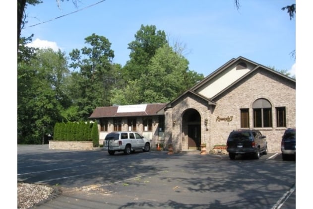
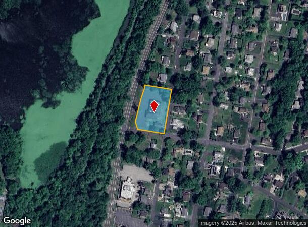
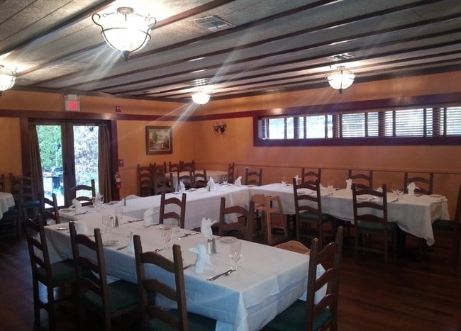
Property Record
77 S Route 303, Congers, NY 10920
NEARBY LISTINGS FOR SALE OR LEASE
Property Detail
77 S Route 303
New York-Jersey City-White Plains, NY-NJ
Merged
392089-044-020-0001-086-000-0000
MERGED LOT 26 INTO LOT 25 126-B-25
Restaurantbuilding
Rockland
X
New York
36087C0118G
86.0
2023
0.99 AC
2024
Clarkstown
010902
Northern New Jersey
13,252 SF
DEMOGRAPHICS near 77 S Route 303
1 Mile
3 Mile
5 Mile
2024 Total Population
6,976
34,128
132,499
2029 Population
6,910
34,040
130,851
Pop Growth 2024-2029
(0.95%)
(0.26%)
(1.24%)
Average Age
43
43
41
2024 Total Households
2,353
12,009
45,191
HH Growth 2024-2029
(0.98%)
(0.21%)
(1.30%)
Median Household Inc
$128,309
$122,750
$110,204
Avg Household Size
2.90
2.80
2.80
2024 Avg HH Vehicles
2.00
2.00
2.00
Median Home Value
$480,333
$523,062
$528,347
Median Year Built
1971
1970
1967
Nearby Places
- Restaurants
- Banks
- Shops
- Fitness
- Groceries
PUBLIC TRANSPORTATION
AIRPORT
Westchester County
DRIVE
WALK
Distance
Westchester County
32 min
23.0 mi
New York Stewart International
DRIVE
WALK
Distance
New York Stewart International
51 min
34.7 mi
LaGuardia
DRIVE
WALK
Distance
LaGuardia
51 min
35.7 mi
Freight Ports
NY - Red Hook Container Terminal
DRIVE
WALK
Distance
NY - Red Hook Container Terminal
62 min
38.9 mi
SALE & LEASE HISTORY
LISTING DATE
SALE/LEASE

May 16, 2019
For Sale
Nearby Properties
Address
Land Use
TOTAL SIZE
Lot Size
Zoning
Address
Land Use
TOTAL SIZE
Lot Size
Zoning
316,644 SF
65.70 AC
Address
Land Use
TOTAL SIZE
Lot Size
Zoning
247,711 SF
37.26 AC
Address
Land Use
TOTAL SIZE
Lot Size
Zoning
201.67 AC
Address
Land Use
TOTAL SIZE
Lot Size
Zoning
Address
Land Use
TOTAL SIZE
Lot Size
Zoning
68,910 SF
27 AC
Address
Land Use
TOTAL SIZE
Lot Size
Zoning
Address
Land Use
TOTAL SIZE
Lot Size
Zoning
68,910 SF
6.90 AC
02 - SINGL
Address
Land Use
TOTAL SIZE
Lot Size
Zoning
2,140 SF
1.91 AC
Address
Land Use
TOTAL SIZE
Lot Size
Zoning
133,039 SF
14.80 AC
CS
Address
Land Use
TOTAL SIZE
Lot Size
Zoning
60,423 SF
2.90 AC
Address
Land Use
TOTAL SIZE
Lot Size
Zoning
Address
Land Use
TOTAL SIZE
Lot Size
Zoning
129,218 SF
11.56 AC
Address
Land Use
TOTAL SIZE
Lot Size
Zoning
100,800 SF
13.40 AC
02 - SINGL
Address
Land Use
TOTAL SIZE
Lot Size
Zoning
130,930 SF
11 AC
Address
Land Use
TOTAL SIZE
Lot Size
Zoning
248,709 SF
15.30 AC
Address
Land Use
TOTAL SIZE
Lot Size
Zoning
38,624 SF
5.90 AC
Address
Land Use
TOTAL SIZE
Lot Size
Zoning
106,960 SF
8.04 AC
CS
Address
Land Use
TOTAL SIZE
Lot Size
Zoning
99,725 SF
17.78 AC
03 - MULTI
Address
Land Use
TOTAL SIZE
Lot Size
Zoning
58,786 SF
7.90 AC
Address
Land Use
TOTAL SIZE
Lot Size
Zoning
40,194 SF
14 AC
Address
Land Use
TOTAL SIZE
Lot Size
Zoning
47,722 SF
2.65 AC
CS
Address
Land Use
TOTAL SIZE
Lot Size
Zoning
35,921 SF
6.10 AC
02 - SINGL
Address
Land Use
TOTAL SIZE
Lot Size
Zoning
214,974 SF
10.80 AC
Address
Land Use
TOTAL SIZE
Lot Size
Zoning
26,698 SF
7.75 AC
Address
Land Use
TOTAL SIZE
Lot Size
Zoning
38,700 SF
21.45 AC
Address
Land Use
TOTAL SIZE
Lot Size
Zoning
51,445 SF
12.70 AC
Address
Land Use
TOTAL SIZE
Lot Size
Zoning
46,962 SF
0.68 AC
PO
Address
Land Use
TOTAL SIZE
Lot Size
Zoning
111,550 SF
9.29 AC
LI
Address
Land Use
TOTAL SIZE
Lot Size
Zoning
43,525 SF
14.30 AC
02 - SINGL
Address
Land Use
TOTAL SIZE
Lot Size
Zoning
81,780 SF
7.52 AC
The World's #1 Commercial Real Estate Marketplace
Connect with us
© 2025 CoStar Group
The information above has been obtained from sources believed reliable. While we do not doubt its accuracy we have not verified it and make no guarantee, warranty or representation about it. It is your responsibility to independently confirm its accuracy and completeness. Any projections, opinions, assumptions, or estimates used are for example only and do not represent the current or future performance of the property. The value of this transaction to you depends on tax and other factors which should be evaluated by your tax, financial, and legal advisors. You and your advisors should conduct a careful, independent investigation of the property to determine to your satisfaction the suitability of the property for your needs.