Property Record
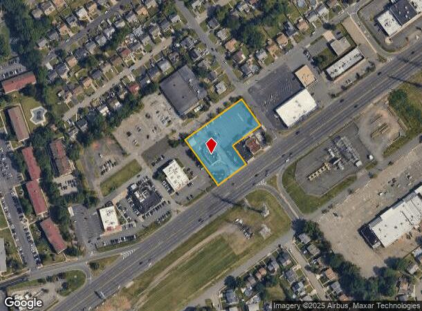
77 Us Highway 1 S, Metuchen, NJ 08840


NEARBY LISTINGS FOR SALE OR LEASE
Property Detail
77 Us Highway 1 S
25-00350-05-00002
150.0X240.0 3
Vacantlandnec
Middlesex
X
New Jersey
34023C0062F
2
2024
0.83 AC
2025
North Edison/Woodbridge
003001
Northern New Jersey
2,776 SF
New York-Jersey City-White Plains, NY-NJ
DEMOGRAPHICS near 77 Us Highway 1 S
1 Mile
3 Mile
5 Mile
2024 Total Population
17,668
129,740
316,446
2029 Population
17,637
128,915
312,950
Pop Growth 2024-2029
(0.18%)
(0.64%)
(1.10%)
Average Age
40
41
40
2024 Total Households
6,460
46,136
109,828
HH Growth 2024-2029
(0.36%)
(0.72%)
(1.12%)
Median Household Inc
$105,635
$107,949
$101,136
Avg Household Size
2.60
2.70
2.80
2024 Avg HH Vehicles
2.00
2.00
2.00
Median Home Value
$353,820
$394,983
$398,431
Median Year Built
1963
1963
1966
Nearby Places
Map Layers
Map Styles
 Street
 Aerial
- Restaurants
- Banks
- Shops
- Fitness
- Groceries
PUBLIC TRANSPORTATION
COMMUTER RAIL
Metuchen (Northeast Corridor Line - NJ Transit Commuter Rail (NJ Transit))
DRIVE
WALK
Distance
Metuchen (Northeast Corridor Line - NJ Transit Commuter Rail (NJ Transit))
5 min
2.1 mi
Metropark (Northeast Corridor Line - NJ Transit Commuter Rail (NJ Transit))
DRIVE
WALK
Distance
Metropark (Northeast Corridor Line - NJ Transit Commuter Rail (NJ Transit))
6 min
2.5 mi
AIRPORT
Newark Liberty International
DRIVE
WALK
Distance
Newark Liberty International
26 min
19.9 mi
LaGuardia
DRIVE
WALK
Distance
LaGuardia
60 min
37.3 mi
John F Kennedy International
DRIVE
WALK
Distance
John F Kennedy International
60 min
40.0 mi
Freight Ports
New York Container Terminal
DRIVE
WALK
Distance
New York Container Terminal
21 min
12.7 mi
Nearby Properties
Address
Land Use
TOTAL SIZE
Lot Size
Zoning
Address
Land Use
TOTAL SIZE
Lot Size
Zoning
37.46 AC
EI
Address
Land Use
TOTAL SIZE
Lot Size
Zoning
65.84 AC
PB
Address
Land Use
TOTAL SIZE
Lot Size
Zoning
37.32 AC
S-3B
Address
Land Use
TOTAL SIZE
Lot Size
Zoning
11.63 AC
S-3D
Address
Land Use
TOTAL SIZE
Lot Size
Zoning
80,000 SF
23.37 AC
R50
Address
Land Use
TOTAL SIZE
Lot Size
Zoning
28.90 AC
S-3B
Address
Land Use
TOTAL SIZE
Lot Size
Zoning
40.78 AC
RRRD
Address
Land Use
TOTAL SIZE
Lot Size
Zoning
96.22 AC
RA
Address
Land Use
TOTAL SIZE
Lot Size
Zoning
27.36 AC
Address
Land Use
TOTAL SIZE
Lot Size
Zoning
191.81 AC
R75
Address
Land Use
TOTAL SIZE
Lot Size
Zoning
3.18 AC
Address
Land Use
TOTAL SIZE
Lot Size
Zoning
53.95 AC
RRRD
Address
Land Use
TOTAL SIZE
Lot Size
Zoning
90.33 AC
Address
Land Use
TOTAL SIZE
Lot Size
Zoning
10,173 SF
14.04 AC
OR
Address
Land Use
TOTAL SIZE
Lot Size
Zoning
317 SF
11.60 AC
R-MM
Address
Land Use
TOTAL SIZE
Lot Size
Zoning
43.63 AC
MF
Address
Land Use
TOTAL SIZE
Lot Size
Zoning
5.83 AC
RO
Address
Land Use
TOTAL SIZE
Lot Size
Zoning
15.55 AC
Address
Land Use
TOTAL SIZE
Lot Size
Zoning
19.50 AC
LR
Address
Land Use
TOTAL SIZE
Lot Size
Zoning
6.10 AC
RO
Address
Land Use
TOTAL SIZE
Lot Size
Zoning
22.50 AC
LR
Address
Land Use
TOTAL SIZE
Lot Size
Zoning
74.58 AC
B4
Address
Land Use
TOTAL SIZE
Lot Size
Zoning
Address
Land Use
TOTAL SIZE
Lot Size
Zoning
15.83 AC
M-3
Address
Land Use
TOTAL SIZE
Lot Size
Zoning
26.50 AC
LR
Address
Land Use
TOTAL SIZE
Lot Size
Zoning
25.82 AC
RRRD
Address
Land Use
TOTAL SIZE
Lot Size
Zoning
11.49 AC
RO
Address
Land Use
TOTAL SIZE
Lot Size
Zoning
11.25 AC
LI
Address
Land Use
TOTAL SIZE
Lot Size
Zoning
261,144 SF
10.14 AC
OR
Address
Land Use
TOTAL SIZE
Lot Size
Zoning
26 AC
R1
The World's #1 Commercial Real Estate Marketplace
Connect with us
© 2025 CoStar Group
The information above has been obtained from sources believed reliable. While we do not doubt its accuracy we have not verified it and make no guarantee, warranty or representation about it. It is your responsibility to independently confirm its accuracy and completeness. Any projections, opinions, assumptions, or estimates used are for example only and do not represent the current or future performance of the property. The value of this transaction to you depends on tax and other factors which should be evaluated by your tax, financial, and legal advisors. You and your advisors should conduct a careful, independent investigation of the property to determine to your satisfaction the suitability of the property for your needs.