Property Record
770 Canning Pky, Victor, NY 14564


NEARBY LISTINGS FOR SALE OR LEASE
Property Detail
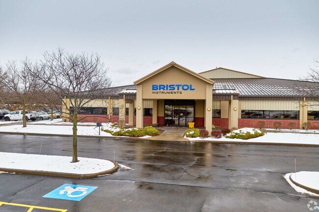
770 Canning Pky
Rochester, NY
Ontario
324889-014-002-0001-054-111
New York
Officebuilding
54.111
2025
8.10 AC
2024
Southeast
050101
Rochester
41,414 SF
DEMOGRAPHICS near 770 Canning Pky
1 Mile
3 Mile
5 Mile
2024 Total Population
676
9,746
35,301
2029 Population
669
9,706
35,025
Pop Growth 2024-2029
(1.04%)
(0.41%)
(0.78%)
Average Age
44
43
43
2024 Total Households
265
3,677
13,306
HH Growth 2024-2029
(1.51%)
(0.54%)
(0.88%)
Median Household Inc
$160,811
$157,197
$135,484
Avg Household Size
2.50
2.60
2.60
2024 Avg HH Vehicles
2.00
2.00
2.00
Median Home Value
$375,372
$370,170
$324,020
Median Year Built
1988
1991
1983
Nearby Places
Map Layers
Map Styles
 Street
 Aerial
- Restaurants
- Banks
- Shops
- Fitness
- Groceries
PUBLIC TRANSPORTATION
AIRPORT
Frederick Douglass/Greater Rochester International
DRIVE
WALK
Distance
Frederick Douglass/Greater Rochester International
31 min
18.3 mi
Freight Ports
Albany, NY Port
DRIVE
WALK
Distance
Albany, NY Port
253 min
215.0 mi
SALE & LEASE HISTORY
LISTING DATE
SALE/LEASE

Oct 05, 2016
For Lease
Mar 07, 2018
For Lease
Nearby Properties
Address
Land Use
TOTAL SIZE
Lot Size
Zoning
Address
Land Use
TOTAL SIZE
Lot Size
Zoning
667,703 SF
89.60 AC
COMM
Address
Land Use
TOTAL SIZE
Lot Size
Zoning
385,152 SF
124.20 AC
R1-C
Address
Land Use
TOTAL SIZE
Lot Size
Zoning
239,694 SF
94.46 AC
COMM
Address
Land Use
TOTAL SIZE
Lot Size
Zoning
Address
Land Use
TOTAL SIZE
Lot Size
Zoning
Address
Land Use
TOTAL SIZE
Lot Size
Zoning
16,965 SF
9.90 AC
PDD
Address
Land Use
TOTAL SIZE
Lot Size
Zoning
145,904 SF
24.20 AC
PDD
Address
Land Use
TOTAL SIZE
Lot Size
Zoning
211,069 SF
22.70 AC
COMM
Address
Land Use
TOTAL SIZE
Lot Size
Zoning
3,864 SF
69.30 AC
MD
Address
Land Use
TOTAL SIZE
Lot Size
Zoning
107,120 SF
9.01 AC
INDUSTRIAL
Address
Land Use
TOTAL SIZE
Lot Size
Zoning
135,844 SF
8.40 AC
COMM
Address
Land Use
TOTAL SIZE
Lot Size
Zoning
Address
Land Use
TOTAL SIZE
Lot Size
Zoning
Address
Land Use
TOTAL SIZE
Lot Size
Zoning
155,915 SF
20.80 AC
PDD
Address
Land Use
TOTAL SIZE
Lot Size
Zoning
123,500 SF
8.80 AC
PDD
Address
Land Use
TOTAL SIZE
Lot Size
Zoning
117,445 SF
11.86 AC
PDD
Address
Land Use
TOTAL SIZE
Lot Size
Zoning
122,402 SF
10 AC
PDD
Address
Land Use
TOTAL SIZE
Lot Size
Zoning
67,898 SF
14.50 AC
LI
Address
Land Use
TOTAL SIZE
Lot Size
Zoning
33,680 SF
34 AC
LI
Address
Land Use
TOTAL SIZE
Lot Size
Zoning
112,061 SF
20.16 AC
COMM
Address
Land Use
TOTAL SIZE
Lot Size
Zoning
114,667 SF
10.30 AC
PDD
Address
Land Use
TOTAL SIZE
Lot Size
Zoning
150,192 SF
20 AC
PDD
Address
Land Use
TOTAL SIZE
Lot Size
Zoning
174,700 SF
15.90 AC
COMM
Address
Land Use
TOTAL SIZE
Lot Size
Zoning
98,497 SF
14.10 AC
COMM
Address
Land Use
TOTAL SIZE
Lot Size
Zoning
123,711 SF
13.70 AC
COMM
Address
Land Use
TOTAL SIZE
Lot Size
Zoning
1.10 AC
COMM
Address
Land Use
TOTAL SIZE
Lot Size
Zoning
95,167 SF
20.10 AC
PDD
Address
Land Use
TOTAL SIZE
Lot Size
Zoning
197,263 SF
24.84 AC
I
Address
Land Use
TOTAL SIZE
Lot Size
Zoning
Address
Land Use
TOTAL SIZE
Lot Size
Zoning
100,057 SF
5.98 AC
INDUSTRIAL
The World's #1 Commercial Real Estate Marketplace
Connect with us
© 2025 CoStar Group
The information above has been obtained from sources believed reliable. While we do not doubt its accuracy we have not verified it and make no guarantee, warranty or representation about it. It is your responsibility to independently confirm its accuracy and completeness. Any projections, opinions, assumptions, or estimates used are for example only and do not represent the current or future performance of the property. The value of this transaction to you depends on tax and other factors which should be evaluated by your tax, financial, and legal advisors. You and your advisors should conduct a careful, independent investigation of the property to determine to your satisfaction the suitability of the property for your needs.