Property Record
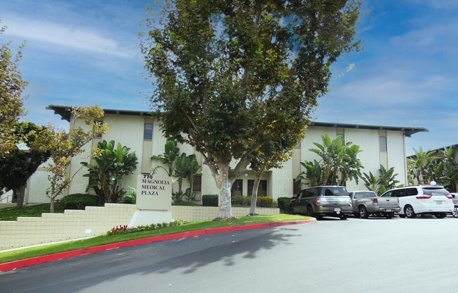
770 Magnolia Ave, Corona, CA 92879
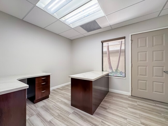

Current Lease Availabilities
NEARBY LISTINGS FOR SALE OR LEASE
Property Detail
770 Magnolia Ave
Riverside-San Bernardino-Ontario, CA
Lands/South Riverside & Water
107-112-001
UNIT 1A CM 154/001
Medicalbuilding
Riverside
X
California
06059C0225J
1a
2024
1.05 AC
2025
Corona/Eastvale
041809
Inland Empire (California)
15,475 SF
DEMOGRAPHICS near 770 Magnolia Ave
1 Mile
3 Mile
5 Mile
2024 Total Population
19,411
128,724
208,593
2029 Population
20,296
135,063
218,897
Pop Growth 2024-2029
+ 4.56%
+ 4.92%
+ 4.94%
Average Age
38
36
37
2024 Total Households
5,922
37,073
60,930
HH Growth 2024-2029
+ 4.19%
+ 4.46%
+ 4.48%
Median Household Inc
$83,839
$93,266
$98,229
Avg Household Size
3.10
3.30
3.20
2024 Avg HH Vehicles
2.00
2.00
2.00
Median Home Value
$550,053
$620,815
$634,866
Median Year Built
1982
1987
1988
Nearby Places
Map Layers
Map Styles
 Street
 Aerial
- Restaurants
- Banks
- Shops
- Fitness
- Groceries
PUBLIC TRANSPORTATION
COMMUTER RAIL
North Main Corona (91 Line - Southern California Regional Rail Authority (Metrolink), Inland Empire-Orange County Line - Southern California Regional Rail Authority (Metrolink))
DRIVE
WALK
Distance
North Main Corona (91 Line - Southern California Regional Rail Authority (Metrolink), Inland Empire-Orange County Line - Southern California Regional Rail Authority (Metrolink))
5 min
2.1 mi
West Corona (91 Line - Southern California Regional Rail Authority (Metrolink), Inland Empire-Orange County Line - Southern California Regional Rail Authority (Metrolink))
DRIVE
WALK
Distance
West Corona (91 Line - Southern California Regional Rail Authority (Metrolink), Inland Empire-Orange County Line - Southern California Regional Rail Authority (Metrolink))
10 min
5.3 mi
AIRPORT
Ontario International
DRIVE
WALK
Distance
Ontario International
25 min
17.9 mi
John Wayne/Orange County
DRIVE
WALK
Distance
John Wayne/Orange County
39 min
30.3 mi
Long Beach (Daugherty Field)
DRIVE
WALK
Distance
Long Beach (Daugherty Field)
55 min
44.8 mi
Nearby Properties
Address
Land Use
TOTAL SIZE
Lot Size
Zoning
Address
Land Use
TOTAL SIZE
Lot Size
Zoning
32,924 SF
24.04 AC
Address
Land Use
TOTAL SIZE
Lot Size
Zoning
12.69 AC
Address
Land Use
TOTAL SIZE
Lot Size
Zoning
29,695 SF
18.71 AC
R3
Address
Land Use
TOTAL SIZE
Lot Size
Zoning
205,235 SF
10.30 AC
Address
Land Use
TOTAL SIZE
Lot Size
Zoning
71,440 SF
14.37 AC
Address
Land Use
TOTAL SIZE
Lot Size
Zoning
289,297 SF
13.28 AC
M3
Address
Land Use
TOTAL SIZE
Lot Size
Zoning
186,190 SF
9.79 AC
Address
Land Use
TOTAL SIZE
Lot Size
Zoning
164,712 SF
10 AC
R3
Address
Land Use
TOTAL SIZE
Lot Size
Zoning
173,676 SF
10.96 AC
R3
Address
Land Use
TOTAL SIZE
Lot Size
Zoning
24,144 SF
13.34 AC
R3
Address
Land Use
TOTAL SIZE
Lot Size
Zoning
245,658 SF
15.38 AC
PD
Address
Land Use
TOTAL SIZE
Lot Size
Zoning
152,369 SF
5.38 AC
Address
Land Use
TOTAL SIZE
Lot Size
Zoning
8.80 AC
R3
Address
Land Use
TOTAL SIZE
Lot Size
Zoning
150,404 SF
8.02 AC
Address
Land Use
TOTAL SIZE
Lot Size
Zoning
248,799 SF
12.06 AC
Address
Land Use
TOTAL SIZE
Lot Size
Zoning
421,898 SF
3 AC
Address
Land Use
TOTAL SIZE
Lot Size
Zoning
217,299 SF
7.41 AC
Address
Land Use
TOTAL SIZE
Lot Size
Zoning
141,280 SF
9.31 AC
Address
Land Use
TOTAL SIZE
Lot Size
Zoning
115,545 SF
5.97 AC
Address
Land Use
TOTAL SIZE
Lot Size
Zoning
171,707 SF
8.55 AC
Address
Land Use
TOTAL SIZE
Lot Size
Zoning
149,389 SF
6.72 AC
Address
Land Use
TOTAL SIZE
Lot Size
Zoning
359,304 SF
8.86 AC
R3
Address
Land Use
TOTAL SIZE
Lot Size
Zoning
152,756 SF
7.07 AC
Address
Land Use
TOTAL SIZE
Lot Size
Zoning
138,800 SF
10 AC
M4
Address
Land Use
TOTAL SIZE
Lot Size
Zoning
140,216 SF
6.43 AC
Address
Land Use
TOTAL SIZE
Lot Size
Zoning
111,862 SF
9.98 AC
A
Address
Land Use
TOTAL SIZE
Lot Size
Zoning
311,297 SF
13.39 AC
Address
Land Use
TOTAL SIZE
Lot Size
Zoning
364,162 SF
10 AC
M4
The World's #1 Commercial Real Estate Marketplace
Connect with us
© 2025 CoStar Group
The information above has been obtained from sources believed reliable. While we do not doubt its accuracy we have not verified it and make no guarantee, warranty or representation about it. It is your responsibility to independently confirm its accuracy and completeness. Any projections, opinions, assumptions, or estimates used are for example only and do not represent the current or future performance of the property. The value of this transaction to you depends on tax and other factors which should be evaluated by your tax, financial, and legal advisors. You and your advisors should conduct a careful, independent investigation of the property to determine to your satisfaction the suitability of the property for your needs.