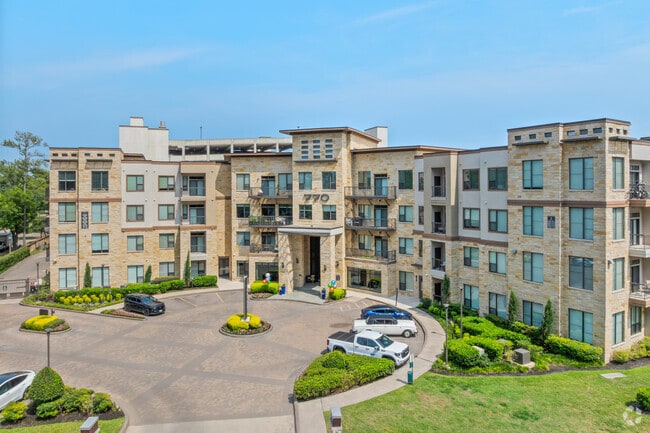
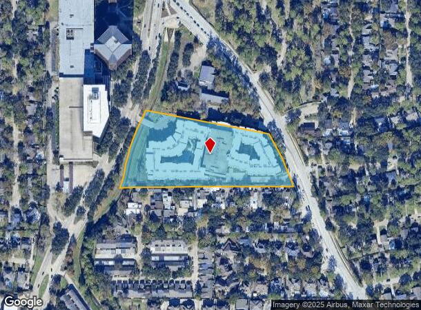
Property Record
770 N Eldridge Pkwy, Houston, TX 77079
NEARBY LISTINGS FOR SALE OR LEASE
Property Detail
770 N Eldridge Pkwy
1337580010001
Alliance Memorial
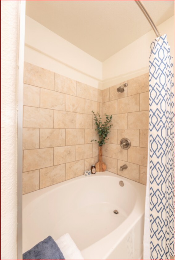
Apartment
RES B BLK 1 ALLIANCE MEMORIAL
AE
Harris
48201C0640M
Texas
2024
5.46 AC
2025
Energy Corridor
450600
Houston
437,786 SF
Houston-The Woodlands-Sugar Land, TX
DEMOGRAPHICS near 770 N Eldridge Pkwy
1 Mile
3 Mile
5 Mile
2024 Total Population
14,079
104,289
270,920
2029 Population
14,392
106,569
276,844
Pop Growth 2024-2029
+ 2.22%
+ 2.19%
+ 2.19%
Average Age
37
38
37
2024 Total Households
6,148
44,230
109,759
HH Growth 2024-2029
+ 1.97%
+ 2.07%
+ 2.17%
Median Household Inc
$71,138
$69,848
$63,837
Avg Household Size
2.20
2.30
2.40
2024 Avg HH Vehicles
2.00
2.00
2.00
Median Home Value
$460,493
$389,418
$335,525
Median Year Built
1993
1986
1986
Nearby Places
Map Layers
Map Styles
 Street
 Aerial
- Restaurants
- Banks
- Shops
- Fitness
- Groceries
PUBLIC TRANSPORTATION
AIRPORT
William P Hobby
DRIVE
WALK
Distance
William P Hobby
45 min
29.6 mi
George Bush Intcntl/Houston
DRIVE
WALK
Distance
George Bush Intcntl/Houston
39 min
30.9 mi
Freight Ports
Port of Houston
DRIVE
WALK
Distance
Port of Houston
38 min
26.4 mi
SALE & LEASE HISTORY
LISTING DATE
SALE/LEASE

May 08, 2019
For Sale
Nearby Properties
Address
Land Use
TOTAL SIZE
Lot Size
Zoning
Address
Land Use
TOTAL SIZE
Lot Size
Zoning
2,976,779 SF
41.36 AC
Address
Land Use
TOTAL SIZE
Lot Size
Zoning
1,385,616 SF
6.48 AC
Address
Land Use
TOTAL SIZE
Lot Size
Zoning
1,131,022 SF
6.26 AC
Address
Land Use
TOTAL SIZE
Lot Size
Zoning
1,208,144 SF
6.15 AC
Address
Land Use
TOTAL SIZE
Lot Size
Zoning
759,908 SF
4.54 AC
Address
Land Use
TOTAL SIZE
Lot Size
Zoning
953,143 SF
63.82 AC
Address
Land Use
TOTAL SIZE
Lot Size
Zoning
1,543,856 SF
10.03 AC
Address
Land Use
TOTAL SIZE
Lot Size
Zoning
764,429 SF
6.78 AC
Address
Land Use
TOTAL SIZE
Lot Size
Zoning
1,045,896 SF
11.14 AC
Address
Land Use
TOTAL SIZE
Lot Size
Zoning
690,519 SF
26.57 AC
Address
Land Use
TOTAL SIZE
Lot Size
Zoning
617,832 SF
9.24 AC
Address
Land Use
TOTAL SIZE
Lot Size
Zoning
422,801 SF
12.71 AC
Address
Land Use
TOTAL SIZE
Lot Size
Zoning
520,277 SF
10.04 AC
Address
Land Use
TOTAL SIZE
Lot Size
Zoning
601,167 SF
14.93 AC
Address
Land Use
TOTAL SIZE
Lot Size
Zoning
845,902 SF
16.27 AC
Address
Land Use
TOTAL SIZE
Lot Size
Zoning
341,801 SF
9.72 AC
Address
Land Use
TOTAL SIZE
Lot Size
Zoning
533,048 SF
5.80 AC
Address
Land Use
TOTAL SIZE
Lot Size
Zoning
672,183 SF
8.80 AC
Address
Land Use
TOTAL SIZE
Lot Size
Zoning
803,103 SF
5.78 AC
Address
Land Use
TOTAL SIZE
Lot Size
Zoning
638,248 SF
23.38 AC
Address
Land Use
TOTAL SIZE
Lot Size
Zoning
927,684 SF
4.38 AC
Address
Land Use
TOTAL SIZE
Lot Size
Zoning
828,328 SF
3.90 AC
Address
Land Use
TOTAL SIZE
Lot Size
Zoning
856,208 SF
4.11 AC
Address
Land Use
TOTAL SIZE
Lot Size
Zoning
910,592 SF
6.35 AC
Address
Land Use
TOTAL SIZE
Lot Size
Zoning
775,560 SF
7.96 AC
Address
Land Use
TOTAL SIZE
Lot Size
Zoning
487,054 SF
13.85 AC
Address
Land Use
TOTAL SIZE
Lot Size
Zoning
502,709 SF
7.24 AC
Address
Land Use
TOTAL SIZE
Lot Size
Zoning
845,371 SF
32.37 AC
Address
Land Use
TOTAL SIZE
Lot Size
Zoning
403,650 SF
20.19 AC
Address
Land Use
TOTAL SIZE
Lot Size
Zoning
709,724 SF
6.17 AC
The World's #1 Commercial Real Estate Marketplace
Connect with us
© 2026 CoStar Group
The information above has been obtained from sources believed reliable. While we do not doubt its accuracy we have not verified it and make no guarantee, warranty or representation about it. It is your responsibility to independently confirm its accuracy and completeness. Any projections, opinions, assumptions, or estimates used are for example only and do not represent the current or future performance of the property. The value of this transaction to you depends on tax and other factors which should be evaluated by your tax, financial, and legal advisors. You and your advisors should conduct a careful, independent investigation of the property to determine to your satisfaction the suitability of the property for your needs.