Property Record
770 N Pleasant Hill Blvd, Pleasant Hill, IA 50327


NEARBY LISTINGS FOR SALE OR LEASE
-
-
View all Pleasant Hill listings for sale on LoopNet.com
Property Detail
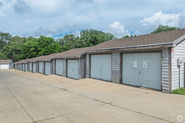
770 N Pleasant Hill Blvd
Des Moines-West Des Moines, IA
Orp Sec 5-78-23
221-00008002000
-EX BEG 24.1F NW OF NE COR THN NW342.4F SWLY 178.4F SE 437.1F N 150F TO POB- LOT 5 LESS RD ORP SEC 5-78-23
Apartment
Polk
X
Iowa
19153C0360F
5
2024
2.41 AC
2025
Outlying Polk County
010803
Des Moines
51,300 SF
DEMOGRAPHICS near 770 N Pleasant Hill Blvd
1 Mile
3 Mile
5 Mile
2024 Total Population
6,373
43,036
108,926
2029 Population
6,608
44,752
113,588
Pop Growth 2024-2029
+ 3.69%
+ 3.99%
+ 4.28%
Average Age
41
39
38
2024 Total Households
2,564
16,707
41,932
HH Growth 2024-2029
+ 3.82%
+ 4.11%
+ 4.55%
Median Household Inc
$68,709
$64,430
$63,612
Avg Household Size
2.50
2.50
2.50
2024 Avg HH Vehicles
2.00
2.00
2.00
Median Home Value
$225,443
$171,892
$174,309
Median Year Built
1989
1972
1976
Nearby Places
Map Layers
Map Styles
 Street
 Aerial
- Restaurants
- Banks
- Shops
- Fitness
- Groceries
PUBLIC TRANSPORTATION
AIRPORT
Des Moines International
DRIVE
WALK
Distance
Des Moines International
25 min
11.7 mi
Nearby Properties
Address
Land Use
TOTAL SIZE
Lot Size
Zoning
Address
Land Use
TOTAL SIZE
Lot Size
Zoning
475,929 SF
49.86 AC
M2
Address
Land Use
TOTAL SIZE
Lot Size
Zoning
320,429 SF
22.34 AC
R3
Address
Land Use
TOTAL SIZE
Lot Size
Zoning
90,325 SF
5.49 AC
PUD
Address
Land Use
TOTAL SIZE
Lot Size
Zoning
129,276 SF
7.63 AC
Address
Land Use
TOTAL SIZE
Lot Size
Zoning
175,854 SF
22.81 AC
Address
Land Use
TOTAL SIZE
Lot Size
Zoning
1,890,511 SF
39.03 AC
M-2
Address
Land Use
TOTAL SIZE
Lot Size
Zoning
155,276 SF
6.66 AC
R-4
Address
Land Use
TOTAL SIZE
Lot Size
Zoning
201,072 SF
26.81 AC
Address
Land Use
TOTAL SIZE
Lot Size
Zoning
47,267 SF
22.69 AC
R-4
Address
Land Use
TOTAL SIZE
Lot Size
Zoning
126,830 SF
6.53 AC
Address
Land Use
TOTAL SIZE
Lot Size
Zoning
39,936 SF
4.62 AC
R-4
Address
Land Use
TOTAL SIZE
Lot Size
Zoning
45,004 SF
5.68 AC
Address
Land Use
TOTAL SIZE
Lot Size
Zoning
65,079 SF
6.19 AC
R-2
Address
Land Use
TOTAL SIZE
Lot Size
Zoning
55,091 SF
1.40 AC
Address
Land Use
TOTAL SIZE
Lot Size
Zoning
70,148 SF
5.52 AC
Address
Land Use
TOTAL SIZE
Lot Size
Zoning
89,286 SF
14.49 AC
R1-60
Address
Land Use
TOTAL SIZE
Lot Size
Zoning
31,544 SF
9.38 AC
R1-80
Address
Land Use
TOTAL SIZE
Lot Size
Zoning
51,023 SF
5.49 AC
R160
Address
Land Use
TOTAL SIZE
Lot Size
Zoning
123,059 SF
27.23 AC
M2
Address
Land Use
TOTAL SIZE
Lot Size
Zoning
64,734 SF
4.48 AC
Address
Land Use
TOTAL SIZE
Lot Size
Zoning
71,730 SF
6.39 AC
I-2
Address
Land Use
TOTAL SIZE
Lot Size
Zoning
99,200 SF
7 AC
I-2
Address
Land Use
TOTAL SIZE
Lot Size
Zoning
62,467 SF
4.60 AC
Address
Land Use
TOTAL SIZE
Lot Size
Zoning
107,640 SF
9.57 AC
Address
Land Use
TOTAL SIZE
Lot Size
Zoning
107,190 SF
12.32 AC
C-4
Address
Land Use
TOTAL SIZE
Lot Size
Zoning
1,326 SF
5.15 AC
I-3
Address
Land Use
TOTAL SIZE
Lot Size
Zoning
56,281 SF
5.80 AC
C-1
Address
Land Use
TOTAL SIZE
Lot Size
Zoning
83,294 SF
8.25 AC
PUD
Address
Land Use
TOTAL SIZE
Lot Size
Zoning
16.80 AC
M-1
Address
Land Use
TOTAL SIZE
Lot Size
Zoning
38,172 SF
3.27 AC
C-2
The World's #1 Commercial Real Estate Marketplace
Connect with us
© 2026 CoStar Group
The information above has been obtained from sources believed reliable. While we do not doubt its accuracy we have not verified it and make no guarantee, warranty or representation about it. It is your responsibility to independently confirm its accuracy and completeness. Any projections, opinions, assumptions, or estimates used are for example only and do not represent the current or future performance of the property. The value of this transaction to you depends on tax and other factors which should be evaluated by your tax, financial, and legal advisors. You and your advisors should conduct a careful, independent investigation of the property to determine to your satisfaction the suitability of the property for your needs.