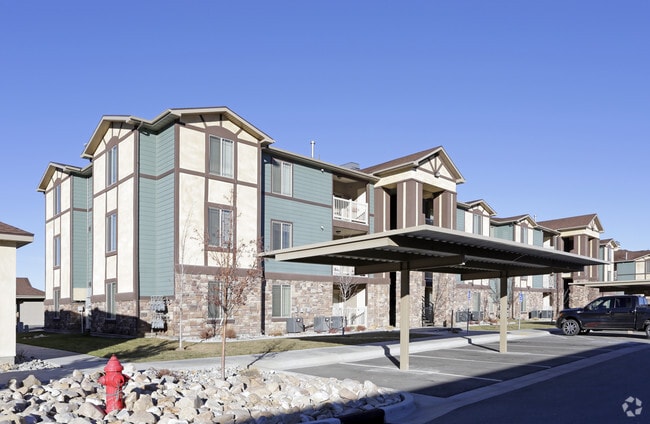
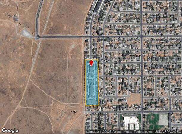
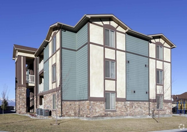
Property Record
770 S 1050 W, Tooele, UT 84074
NEARBY LISTINGS FOR SALE OR LEASE
-
-
View all Tooele listings for sale on LoopNet.com
Property Detail
770 S 1050 W
Salt Lake City, UT
West Meadows Plat D Amended
16-078-0-0021
LOT 21, WEST MEADOWS PLAT D AMENDED, A SUBDIVISION OF TOOELE CITY. OUT OF 15-96-4 FOR 2009 YEAR.
Welfaresocialservicelowincomehousingexempt
Tooele
X
Utah
49045C1640C
21
2025
5.34 AC
2025
Tooele County
131101
Salt Lake City
4,092 SF
DEMOGRAPHICS near 770 S 1050 W
1 Mile
3 Mile
5 Mile
2024 Total Population
6,543
28,954
42,646
2029 Population
8,163
36,143
53,349
Pop Growth 2024-2029
+ 24.76%
+ 24.83%
+ 25.10%
Average Age
34
35
34
2024 Total Households
2,038
9,729
13,689
HH Growth 2024-2029
+ 25.17%
+ 25.25%
+ 25.49%
Median Household Inc
$102,687
$81,200
$87,506
Avg Household Size
3.20
2.90
3.10
2024 Avg HH Vehicles
3.00
2.00
3.00
Median Home Value
$287,281
$274,912
$292,863
Median Year Built
1995
1991
1995
Nearby Places
Map Layers
Map Styles
 Street
 Aerial
- Restaurants
- Banks
- Shops
- Fitness
- Groceries
PUBLIC TRANSPORTATION
AIRPORT
Salt Lake City International
DRIVE
WALK
Distance
Salt Lake City International
44 min
32.7 mi
Freight Ports
Port of Stockton
DRIVE
WALK
Distance
Port of Stockton
705 min
683.4 mi
Nearby Properties
Address
Land Use
TOTAL SIZE
Lot Size
Zoning
Address
Land Use
TOTAL SIZE
Lot Size
Zoning
205,900 SF
107.47 AC
Address
Land Use
TOTAL SIZE
Lot Size
Zoning
8.47 AC
Address
Land Use
TOTAL SIZE
Lot Size
Zoning
Address
Land Use
TOTAL SIZE
Lot Size
Zoning
610,536 SF
48.93 AC
Address
Land Use
TOTAL SIZE
Lot Size
Zoning
263,948 SF
47.90 AC
Address
Land Use
TOTAL SIZE
Lot Size
Zoning
8.32 AC
Address
Land Use
TOTAL SIZE
Lot Size
Zoning
999,999 SF
10.51 AC
Address
Land Use
TOTAL SIZE
Lot Size
Zoning
339,571 SF
35.61 AC
Address
Land Use
TOTAL SIZE
Lot Size
Zoning
166,140 SF
7 AC
Address
Land Use
TOTAL SIZE
Lot Size
Zoning
90,340 SF
41.76 AC
Address
Land Use
TOTAL SIZE
Lot Size
Zoning
14,400 SF
5.48 AC
Address
Land Use
TOTAL SIZE
Lot Size
Zoning
54,648 SF
4.53 AC
Address
Land Use
TOTAL SIZE
Lot Size
Zoning
140,412 SF
10.38 AC
Address
Land Use
TOTAL SIZE
Lot Size
Zoning
86,615 SF
8.87 AC
Address
Land Use
TOTAL SIZE
Lot Size
Zoning
3.50 AC
Address
Land Use
TOTAL SIZE
Lot Size
Zoning
114,155 SF
20 AC
Address
Land Use
TOTAL SIZE
Lot Size
Zoning
59,960 SF
16.45 AC
Address
Land Use
TOTAL SIZE
Lot Size
Zoning
191,148 SF
11.08 AC
Address
Land Use
TOTAL SIZE
Lot Size
Zoning
60,127 SF
1.67 AC
Address
Land Use
TOTAL SIZE
Lot Size
Zoning
53,151 SF
1.18 AC
Address
Land Use
TOTAL SIZE
Lot Size
Zoning
1,532 SF
40.33 AC
Address
Land Use
TOTAL SIZE
Lot Size
Zoning
2,540 SF
2.25 AC
Address
Land Use
TOTAL SIZE
Lot Size
Zoning
24,550 SF
0.86 AC
Address
Land Use
TOTAL SIZE
Lot Size
Zoning
60,169 SF
40.57 AC
Address
Land Use
TOTAL SIZE
Lot Size
Zoning
29,667 SF
6.48 AC
Address
Land Use
TOTAL SIZE
Lot Size
Zoning
59,652 SF
2.37 AC
Address
Land Use
TOTAL SIZE
Lot Size
Zoning
37,261 SF
3.03 AC
Address
Land Use
TOTAL SIZE
Lot Size
Zoning
2,797 SF
5.02 AC
The World's #1 Commercial Real Estate Marketplace
Connect with us
© 2025 CoStar Group
The information above has been obtained from sources believed reliable. While we do not doubt its accuracy we have not verified it and make no guarantee, warranty or representation about it. It is your responsibility to independently confirm its accuracy and completeness. Any projections, opinions, assumptions, or estimates used are for example only and do not represent the current or future performance of the property. The value of this transaction to you depends on tax and other factors which should be evaluated by your tax, financial, and legal advisors. You and your advisors should conduct a careful, independent investigation of the property to determine to your satisfaction the suitability of the property for your needs.