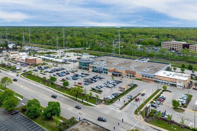
Property Record
770 Skokie Blvd, Northbrook, IL 60062


NEARBY LISTINGS FOR SALE OR LEASE
Property Detail
770 Skokie Blvd
04-02-422-010-0000
Northside 770 Sub
Supermarket
Cook
X
Illinois
17097C0293K
1-6
2023
6.17 AC
2024
Central North
801800
Chicago
71,565 SF
Chicago-Naperville-Elgin, IL-IN-WI
DEMOGRAPHICS near 770 Skokie Blvd
1 Mile
3 Mile
5 Mile
2024 Total Population
4,414
56,768
158,086
2029 Population
4,484
55,844
154,891
Pop Growth 2024-2029
+ 1.59%
(1.63%)
(2.02%)
Average Age
45
44
44
2024 Total Households
1,727
20,870
58,256
HH Growth 2024-2029
+ 1.39%
(1.84%)
(2.21%)
Median Household Inc
$130,955
$159,312
$147,289
Avg Household Size
2.50
2.60
2.60
2024 Avg HH Vehicles
2.00
2.00
2.00
Median Home Value
$544,712
$679,526
$660,376
Median Year Built
1971
1967
1970
Nearby Places
Map Layers
Map Styles
 Street
 Aerial
- Restaurants
- Banks
- Shops
- Fitness
- Groceries
PUBLIC TRANSPORTATION
COMMUTER RAIL
Glencoe Station (Union Pacific North Line - Northeast Illinois Regional Commuter Railroad (Metra))
DRIVE
WALK
Distance
Glencoe Station (Union Pacific North Line - Northeast Illinois Regional Commuter Railroad (Metra))
5 min
2.2 mi
Northbrook Station (Milwaukee District North Line - Northeast Illinois Regional Commuter Railroad (Metra))
DRIVE
WALK
Distance
Northbrook Station (Milwaukee District North Line - Northeast Illinois Regional Commuter Railroad (Metra))
6 min
2.4 mi
AIRPORT
Chicago O'Hare International
DRIVE
WALK
Distance
Chicago O'Hare International
27 min
16.4 mi
Chicago Midway International
DRIVE
WALK
Distance
Chicago Midway International
43 min
27.4 mi
Nearby Properties
Address
Land Use
TOTAL SIZE
Lot Size
Zoning
Address
Land Use
TOTAL SIZE
Lot Size
Zoning
815,308 SF
12.95 AC
Address
Land Use
TOTAL SIZE
Lot Size
Zoning
708,522 SF
17.11 AC
Address
Land Use
TOTAL SIZE
Lot Size
Zoning
530,208 SF
Address
Land Use
TOTAL SIZE
Lot Size
Zoning
8.04 AC
Address
Land Use
TOTAL SIZE
Lot Size
Zoning
629,447 SF
3.96 AC
Address
Land Use
TOTAL SIZE
Lot Size
Zoning
679,109 SF
24.46 AC
Address
Land Use
TOTAL SIZE
Lot Size
Zoning
419,812 SF
13.88 AC
Address
Land Use
TOTAL SIZE
Lot Size
Zoning
32.61 AC
Address
Land Use
TOTAL SIZE
Lot Size
Zoning
534,816 SF
6.98 AC
Address
Land Use
TOTAL SIZE
Lot Size
Zoning
579,162 SF
6.41 AC
Address
Land Use
TOTAL SIZE
Lot Size
Zoning
14.11 AC
Address
Land Use
TOTAL SIZE
Lot Size
Zoning
333,202 SF
13.88 AC
Address
Land Use
TOTAL SIZE
Lot Size
Zoning
167,843 SF
12.55 AC
Address
Land Use
TOTAL SIZE
Lot Size
Zoning
215,633 SF
9.78 AC
Address
Land Use
TOTAL SIZE
Lot Size
Zoning
8.89 AC
Address
Land Use
TOTAL SIZE
Lot Size
Zoning
193,804 SF
7.98 AC
Address
Land Use
TOTAL SIZE
Lot Size
Zoning
191,402 SF
6.92 AC
Address
Land Use
TOTAL SIZE
Lot Size
Zoning
3,896 SF
4.36 AC
Address
Land Use
TOTAL SIZE
Lot Size
Zoning
149,716 SF
6.02 AC
Address
Land Use
TOTAL SIZE
Lot Size
Zoning
58,280 SF
3.46 AC
Address
Land Use
TOTAL SIZE
Lot Size
Zoning
230,886 SF
9.30 AC
Address
Land Use
TOTAL SIZE
Lot Size
Zoning
141,340 SF
7.18 AC
Address
Land Use
TOTAL SIZE
Lot Size
Zoning
250,096 SF
2.16 AC
Address
Land Use
TOTAL SIZE
Lot Size
Zoning
1.37 AC
Address
Land Use
TOTAL SIZE
Lot Size
Zoning
154,086 SF
5.90 AC
Address
Land Use
TOTAL SIZE
Lot Size
Zoning
127,191 SF
76.51 AC
Address
Land Use
TOTAL SIZE
Lot Size
Zoning
191,275 SF
17.08 AC
Address
Land Use
TOTAL SIZE
Lot Size
Zoning
732,143 SF
57.63 AC
Address
Land Use
TOTAL SIZE
Lot Size
Zoning
75,528 SF
7.83 AC
Address
Land Use
TOTAL SIZE
Lot Size
Zoning
109,192 SF
3.64 AC
The World's #1 Commercial Real Estate Marketplace
Connect with us
© 2025 CoStar Group
The information above has been obtained from sources believed reliable. While we do not doubt its accuracy we have not verified it and make no guarantee, warranty or representation about it. It is your responsibility to independently confirm its accuracy and completeness. Any projections, opinions, assumptions, or estimates used are for example only and do not represent the current or future performance of the property. The value of this transaction to you depends on tax and other factors which should be evaluated by your tax, financial, and legal advisors. You and your advisors should conduct a careful, independent investigation of the property to determine to your satisfaction the suitability of the property for your needs.