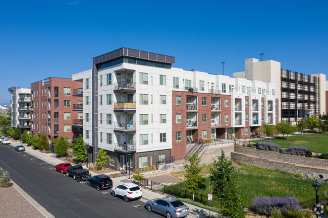
Property Record
7700 E Peakview Ave, Centennial, CO 80111


Property Detail
7700 E Peakview Ave
2075-21-3-40-001
SUBDIVISIONCD 049082 SUBDIVISIONNAME PEAKVIEW HEIGHTS 2ND FLG 1ST AMENDMENT BLOCK 000 LOT 002 LOT 2 PEAKVIEW HEIGHTS 2ND FLG 1ST AMENDMENT
Apartment
Arapahoe
AMU
Colorado
B and X Area of moderate flood hazard, usually the area between the limits of the 100-year and 500-year floods.
2
2024
3.69 AC
2025
Denver Tech Center
006713
Denver
305,651 SF
Denver-Aurora-Centennial, CO
NEARBY LISTINGS FOR SALE OR LEASE
DEMOGRAPHICS near 7700 E Peakview Ave
1 mile
3 mile
5 mile
2025 Total Population
11,796
91,548
246,498
2030 Population
11,965
92,934
252,777
Pop Growth 2025-2030
+ 1.43%
+ 1.51%
+ 2.55%
Average Age
41
41
41
2025 Total Households
4,862
39,528
103,317
HH Growth 2025-2030
+ 1.77%
+ 1.94%
+ 2.78%
Median Household Inc
$124,241
$119,711
$112,739
Avg Household Size
2.40
2.30
2.30
2025 Avg HH Vehicles
2.00
2.00
2.00
Median Home Value
$729,262
$771,434
$744,082
Median Year Built
1980
1986
1986
Nearby Places
Map Layers
Map Styles
 Street
 Aerial
Layers
 Traffic
 Biking
Places
Listings with unknown addresses are not visible on the map
- Restaurants
- Banks
- Shops
- Fitness
- Groceries
PUBLIC TRANSPORTATION
TRANSIT/SUBWAY
Arapahoe At Village Center (E Line - Denver Regional Transportation District Light Rail (TheRide), F Line - Denver Regional Transportation District Light Rail (TheRide), G Line - Denver Regional Transportation District Light Rail (TheRide))
Drive
Walk
Distance
Arapahoe At Village Center (E Line - Denver Regional Transportation District Light Rail (TheRide), F Line - Denver Regional Transportation District Light Rail (TheRide), G Line - Denver Regional Transportation District Light Rail (TheRide))
4 min
15 min
0.8 mi
AIRPORT
Denver International
Drive
Walk
Distance
Denver International
36 min
28.4 mi
Freight Ports
Tulsa Port Of Catoosa
Drive
Walk
Distance
Tulsa Port Of Catoosa
733 min
711.2 mi
Nearby Properties
Address
Land Use
TOTAL SIZE
Lot Size
Zoning
Address
Land Use
TOTAL SIZE
Lot Size
Zoning
579,353 SF
3.26 AC
T-MU
Address
Land Use
TOTAL SIZE
Lot Size
Zoning
709,725 SF
15.21 AC
Address
Land Use
TOTAL SIZE
Lot Size
Zoning
709,725 SF
29.14 AC
Address
Land Use
TOTAL SIZE
Lot Size
Zoning
443,472 SF
7.88 AC
AMU
Address
Land Use
TOTAL SIZE
Lot Size
Zoning
277,917 SF
12.59 AC
B-4
Address
Land Use
TOTAL SIZE
Lot Size
Zoning
344,259 SF
5.18 AC
Address
Land Use
TOTAL SIZE
Lot Size
Zoning
92,346 SF
4.22 AC
Address
Land Use
TOTAL SIZE
Lot Size
Zoning
470,605 SF
13.68 AC
B-8
Address
Land Use
TOTAL SIZE
Lot Size
Zoning
313,812 SF
5.24 AC
GMC
Address
Land Use
TOTAL SIZE
Lot Size
Zoning
389,502 SF
2.32 AC
T-MU-30
Address
Land Use
TOTAL SIZE
Lot Size
Zoning
1,666,986 SF
11.12 AC
Address
Land Use
TOTAL SIZE
Lot Size
Zoning
898,130 SF
89.50 AC
Address
Land Use
TOTAL SIZE
Lot Size
Zoning
637,459 SF
4.94 AC
AMU
Address
Land Use
TOTAL SIZE
Lot Size
Zoning
207,637 SF
28.17 AC
PDU
Address
Land Use
TOTAL SIZE
Lot Size
Zoning
331,620 SF
2.03 AC
T-MU-30
Address
Land Use
TOTAL SIZE
Lot Size
Zoning
252,760 SF
3.63 AC
Address
Land Use
TOTAL SIZE
Lot Size
Zoning
959,756 SF
5.52 AC
PUD
Address
Land Use
TOTAL SIZE
Lot Size
Zoning
109,980 SF
1.99 AC
Address
Land Use
TOTAL SIZE
Lot Size
Zoning
453,595 SF
26.08 AC
PUD
Address
Land Use
TOTAL SIZE
Lot Size
Zoning
1,210,850 SF
13.65 AC
AMU
Address
Land Use
TOTAL SIZE
Lot Size
Zoning
394,111 SF
0.91 AC
T-MU
Address
Land Use
TOTAL SIZE
Lot Size
Zoning
305,198 SF
34.41 AC
PUD
Address
Land Use
TOTAL SIZE
Lot Size
Zoning
355,464 SF
6.20 AC
B-8
Address
Land Use
TOTAL SIZE
Lot Size
Zoning
186,993 SF
16.22 AC
Address
Land Use
TOTAL SIZE
Lot Size
Zoning
313,836 SF
5.90 AC
B-8
Address
Land Use
TOTAL SIZE
Lot Size
Zoning
162,758 SF
11.21 AC
Address
Land Use
TOTAL SIZE
Lot Size
Zoning
585,091 SF
5.42 AC
PUD
Address
Land Use
TOTAL SIZE
Lot Size
Zoning
247,689 SF
26.15 AC
AMU
Address
Land Use
TOTAL SIZE
Lot Size
Zoning
372,593 SF
5.61 AC
S-MX-12
Address
Land Use
TOTAL SIZE
Lot Size
Zoning
139,291 SF
8.63 AC
AMU
The World's #1 Commercial Real Estate Marketplace
Connect with us
© 2026 CoStar Group
The information above has been obtained from sources believed reliable. While we do not doubt its accuracy we have not verified it and make no guarantee, warranty or representation about it. It is your responsibility to independently confirm its accuracy and completeness. Any projections, opinions, assumptions, or estimates used are for example only and do not represent the current or future performance of the property. The value of this transaction to you depends on tax and other factors which should be evaluated by your tax, financial, and legal advisors. You and your advisors should conduct a careful, independent investigation of the property to determine to your satisfaction the suitability of the property for your needs.