Property Record
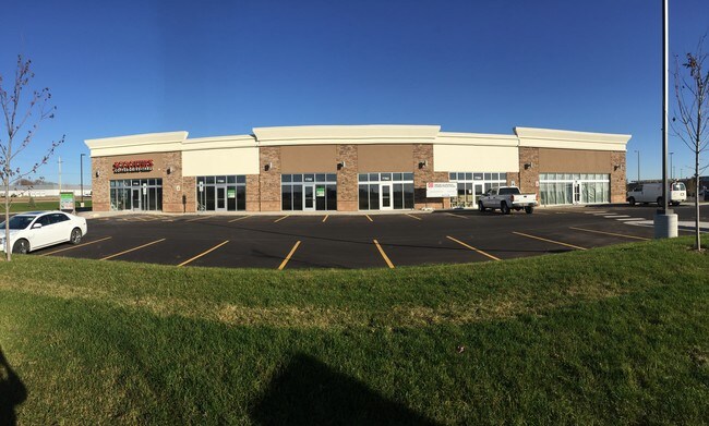
7700 S Dakota Hawk Ave, Sioux Falls, SD 57108


NEARBY LISTINGS FOR SALE OR LEASE
Property Detail
7700 S Dakota Hawk Ave
Sioux Falls, SD
Springdale Development Add
281.97.01.004
SF - SPRINGDALE DEVELOPMENT ADD 1 - LOT 4 BLK 1
Commercialnec
Lincoln
X
South Dakota
46099C0626E
4
2024
1.43 AC
2024
Sioux Falls
010116
Other Market Areas
DEMOGRAPHICS near 7700 S Dakota Hawk Ave
1 Mile
3 Mile
5 Mile
2024 Total Population
5,838
46,096
131,299
2029 Population
7,104
55,094
149,545
Pop Growth 2024-2029
+ 21.69%
+ 19.52%
+ 13.90%
Average Age
38
39
38
2024 Total Households
2,270
18,758
54,087
HH Growth 2024-2029
+ 22.11%
+ 19.71%
+ 14.05%
Median Household Inc
$94,322
$90,857
$77,610
Avg Household Size
2.60
2.40
2.30
2024 Avg HH Vehicles
2.00
2.00
2.00
Median Home Value
$440,362
$324,023
$262,666
Median Year Built
2009
2005
1993
Nearby Places
Map Layers
Map Styles
 Street
 Aerial
- Restaurants
- Banks
- Shops
- Fitness
- Groceries
PUBLIC TRANSPORTATION
AIRPORT
Joe Foss Field
DRIVE
WALK
Distance
Joe Foss Field
31 min
9.6 mi
Freight Ports
Port Milwaukee
DRIVE
WALK
Distance
Port Milwaukee
554 min
508.8 mi
SALE & LEASE HISTORY
LISTING DATE
SALE/LEASE

Sep 25, 2016
For Lease
Nearby Properties
Address
Land Use
TOTAL SIZE
Lot Size
Zoning
Address
Land Use
TOTAL SIZE
Lot Size
Zoning
14.81 AC
MUNICIPALI
Address
Land Use
TOTAL SIZE
Lot Size
Zoning
8.89 AC
MUNICIPALI
Address
Land Use
TOTAL SIZE
Lot Size
Zoning
8.80 AC
MUNICIPALI
Address
Land Use
TOTAL SIZE
Lot Size
Zoning
7,252 SF
12.07 AC
Address
Land Use
TOTAL SIZE
Lot Size
Zoning
15.24 AC
MUNICIPALI
Address
Land Use
TOTAL SIZE
Lot Size
Zoning
360,262 SF
26 AC
Address
Land Use
TOTAL SIZE
Lot Size
Zoning
9.42 AC
MUNICIPALI
Address
Land Use
TOTAL SIZE
Lot Size
Zoning
8.51 AC
MUNICIPALI
Address
Land Use
TOTAL SIZE
Lot Size
Zoning
10.75 AC
MUNICIPALI
Address
Land Use
TOTAL SIZE
Lot Size
Zoning
9.45 AC
MUNICIPALI
Address
Land Use
TOTAL SIZE
Lot Size
Zoning
7.59 AC
MUNICIPALI
Address
Land Use
TOTAL SIZE
Lot Size
Zoning
11.91 AC
MUNICIPALI
Address
Land Use
TOTAL SIZE
Lot Size
Zoning
9.57 AC
MUNICIPALI
Address
Land Use
TOTAL SIZE
Lot Size
Zoning
1.40 AC
MUNICIPALI
Address
Land Use
TOTAL SIZE
Lot Size
Zoning
13.67 AC
MUNICIPALI
Address
Land Use
TOTAL SIZE
Lot Size
Zoning
8.57 AC
MUNICIPALI
Address
Land Use
TOTAL SIZE
Lot Size
Zoning
18.88 AC
MUNICIPALI
Address
Land Use
TOTAL SIZE
Lot Size
Zoning
7.91 AC
MUNICIPALI
Address
Land Use
TOTAL SIZE
Lot Size
Zoning
10.24 AC
MUNICIPALI
Address
Land Use
TOTAL SIZE
Lot Size
Zoning
11.13 AC
MUNICIPALI
Address
Land Use
TOTAL SIZE
Lot Size
Zoning
9.15 AC
MUNICIPALI
Address
Land Use
TOTAL SIZE
Lot Size
Zoning
4.61 AC
MUNICIPALI
Address
Land Use
TOTAL SIZE
Lot Size
Zoning
9.56 AC
MUNICIPALI
Address
Land Use
TOTAL SIZE
Lot Size
Zoning
9.82 AC
MUNICIPALI
Address
Land Use
TOTAL SIZE
Lot Size
Zoning
7.07 AC
MUNICIPALI
Address
Land Use
TOTAL SIZE
Lot Size
Zoning
106,064 SF
35.38 AC
Address
Land Use
TOTAL SIZE
Lot Size
Zoning
7.09 AC
MUNICIPALI
Address
Land Use
TOTAL SIZE
Lot Size
Zoning
7.63 AC
MUNICIPALI
Address
Land Use
TOTAL SIZE
Lot Size
Zoning
5.81 AC
MUNICIPALI
Address
Land Use
TOTAL SIZE
Lot Size
Zoning
5.99 AC
MUNICIPALI
The World's #1 Commercial Real Estate Marketplace
Connect with us
© 2025 CoStar Group
The information above has been obtained from sources believed reliable. While we do not doubt its accuracy we have not verified it and make no guarantee, warranty or representation about it. It is your responsibility to independently confirm its accuracy and completeness. Any projections, opinions, assumptions, or estimates used are for example only and do not represent the current or future performance of the property. The value of this transaction to you depends on tax and other factors which should be evaluated by your tax, financial, and legal advisors. You and your advisors should conduct a careful, independent investigation of the property to determine to your satisfaction the suitability of the property for your needs.