Property Record
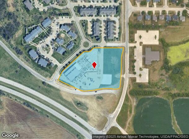
7701 Bloomfield Rd, Des Moines, IA 50320


NEARBY LISTINGS FOR SALE OR LEASE
Property Detail
7701 Bloomfield Rd
Des Moines
The Meadowlands Plat 1
Des Moines-West Des Moines, IA
LOT 1 -EX COM NE COR LOT 1 THN SW 85.35F S 150.03F SW 139.64F SW 13.68F TO POB THN SW 172.31F NW 346.67F ELY ALNG CRV 140.34F ELY ALNG CRV 174.87F ELY ALNG CRV 50.66F TO POB- THE MEADOWLANDS PLAT 1
120/05302-201-001
Polk
Storebuilding
Iowa
0
1
2025
4.30 AC
010806
South
18,610 SF
DEMOGRAPHICS near 7701 Bloomfield Rd
1 mile
3 mile
5 mile
2024 Total Population
2,795
36,860
74,950
2029 Population
2,912
38,307
78,368
Pop Growth 2024-2029
+ 4.19%
+ 3.93%
+ 4.56%
Average Age
36
37
38
2024 Total Households
1,054
13,908
29,335
HH Growth 2024-2029
+ 4.36%
+ 4.15%
+ 4.80%
Median Household Inc
$51,489
$61,506
$63,571
Avg Household Size
2.70
2.60
2.50
2024 Avg HH Vehicles
2.00
2.00
2.00
Median Home Value
$149,180
$165,601
$166,099
Median Year Built
1995
1978
1974
Nearby Places
Map Layers
Map Styles
 Street
 Aerial
Transit
 Traffic
 Biking
Places
Listings with unknown addresses are not visible on the map
- Restaurants
- Banks
- Shops
- Fitness
- Groceries
PUBLIC TRANSPORTATION
AIRPORT
Des Moines International
Drive
Walk
Distance
Des Moines International
13 min
6.5 mi
Freight Ports
Port Milwaukee
Drive
Walk
Distance
Port Milwaukee
421 min
379.4 mi
Nearby Properties
Address
Land Use
TOTAL SIZE
Lot Size
Zoning
Address
Land Use
TOTAL SIZE
Lot Size
Zoning
208,456 SF
14.42 AC
PUD
Address
Land Use
TOTAL SIZE
Lot Size
Zoning
231,168 SF
22.29 AC
PUD
Address
Land Use
TOTAL SIZE
Lot Size
Zoning
108,064 SF
16.72 AC
Address
Land Use
TOTAL SIZE
Lot Size
Zoning
160,680 SF
20.08 AC
C-2
Address
Land Use
TOTAL SIZE
Lot Size
Zoning
155,640 SF
9.15 AC
R-6
Address
Land Use
TOTAL SIZE
Lot Size
Zoning
64,494 SF
5.16 AC
R1-60
Address
Land Use
TOTAL SIZE
Lot Size
Zoning
138,490 SF
10.01 AC
R-6
Address
Land Use
TOTAL SIZE
Lot Size
Zoning
51,965 SF
3.83 AC
C-4
Address
Land Use
TOTAL SIZE
Lot Size
Zoning
169,201 SF
13.66 AC
C-4
Address
Land Use
TOTAL SIZE
Lot Size
Zoning
3,468 SF
43.37 AC
PUD
Address
Land Use
TOTAL SIZE
Lot Size
Zoning
147,173 SF
20.84 AC
PUD
Address
Land Use
TOTAL SIZE
Lot Size
Zoning
58,366 SF
11.58 AC
Address
Land Use
TOTAL SIZE
Lot Size
Zoning
1,600 SF
57.40 AC
R-5
Address
Land Use
TOTAL SIZE
Lot Size
Zoning
301,434 SF
29.03 AC
C4
Address
Land Use
TOTAL SIZE
Lot Size
Zoning
121,200 SF
10.32 AC
C-2
Address
Land Use
TOTAL SIZE
Lot Size
Zoning
310,851 SF
18.05 AC
C-4
Address
Land Use
TOTAL SIZE
Lot Size
Zoning
92,232 SF
6.01 AC
R-3
Address
Land Use
TOTAL SIZE
Lot Size
Zoning
110,260 SF
9.56 AC
PUD
Address
Land Use
TOTAL SIZE
Lot Size
Zoning
147,400 SF
15.05 AC
C-2
Address
Land Use
TOTAL SIZE
Lot Size
Zoning
1,752 SF
35.77 AC
R-5
Address
Land Use
TOTAL SIZE
Lot Size
Zoning
50,969 SF
4.64 AC
R-2
Address
Land Use
TOTAL SIZE
Lot Size
Zoning
102,532 SF
10.71 AC
C-2
Address
Land Use
TOTAL SIZE
Lot Size
Zoning
64,004 SF
5.22 AC
C-4
Address
Land Use
TOTAL SIZE
Lot Size
Zoning
82,290 SF
6.88 AC
PUD
Address
Land Use
TOTAL SIZE
Lot Size
Zoning
125,300 SF
9.75 AC
C-2
Address
Land Use
TOTAL SIZE
Lot Size
Zoning
67,104 SF
4.04 AC
R-6
Address
Land Use
TOTAL SIZE
Lot Size
Zoning
86,400 SF
4.49 AC
R-3
Address
Land Use
TOTAL SIZE
Lot Size
Zoning
25,764 SF
4.73 AC
C-2
The World's #1 Commercial Real Estate Marketplace
Connect with us
© 2026 CoStar Group
The information above has been obtained from sources believed reliable. While we do not doubt its accuracy we have not verified it and make no guarantee, warranty or representation about it. It is your responsibility to independently confirm its accuracy and completeness. Any projections, opinions, assumptions, or estimates used are for example only and do not represent the current or future performance of the property. The value of this transaction to you depends on tax and other factors which should be evaluated by your tax, financial, and legal advisors. You and your advisors should conduct a careful, independent investigation of the property to determine to your satisfaction the suitability of the property for your needs.