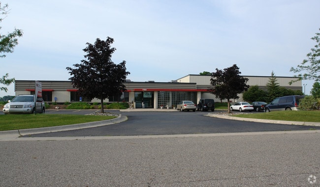
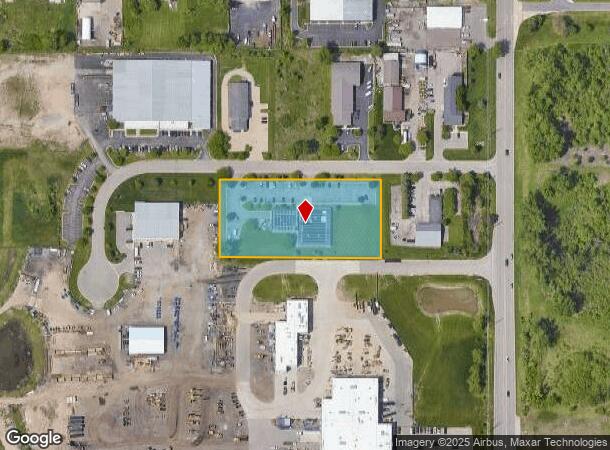
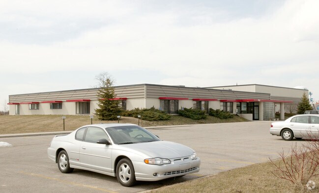
Property Record
7701 Northport Dr, Lansing, MI 48917
NEARBY LISTINGS FOR SALE OR LEASE
Property Detail
7701 Northport Dr
Lansing-East Lansing, MI
Techwood Industrial Park
040-079-800-041-00
LOT 4 AND 5. TECHWOOD INDUSTRIAL PARK, SEC.28, T4N,R3W, DELTA TWP 1998
Officebuilding
Eaton
X
Michigan
26065C0108D
4-5
2024
2.40 AC
2025
Southern Lansing
020303
West Michigan
14,859 SF
DEMOGRAPHICS near 7701 Northport Dr
1 Mile
3 Mile
5 Mile
2024 Total Population
142
16,569
75,627
2029 Population
141
16,540
75,338
Pop Growth 2024-2029
(0.70%)
(0.18%)
(0.38%)
Average Age
42
43
41
2024 Total Households
57
7,371
32,484
HH Growth 2024-2029
(1.75%)
(0.18%)
(0.44%)
Median Household Inc
$101,136
$69,292
$62,631
Avg Household Size
2.40
2.20
2.30
2024 Avg HH Vehicles
2.00
2.00
2.00
Median Home Value
$256,249
$211,118
$171,328
Median Year Built
1993
1978
1972
Nearby Places
- Restaurants
- Banks
- Shops
- Fitness
- Groceries
PUBLIC TRANSPORTATION
AIRPORT
Capital Region International
DRIVE
WALK
Distance
Capital Region International
19 min
9.1 mi
Nearby Properties
Address
Land Use
TOTAL SIZE
Lot Size
Zoning
Address
Land Use
TOTAL SIZE
Lot Size
Zoning
Address
Land Use
TOTAL SIZE
Lot Size
Zoning
4,395,257 SF
324 AC
I HVY
Address
Land Use
TOTAL SIZE
Lot Size
Zoning
1,085,633 SF
115.14 AC
NONE
Address
Land Use
TOTAL SIZE
Lot Size
Zoning
628,230 SF
38.20 AC
NONE
Address
Land Use
TOTAL SIZE
Lot Size
Zoning
166,083 SF
39.98 AC
NONE
Address
Land Use
TOTAL SIZE
Lot Size
Zoning
170,860 SF
16.35 AC
NONE
Address
Land Use
TOTAL SIZE
Lot Size
Zoning
217,664 SF
61.37 AC
NONE
Address
Land Use
TOTAL SIZE
Lot Size
Zoning
286.23 AC
NONE
Address
Land Use
TOTAL SIZE
Lot Size
Zoning
389,485 SF
30.04 AC
NONE
Address
Land Use
TOTAL SIZE
Lot Size
Zoning
1,059,295 SF
139.28 AC
NONE
Address
Land Use
TOTAL SIZE
Lot Size
Zoning
198,225 SF
11.54 AC
NONE
Address
Land Use
TOTAL SIZE
Lot Size
Zoning
111,804 SF
80 AC
NONE
Address
Land Use
TOTAL SIZE
Lot Size
Zoning
436,698 SF
48.16 AC
NONE
Address
Land Use
TOTAL SIZE
Lot Size
Zoning
628,651 SF
34.29 AC
NONE
Address
Land Use
TOTAL SIZE
Lot Size
Zoning
231,000 SF
26 AC
Address
Land Use
TOTAL SIZE
Lot Size
Zoning
292,918 SF
I-FAC
Address
Land Use
TOTAL SIZE
Lot Size
Zoning
113.83 AC
NONE
Address
Land Use
TOTAL SIZE
Lot Size
Zoning
824,570 SF
47.65 AC
NONE
Address
Land Use
TOTAL SIZE
Lot Size
Zoning
260,958 SF
19.17 AC
NONE
Address
Land Use
TOTAL SIZE
Lot Size
Zoning
144,630 SF
11.51 AC
M-1
Address
Land Use
TOTAL SIZE
Lot Size
Zoning
219,176 SF
9.45 AC
NONE
Address
Land Use
TOTAL SIZE
Lot Size
Zoning
95,747 SF
7.17 AC
NONE
Address
Land Use
TOTAL SIZE
Lot Size
Zoning
590.26 AC
I HVY
Address
Land Use
TOTAL SIZE
Lot Size
Zoning
50,364 SF
25.57 AC
M-1
Address
Land Use
TOTAL SIZE
Lot Size
Zoning
106,344 SF
10.69 AC
NONE
Address
Land Use
TOTAL SIZE
Lot Size
Zoning
250,100 SF
25.45 AC
NONE
Address
Land Use
TOTAL SIZE
Lot Size
Zoning
404,215 SF
40 AC
NONE
Address
Land Use
TOTAL SIZE
Lot Size
Zoning
80,149 SF
9.99 AC
NONE
Address
Land Use
TOTAL SIZE
Lot Size
Zoning
160,000 SF
16.18 AC
Address
Land Use
TOTAL SIZE
Lot Size
Zoning
269,800 SF
20.10 AC
NONE
The World's #1 Commercial Real Estate Marketplace
Connect with us
© 2025 CoStar Group
The information above has been obtained from sources believed reliable. While we do not doubt its accuracy we have not verified it and make no guarantee, warranty or representation about it. It is your responsibility to independently confirm its accuracy and completeness. Any projections, opinions, assumptions, or estimates used are for example only and do not represent the current or future performance of the property. The value of this transaction to you depends on tax and other factors which should be evaluated by your tax, financial, and legal advisors. You and your advisors should conduct a careful, independent investigation of the property to determine to your satisfaction the suitability of the property for your needs.