Property Record
7701 S Coulter St, Amarillo, TX 79119


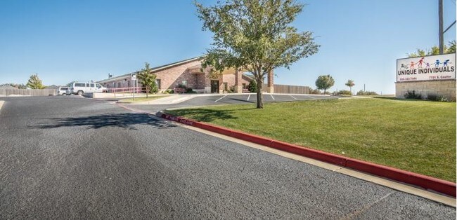
Property Detail
7701 S Coulter St
R-086-3582-1010
WESTOVER PARK # 23, LOT 056, BLK 0006, 2.0400 ACRES
Daycare
Randall
A
Texas
B and X Area of moderate flood hazard, usually the area between the limits of the 100-year and 500-year floods.
56
2024
2.04 AC
2025
Amarillo
021610
Other Market Areas
15,856 SF
Amarillo, TX
NEARBY LISTINGS FOR SALE OR LEASE
DEMOGRAPHICS near 7701 S Coulter St
1 mile
3 mile
5 mile
2025 Total Population
9,628
52,494
111,196
2030 Population
10,013
55,179
116,154
Pop Growth 2025-2030
+ 4.00%
+ 5.11%
+ 4.46%
Average Age
43
40
39
2025 Total Households
3,942
21,520
45,854
HH Growth 2025-2030
+ 3.86%
+ 5.01%
+ 4.37%
Median Household Inc
$99,385
$91,212
$75,470
Avg Household Size
2.40
2.40
2.30
2025 Avg HH Vehicles
2.00
2.00
2.00
Median Home Value
$299,745
$273,495
$242,675
Median Year Built
1999
1995
1982
Nearby Places
Map Layers
Map Styles
 Street
 Aerial
Transit
 Traffic
 Biking
Places
Listings with unknown addresses are not visible on the map
- Restaurants
- Banks
- Shops
- Fitness
- Groceries
PUBLIC TRANSPORTATION
AIRPORT
Rick Husband Amarillo International
Drive
Walk
Distance
Rick Husband Amarillo International
29 min
16.6 mi
SALE & LEASE HISTORY
LISTING DATE
SALE/LEASE

Oct 28, 2019
For Sale
Nearby Properties
Address
Land Use
TOTAL SIZE
Lot Size
Zoning
Address
Land Use
TOTAL SIZE
Lot Size
Zoning
362,796 SF
49.98 AC
A
Address
Land Use
TOTAL SIZE
Lot Size
Zoning
269,713 SF
57.96 AC
Address
Land Use
TOTAL SIZE
Lot Size
Zoning
342,930 SF
34.57 AC
PD
Address
Land Use
TOTAL SIZE
Lot Size
Zoning
258,757 SF
22.78 AC
A
Address
Land Use
TOTAL SIZE
Lot Size
Zoning
373,014 SF
14.20 AC
Address
Land Use
TOTAL SIZE
Lot Size
Zoning
148,486 SF
20.66 AC
Address
Land Use
TOTAL SIZE
Lot Size
Zoning
128,970 SF
15.03 AC
Address
Land Use
TOTAL SIZE
Lot Size
Zoning
270,379 SF
12.12 AC
Address
Land Use
TOTAL SIZE
Lot Size
Zoning
260,680 SF
10.16 AC
Address
Land Use
TOTAL SIZE
Lot Size
Zoning
88,841 SF
10.97 AC
R3
Address
Land Use
TOTAL SIZE
Lot Size
Zoning
251,520 SF
9.84 AC
GR
Address
Land Use
TOTAL SIZE
Lot Size
Zoning
92,109 SF
16.03 AC
Address
Land Use
TOTAL SIZE
Lot Size
Zoning
74,960 SF
7 AC
R2
Address
Land Use
TOTAL SIZE
Lot Size
Zoning
190,074 SF
12.07 AC
Address
Land Use
TOTAL SIZE
Lot Size
Zoning
161,321 SF
31 AC
A
Address
Land Use
TOTAL SIZE
Lot Size
Zoning
69,391 SF
6.99 AC
A
Address
Land Use
TOTAL SIZE
Lot Size
Zoning
119,618 SF
11.70 AC
R2
Address
Land Use
TOTAL SIZE
Lot Size
Zoning
161,221 SF
11.78 AC
MF1
Address
Land Use
TOTAL SIZE
Lot Size
Zoning
112,005 SF
7.70 AC
GR
Address
Land Use
TOTAL SIZE
Lot Size
Zoning
227,707 SF
10.78 AC
GR
Address
Land Use
TOTAL SIZE
Lot Size
Zoning
186,001 SF
2.79 AC
PD
Address
Land Use
TOTAL SIZE
Lot Size
Zoning
186,001 SF
2.79 AC
PD
Address
Land Use
TOTAL SIZE
Lot Size
Zoning
186,001 SF
2.79 AC
PD
Address
Land Use
TOTAL SIZE
Lot Size
Zoning
186,001 SF
2.79 AC
PD
Address
Land Use
TOTAL SIZE
Lot Size
Zoning
183,758 SF
16.74 AC
R2
Address
Land Use
TOTAL SIZE
Lot Size
Zoning
89,173 SF
9.55 AC
PD
Address
Land Use
TOTAL SIZE
Lot Size
Zoning
185,895 SF
9.59 AC
Address
Land Use
TOTAL SIZE
Lot Size
Zoning
69,009 SF
37.97 AC
Address
Land Use
TOTAL SIZE
Lot Size
Zoning
172,531 SF
10.37 AC
LC
Address
Land Use
TOTAL SIZE
Lot Size
Zoning
187,253 SF
9.69 AC
PD
The World's #1 Commercial Real Estate Marketplace
Connect with us
© 2026 CoStar Group
The information above has been obtained from sources believed reliable. While we do not doubt its accuracy we have not verified it and make no guarantee, warranty or representation about it. It is your responsibility to independently confirm its accuracy and completeness. Any projections, opinions, assumptions, or estimates used are for example only and do not represent the current or future performance of the property. The value of this transaction to you depends on tax and other factors which should be evaluated by your tax, financial, and legal advisors. You and your advisors should conduct a careful, independent investigation of the property to determine to your satisfaction the suitability of the property for your needs.