Property Record
7705 Egan Dr, Savage, MN 55378
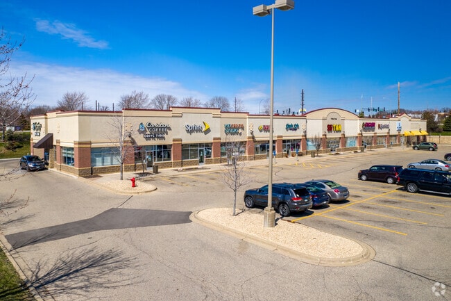


Property Detail
7705 Egan Dr
Minneapolis-St. Paul-Bloomington, MN-WI
TOWNSHIP 115 RANGE 021 SAVAGE CROSSINGS LOT 001 BLOCK 001
26-348-001-0
Scott
Commercialnec
Minnesota
B and X Area of moderate flood hazard, usually the area between the limits of the 100-year and 500-year floods.
1
2025
2.20 AC
2025
Burnsville
080204
Minneapolis/St Paul
18,228 SF
NEARBY LISTINGS FOR SALE OR LEASE
DEMOGRAPHICS near 7705 Egan Dr
1 mile
3 mile
5 mile
2025 Total Population
9,491
50,998
119,074
2030 Population
9,681
52,199
121,627
Pop Growth 2025-2030
+ 2.00%
+ 2.35%
+ 2.14%
Average Age
39
39
40
2025 Total Households
3,461
17,461
43,772
HH Growth 2025-2030
+ 2.17%
+ 2.45%
+ 2.20%
Median Household Inc
$101,675
$113,897
$104,734
Avg Household Size
2.70
2.90
2.70
2025 Avg HH Vehicles
2.00
2.00
2.00
Median Home Value
$446,754
$426,220
$409,209
Median Year Built
2001
1996
1991
Nearby Places
Map Layers
Map Styles
 Street
 Aerial
Transit
 Traffic
 Biking
Places
Listings with unknown addresses are not visible on the map
- Restaurants
- Banks
- Shops
- Fitness
- Groceries
PUBLIC TRANSPORTATION
AIRPORT
Minneapolis-St Paul International/Wold-Chamberlain
Drive
Walk
Distance
Minneapolis-St Paul International/Wold-Chamberlain
27 min
18.2 mi
Freight Ports
Port Milwaukee
Drive
Walk
Distance
Port Milwaukee
390 min
350.7 mi
SALE & LEASE HISTORY
LISTING DATE
SALE/LEASE

Sep 25, 2016
For Lease
Sep 17, 2019
For Lease
Nov 16, 2023
For Lease
Jan 11, 2019
For Lease
Nearby Properties
Address
Land Use
TOTAL SIZE
Lot Size
Zoning
Address
Land Use
TOTAL SIZE
Lot Size
Zoning
378,396 SF
20.25 AC
Address
Land Use
TOTAL SIZE
Lot Size
Zoning
454,738 SF
106.74 AC
Address
Land Use
TOTAL SIZE
Lot Size
Zoning
323,174 SF
54.99 AC
Address
Land Use
TOTAL SIZE
Lot Size
Zoning
184,747 SF
8.44 AC
Address
Land Use
TOTAL SIZE
Lot Size
Zoning
237,045 SF
2.55 AC
Address
Land Use
TOTAL SIZE
Lot Size
Zoning
10.57 AC
Address
Land Use
TOTAL SIZE
Lot Size
Zoning
239,047 SF
9.14 AC
Address
Land Use
TOTAL SIZE
Lot Size
Zoning
216,700 SF
43.17 AC
Address
Land Use
TOTAL SIZE
Lot Size
Zoning
136,535 SF
4.99 AC
Address
Land Use
TOTAL SIZE
Lot Size
Zoning
122,765 SF
4.58 AC
Address
Land Use
TOTAL SIZE
Lot Size
Zoning
369,600 SF
20.22 AC
Address
Land Use
TOTAL SIZE
Lot Size
Zoning
245,291 SF
12.64 AC
Address
Land Use
TOTAL SIZE
Lot Size
Zoning
225,368 SF
34.46 AC
Address
Land Use
TOTAL SIZE
Lot Size
Zoning
75,339 SF
3.99 AC
Address
Land Use
TOTAL SIZE
Lot Size
Zoning
340,588 SF
16.54 AC
Address
Land Use
TOTAL SIZE
Lot Size
Zoning
97,096 SF
15.34 AC
Address
Land Use
TOTAL SIZE
Lot Size
Zoning
108,665 SF
18.85 AC
Address
Land Use
TOTAL SIZE
Lot Size
Zoning
13.99 AC
Address
Land Use
TOTAL SIZE
Lot Size
Zoning
123,085 SF
10.11 AC
Address
Land Use
TOTAL SIZE
Lot Size
Zoning
131,704 SF
9.83 AC
Address
Land Use
TOTAL SIZE
Lot Size
Zoning
89,306 SF
25.06 AC
Address
Land Use
TOTAL SIZE
Lot Size
Zoning
102,797 SF
11.95 AC
Address
Land Use
TOTAL SIZE
Lot Size
Zoning
119,558 SF
4.68 AC
Address
Land Use
TOTAL SIZE
Lot Size
Zoning
178,449 SF
7.44 AC
Address
Land Use
TOTAL SIZE
Lot Size
Zoning
173,996 SF
16.31 AC
Address
Land Use
TOTAL SIZE
Lot Size
Zoning
107,774 SF
9.44 AC
Address
Land Use
TOTAL SIZE
Lot Size
Zoning
108,697 SF
14.62 AC
Address
Land Use
TOTAL SIZE
Lot Size
Zoning
141,600 SF
11.63 AC
Address
Land Use
TOTAL SIZE
Lot Size
Zoning
98,506 SF
3.73 AC
The World's #1 Commercial Real Estate Marketplace
Connect with us
© 2026 CoStar Group
The information above has been obtained from sources believed reliable. While we do not doubt its accuracy we have not verified it and make no guarantee, warranty or representation about it. It is your responsibility to independently confirm its accuracy and completeness. Any projections, opinions, assumptions, or estimates used are for example only and do not represent the current or future performance of the property. The value of this transaction to you depends on tax and other factors which should be evaluated by your tax, financial, and legal advisors. You and your advisors should conduct a careful, independent investigation of the property to determine to your satisfaction the suitability of the property for your needs.