Property Record
7705 Nc Highway 68 N, Stokesdale, NC 27357
NEARBY LISTINGS FOR SALE OR LEASE
-
-
View all Stokesdale listings for sale on LoopNet.com
Property Detail
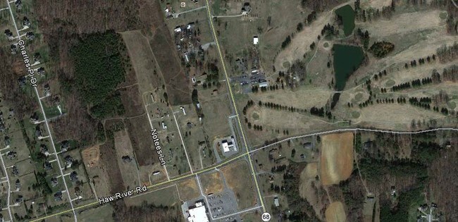
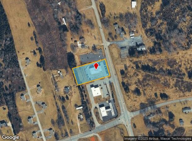
7705 Nc Highway 68 N
Greensboro-High Point, NC
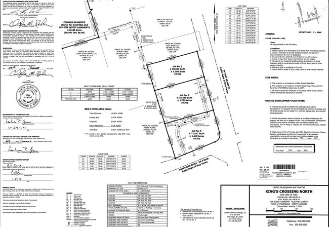
Kings Xing North Map 1
0163765
TIREMAX/HWY 68 NORTH LO:1 PL:183-3
Commercialnec
Guilford
X
North Carolina
3710780900J
1
2024
1.37 AC
2025
NW Guilford County
015901
Greensboro/Winston-Salem
6,820 SF
DEMOGRAPHICS near 7705 Nc Highway 68 N
1 Mile
3 Mile
5 Mile
2024 Total Population
1,942
10,246
24,648
2029 Population
1,979
10,303
24,925
Pop Growth 2024-2029
+ 1.91%
+ 0.56%
+ 1.12%
Average Age
39
40
41
2024 Total Households
671
3,627
8,909
HH Growth 2024-2029
+ 1.94%
+ 0.52%
+ 1.18%
Median Household Inc
$136,057
$118,579
$107,033
Avg Household Size
2.90
2.80
2.80
2024 Avg HH Vehicles
3.00
3.00
3.00
Median Home Value
$318,965
$352,208
$345,845
Median Year Built
2000
1998
1995
Nearby Places
Map Layers
Map Styles
 Street
 Aerial
- Restaurants
- Banks
- Shops
- Fitness
- Groceries
PUBLIC TRANSPORTATION
AIRPORT
Piedmont Triad International
DRIVE
WALK
Distance
Piedmont Triad International
24 min
13.6 mi
Freight Ports
Virginia Port Authority - Richmond
DRIVE
WALK
Distance
Virginia Port Authority - Richmond
248 min
190.1 mi
Nearby Properties
Address
Land Use
TOTAL SIZE
Lot Size
Zoning
Address
Land Use
TOTAL SIZE
Lot Size
Zoning
169,401 SF
30.89 AC
PI
Address
Land Use
TOTAL SIZE
Lot Size
Zoning
516,172 SF
58.24 AC
LI
Address
Land Use
TOTAL SIZE
Lot Size
Zoning
100,320 SF
13.16 AC
SC
Address
Land Use
TOTAL SIZE
Lot Size
Zoning
516,221 SF
106.85 AC
AG
Address
Land Use
TOTAL SIZE
Lot Size
Zoning
121,825 SF
36.43 AC
GO-M
Address
Land Use
TOTAL SIZE
Lot Size
Zoning
25,755 SF
509.95 AC
AG
Address
Land Use
TOTAL SIZE
Lot Size
Zoning
50,853 SF
23.39 AC
CD-HB
Address
Land Use
TOTAL SIZE
Lot Size
Zoning
0.77 AC
CU-SC
Address
Land Use
TOTAL SIZE
Lot Size
Zoning
55,958 SF
5.82 AC
PI
Address
Land Use
TOTAL SIZE
Lot Size
Zoning
21,768 SF
3.06 AC
CU-SC
Address
Land Use
TOTAL SIZE
Lot Size
Zoning
16,445 SF
2.69 AC
CU-GO-M
Address
Land Use
TOTAL SIZE
Lot Size
Zoning
26,410 SF
5.06 AC
GB
Address
Land Use
TOTAL SIZE
Lot Size
Zoning
5,761 SF
39.01 AC
PI
Address
Land Use
TOTAL SIZE
Lot Size
Zoning
10,820 SF
1.95 AC
CU-GB
Address
Land Use
TOTAL SIZE
Lot Size
Zoning
4,692 SF
1.17 AC
CU-SC
Address
Land Use
TOTAL SIZE
Lot Size
Zoning
66.19 AC
PI
Address
Land Use
TOTAL SIZE
Lot Size
Zoning
8,774 SF
2.07 AC
HB
Address
Land Use
TOTAL SIZE
Lot Size
Zoning
3,594 SF
1.15 AC
SC
Address
Land Use
TOTAL SIZE
Lot Size
Zoning
16,640 SF
4.20 AC
HB
Address
Land Use
TOTAL SIZE
Lot Size
Zoning
9,287 SF
1.66 AC
CU-SC
Address
Land Use
TOTAL SIZE
Lot Size
Zoning
4,398 SF
76.58 AC
AG
Address
Land Use
TOTAL SIZE
Lot Size
Zoning
7,403 SF
3.36 AC
GO-M
Address
Land Use
TOTAL SIZE
Lot Size
Zoning
14,350 SF
1.45 AC
LB
Address
Land Use
TOTAL SIZE
Lot Size
Zoning
12,496 SF
7.65 AC
RS-30
Address
Land Use
TOTAL SIZE
Lot Size
Zoning
11,763 SF
5.65 AC
RS-30
Address
Land Use
TOTAL SIZE
Lot Size
Zoning
3,874 SF
1.74 AC
CU-SC
Address
Land Use
TOTAL SIZE
Lot Size
Zoning
7,582 SF
3.82 AC
RS-30
Address
Land Use
TOTAL SIZE
Lot Size
Zoning
14,023 SF
6.38 AC
AG
Address
Land Use
TOTAL SIZE
Lot Size
Zoning
1 SF
155.18 AC
CZ-PD-R
Address
Land Use
TOTAL SIZE
Lot Size
Zoning
6,675 SF
1.20 AC
SC
The World's #1 Commercial Real Estate Marketplace
Connect with us
© 2026 CoStar Group
The information above has been obtained from sources believed reliable. While we do not doubt its accuracy we have not verified it and make no guarantee, warranty or representation about it. It is your responsibility to independently confirm its accuracy and completeness. Any projections, opinions, assumptions, or estimates used are for example only and do not represent the current or future performance of the property. The value of this transaction to you depends on tax and other factors which should be evaluated by your tax, financial, and legal advisors. You and your advisors should conduct a careful, independent investigation of the property to determine to your satisfaction the suitability of the property for your needs.