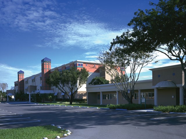
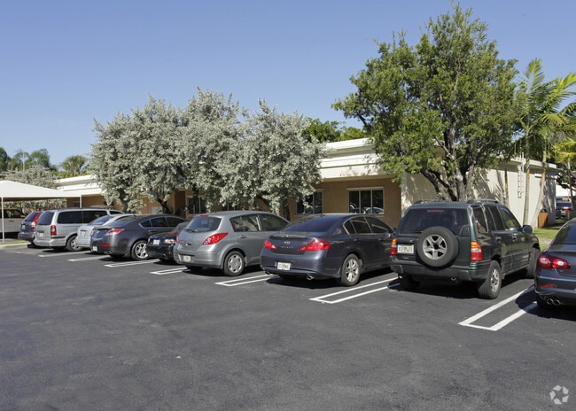
Property Record
7705 Nw 48Th St, Doral, FL 33166

NEARBY LISTINGS FOR SALE OR LEASE
Property Detail
7705 Nw 48Th St
35-3022-008-0010
M/L Palmetto Office Park
Officebuilding
22 53 40 13.90 AC M/L PALMETTO OFFICE PARK PB 94-56 TRACT A LOT SIZE 605484 SQ FT OR 17520-1892 0297 1 F/A/U 30-3022-008-0010
AH
Miami/Dade
12086C0279L
Florida
2024
13.90 AC
2025
Miami Airport
009066
South Florida
204,320 SF
Miami-Miami Beach-Kendall, FL
DEMOGRAPHICS near 7705 Nw 48Th St
1 Mile
3 Mile
5 Mile
2024 Total Population
16,069
103,890
443,535
2029 Population
16,976
103,005
431,222
Pop Growth 2024-2029
+ 5.64%
(0.85%)
(2.78%)
Average Age
35
41
43
2024 Total Households
6,119
37,364
151,251
HH Growth 2024-2029
+ 4.98%
(1.31%)
(3.18%)
Median Household Inc
$67,797
$53,444
$52,444
Avg Household Size
2.60
2.70
2.80
2024 Avg HH Vehicles
1.00
2.00
2.00
Median Home Value
$551,944
$384,629
$345,330
Median Year Built
2011
1984
1977
Nearby Places
Map Layers
Map Styles
 Street
 Aerial
- Restaurants
- Banks
- Shops
- Fitness
- Groceries
PUBLIC TRANSPORTATION
COMMUTER RAIL
Palmetto (Metrorail Green Line - Miami-Dade Transit (Metrorail/Metromover))
DRIVE
WALK
Distance
Palmetto (Metrorail Green Line - Miami-Dade Transit (Metrorail/Metromover))
8 min
4.2 mi
Okeechobee (Metrorail Green Line - Miami-Dade Transit (Metrorail/Metromover))
DRIVE
WALK
Distance
Okeechobee (Metrorail Green Line - Miami-Dade Transit (Metrorail/Metromover))
9 min
4.4 mi
AIRPORT
Miami International
DRIVE
WALK
Distance
Miami International
10 min
3.8 mi
Fort Lauderdale/Hollywood International
DRIVE
WALK
Distance
Fort Lauderdale/Hollywood International
42 min
28.7 mi
Freight Ports
Port of Miami
DRIVE
WALK
Distance
Port of Miami
22 min
13.2 mi
SALE & LEASE HISTORY
LISTING DATE
SALE/LEASE

Jun 20, 2018
For Lease
Jun 18, 2020
For Lease
Apr 14, 2020
For Lease
Nearby Properties
Address
Land Use
TOTAL SIZE
Lot Size
Zoning
Address
Land Use
TOTAL SIZE
Lot Size
Zoning
1,071,874 SF
6.73 AC
4802
Address
Land Use
TOTAL SIZE
Lot Size
Zoning
312,996 SF
157.16 AC
8900
Address
Land Use
TOTAL SIZE
Lot Size
Zoning
851,502 SF
11.73 AC
6119
Address
Land Use
TOTAL SIZE
Lot Size
Zoning
481,242 SF
13.61 AC
6400
Address
Land Use
TOTAL SIZE
Lot Size
Zoning
666,015 SF
4 AC
6119
Address
Land Use
TOTAL SIZE
Lot Size
Zoning
582,921 SF
4.51 AC
6119
Address
Land Use
TOTAL SIZE
Lot Size
Zoning
929,765 SF
453.69 AC
6119
Address
Land Use
TOTAL SIZE
Lot Size
Zoning
418,532 SF
17.95 AC
7300
Address
Land Use
TOTAL SIZE
Lot Size
Zoning
328,554 SF
668.26 AC
8900
Address
Land Use
TOTAL SIZE
Lot Size
Zoning
608,139 SF
5.80 AC
6119
Address
Land Use
TOTAL SIZE
Lot Size
Zoning
612,289 SF
3.38 AC
6119
Address
Land Use
TOTAL SIZE
Lot Size
Zoning
1,700 SF
7.24 AC
7100
Address
Land Use
TOTAL SIZE
Lot Size
Zoning
538,715 SF
24.72 AC
7100
Address
Land Use
TOTAL SIZE
Lot Size
Zoning
352,663 SF
0.65 AC
6119
Address
Land Use
TOTAL SIZE
Lot Size
Zoning
438,387 SF
16.20 AC
3900
Address
Land Use
TOTAL SIZE
Lot Size
Zoning
453,404 SF
469.53 AC
7300
Address
Land Use
TOTAL SIZE
Lot Size
Zoning
322,084 SF
6.60 AC
7100
Address
Land Use
TOTAL SIZE
Lot Size
Zoning
344,465 SF
5.03 AC
6400
Address
Land Use
TOTAL SIZE
Lot Size
Zoning
468,218 SF
17.06 AC
7100
Address
Land Use
TOTAL SIZE
Lot Size
Zoning
344,101 SF
0.74 AC
6119
Address
Land Use
TOTAL SIZE
Lot Size
Zoning
687,304 SF
3.03 AC
6119
Address
Land Use
TOTAL SIZE
Lot Size
Zoning
648,867 SF
33.08 AC
7100
Address
Land Use
TOTAL SIZE
Lot Size
Zoning
527,157 SF
4.15 AC
6119
Address
Land Use
TOTAL SIZE
Lot Size
Zoning
538,739 SF
5.05 AC
7100
Address
Land Use
TOTAL SIZE
Lot Size
Zoning
387,903 SF
4.49 AC
6119
Address
Land Use
TOTAL SIZE
Lot Size
Zoning
516,193 SF
571.83 AC
8900
Address
Land Use
TOTAL SIZE
Lot Size
Zoning
330,528 SF
4.46 AC
6119
Address
Land Use
TOTAL SIZE
Lot Size
Zoning
206,535 SF
7100
Address
Land Use
TOTAL SIZE
Lot Size
Zoning
298,603 SF
24.12 AC
7100
The World's #1 Commercial Real Estate Marketplace
Connect with us
© 2025 CoStar Group
The information above has been obtained from sources believed reliable. While we do not doubt its accuracy we have not verified it and make no guarantee, warranty or representation about it. It is your responsibility to independently confirm its accuracy and completeness. Any projections, opinions, assumptions, or estimates used are for example only and do not represent the current or future performance of the property. The value of this transaction to you depends on tax and other factors which should be evaluated by your tax, financial, and legal advisors. You and your advisors should conduct a careful, independent investigation of the property to determine to your satisfaction the suitability of the property for your needs.