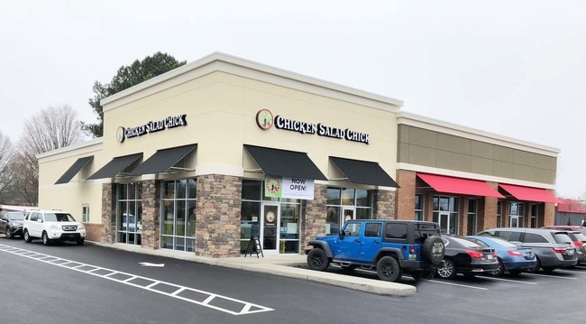
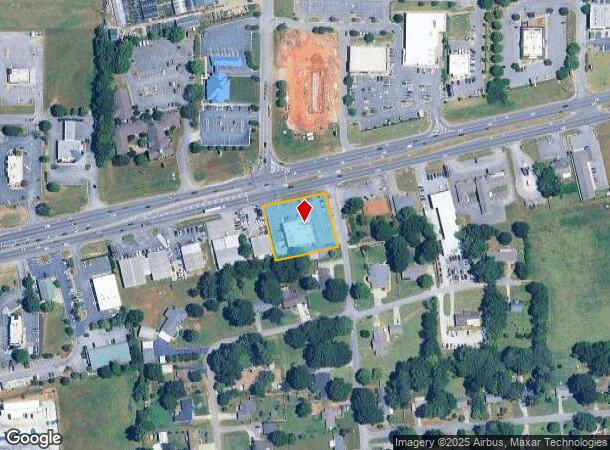
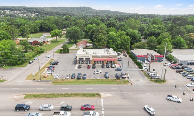
Property Record
7709 Highway 72 W, Madison, AL 35758
NEARBY LISTINGS FOR SALE OR LEASE
Property Detail
7709 Highway 72 W
15-08-28-1-001-025.000
Rainbow Subdivision
Storesoffices
SEC 28 T3S R2W BEG AT THE SW INTER OF US HWY 72 & W ROW OF RAINBOW CIR TH S 13 DEG E 175.25 FT TH S 76 DEG W 200 FT TH N 13 D
X
Madison
01089C0163E
Alabama
2025
0.92 AC
2025
Jetplex/Madison
011012
Huntsville
7,210 SF
Huntsville, AL
DEMOGRAPHICS near 7709 Highway 72 W
1 Mile
3 Mile
5 Mile
2024 Total Population
3,627
51,178
116,550
2029 Population
3,969
56,864
130,234
Pop Growth 2024-2029
+ 9.43%
+ 11.11%
+ 11.74%
Average Age
41
40
39
2024 Total Households
1,371
20,362
46,696
HH Growth 2024-2029
+ 9.85%
+ 11.70%
+ 12.25%
Median Household Inc
$122,259
$104,056
$97,223
Avg Household Size
2.60
2.50
2.40
2024 Avg HH Vehicles
2.00
2.00
2.00
Median Home Value
$319,697
$299,613
$288,317
Median Year Built
1997
2002
2000
Nearby Places
Map Layers
Map Styles
 Street
 Aerial
- Restaurants
- Banks
- Shops
- Fitness
- Groceries
PUBLIC TRANSPORTATION
AIRPORT
Huntsville International-Carl T Jones Field
DRIVE
WALK
Distance
Huntsville International-Carl T Jones Field
20 min
10.3 mi
Freight Ports
Port of Mobile
DRIVE
WALK
Distance
Port of Mobile
388 min
351.5 mi
SALE & LEASE HISTORY
LISTING DATE
SALE/LEASE

Sep 25, 2016
For Lease
Mar 11, 2019
For Lease
Jun 18, 2021
For Sale
Nearby Properties
Address
Land Use
TOTAL SIZE
Lot Size
Zoning
Address
Land Use
TOTAL SIZE
Lot Size
Zoning
61,245 SF
3.39 AC
Address
Land Use
TOTAL SIZE
Lot Size
Zoning
25,692 SF
11.77 AC
Address
Land Use
TOTAL SIZE
Lot Size
Zoning
14,008 SF
19 AC
Address
Land Use
TOTAL SIZE
Lot Size
Zoning
4,367 SF
27 AC
Address
Land Use
TOTAL SIZE
Lot Size
Zoning
4,470 SF
20 AC
Address
Land Use
TOTAL SIZE
Lot Size
Zoning
7,055 SF
19 AC
Address
Land Use
TOTAL SIZE
Lot Size
Zoning
3,746 SF
22.08 AC
Address
Land Use
TOTAL SIZE
Lot Size
Zoning
8,868 SF
25 AC
Address
Land Use
TOTAL SIZE
Lot Size
Zoning
3,363 SF
26.88 AC
Address
Land Use
TOTAL SIZE
Lot Size
Zoning
195,300 SF
Address
Land Use
TOTAL SIZE
Lot Size
Zoning
9,138 SF
27 AC
Address
Land Use
TOTAL SIZE
Lot Size
Zoning
343,176 SF
23 AC
Address
Land Use
TOTAL SIZE
Lot Size
Zoning
1,454 SF
14.22 AC
Address
Land Use
TOTAL SIZE
Lot Size
Zoning
3,257 SF
25.84 AC
Address
Land Use
TOTAL SIZE
Lot Size
Zoning
2,774 SF
16 AC
Address
Land Use
TOTAL SIZE
Lot Size
Zoning
19,078 SF
10 AC
Address
Land Use
TOTAL SIZE
Lot Size
Zoning
7,529 SF
16 AC
Address
Land Use
TOTAL SIZE
Lot Size
Zoning
4,324 SF
38 AC
Address
Land Use
TOTAL SIZE
Lot Size
Zoning
8,468 SF
5.80 AC
Address
Land Use
TOTAL SIZE
Lot Size
Zoning
8,258 SF
15.30 AC
Address
Land Use
TOTAL SIZE
Lot Size
Zoning
3,922 SF
15 AC
Address
Land Use
TOTAL SIZE
Lot Size
Zoning
2,517 SF
35 AC
Address
Land Use
TOTAL SIZE
Lot Size
Zoning
5,062 SF
20 AC
Address
Land Use
TOTAL SIZE
Lot Size
Zoning
3,976 SF
11.20 AC
Address
Land Use
TOTAL SIZE
Lot Size
Zoning
49,380 SF
6.18 AC
Address
Land Use
TOTAL SIZE
Lot Size
Zoning
6,220 SF
6.20 AC
Address
Land Use
TOTAL SIZE
Lot Size
Zoning
86,280 SF
18.90 AC
Address
Land Use
TOTAL SIZE
Lot Size
Zoning
22,171 SF
Address
Land Use
TOTAL SIZE
Lot Size
Zoning
56,025 SF
9.34 AC
Address
Land Use
TOTAL SIZE
Lot Size
Zoning
1,526 SF
11.83 AC
The World's #1 Commercial Real Estate Marketplace
Connect with us
© 2025 CoStar Group
The information above has been obtained from sources believed reliable. While we do not doubt its accuracy we have not verified it and make no guarantee, warranty or representation about it. It is your responsibility to independently confirm its accuracy and completeness. Any projections, opinions, assumptions, or estimates used are for example only and do not represent the current or future performance of the property. The value of this transaction to you depends on tax and other factors which should be evaluated by your tax, financial, and legal advisors. You and your advisors should conduct a careful, independent investigation of the property to determine to your satisfaction the suitability of the property for your needs.