Property Record
7709 W 20Th Ave, Hialeah, FL 33014


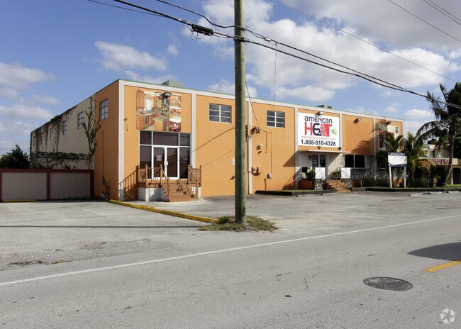

Property Detail
7709 W 20Th Ave
04-2026-001-0334
26 52 40 .826 AC SUB OF PB 2-68 S60FT OF TR 19 LESS W140FT & LESS E160FT & N40FT OF TR 20 LESS W140FT & LESS E160FT IN NW1/4 LOT SIZE 36000 SQUARE FEET OR 9935-512 02-78 1 COC 25942-1851 09 2007 1
Warehouse
Miami-Dade
7100
Florida
B and X Area of moderate flood hazard, usually the area between the limits of the 100-year and 500-year floods.
0.83 AC
2024
Hialeah
2025
South Florida
009316
Miami-Miami Beach-Kendall, FL
12,908 SF
NEARBY LISTINGS FOR SALE OR LEASE
DEMOGRAPHICS near 7709 W 20Th Ave
1 mile
3 mile
5 mile
2025 Total Population
23,701
214,877
422,911
2030 Population
25,065
228,925
449,979
Pop Growth 2025-2030
+ 5.76%
+ 6.54%
+ 6.40%
Average Age
43
43
42
2025 Total Households
7,889
72,151
136,788
HH Growth 2025-2030
+ 5.64%
+ 6.47%
+ 6.34%
Median Household Inc
$68,604
$68,955
$68,105
Avg Household Size
2.90
2.90
3.00
2025 Avg HH Vehicles
2.00
2.00
2.00
Median Home Value
$383,795
$425,078
$438,488
Median Year Built
1977
1983
1981
Nearby Places
Map Layers
Map Styles
 Street
 Aerial
Layers
 Traffic
 Biking
Places
Listings with unknown addresses are not visible on the map
- Restaurants
- Banks
- Shops
- Fitness
- Groceries
PUBLIC TRANSPORTATION
COMMUTER RAIL
Palmetto (Metrorail Green Line - Miami-Dade Transit (Metrorail/Metromover))
Drive
Walk
Distance
Palmetto (Metrorail Green Line - Miami-Dade Transit (Metrorail/Metromover))
8 min
4.1 mi
Okeechobee (Metrorail Green Line - Miami-Dade Transit (Metrorail/Metromover))
Drive
Walk
Distance
Okeechobee (Metrorail Green Line - Miami-Dade Transit (Metrorail/Metromover))
10 min
4.8 mi
AIRPORT
Miami International
Drive
Walk
Distance
Miami International
18 min
9.1 mi
Fort Lauderdale/Hollywood International
Drive
Walk
Distance
Fort Lauderdale/Hollywood International
33 min
22.1 mi
Freight Ports
Port of Miami
Drive
Walk
Distance
Port of Miami
31 min
18.7 mi
SALE & LEASE HISTORY
LISTING DATE
SALE/LEASE

Aug 06, 2019
For Lease
Nearby Properties
Address
Land Use
TOTAL SIZE
Lot Size
Zoning
Address
Land Use
TOTAL SIZE
Lot Size
Zoning
614,708 SF
22.54 AC
4400
Address
Land Use
TOTAL SIZE
Lot Size
Zoning
636,721 SF
52.61 AC
2800
Address
Land Use
TOTAL SIZE
Lot Size
Zoning
439,520 SF
20.20 AC
9400
Address
Land Use
TOTAL SIZE
Lot Size
Zoning
725,624 SF
34.80 AC
7300
Address
Land Use
TOTAL SIZE
Lot Size
Zoning
526,059 SF
18.99 AC
6407
Address
Land Use
TOTAL SIZE
Lot Size
Zoning
469,837 SF
26 AC
7600
Address
Land Use
TOTAL SIZE
Lot Size
Zoning
696,550 SF
2.97 AC
6109
Address
Land Use
TOTAL SIZE
Lot Size
Zoning
301,593 SF
16 AC
7100
Address
Land Use
TOTAL SIZE
Lot Size
Zoning
1,165,101 SF
115.84 AC
8000
Address
Land Use
TOTAL SIZE
Lot Size
Zoning
538,715 SF
24.72 AC
7100
Address
Land Use
TOTAL SIZE
Lot Size
Zoning
399,805 SF
14.02 AC
8000
Address
Land Use
TOTAL SIZE
Lot Size
Zoning
322,084 SF
6.60 AC
7100
Address
Land Use
TOTAL SIZE
Lot Size
Zoning
355,120 SF
18 AC
5000
Address
Land Use
TOTAL SIZE
Lot Size
Zoning
359,483 SF
11.34 AC
8000
Address
Land Use
TOTAL SIZE
Lot Size
Zoning
223,543 SF
39.40 AC
6407
Address
Land Use
TOTAL SIZE
Lot Size
Zoning
331,131 SF
12.09 AC
3900
Address
Land Use
TOTAL SIZE
Lot Size
Zoning
537,862 SF
22.21 AC
7701
Address
Land Use
TOTAL SIZE
Lot Size
Zoning
382,421 SF
19.66 AC
3700
Address
Land Use
TOTAL SIZE
Lot Size
Zoning
400,062 SF
33.33 AC
0101
Address
Land Use
TOTAL SIZE
Lot Size
Zoning
315,033 SF
11.48 AC
6109
Address
Land Use
TOTAL SIZE
Lot Size
Zoning
235,248 SF
12.31 AC
7600
Address
Land Use
TOTAL SIZE
Lot Size
Zoning
230,169 SF
10.62 AC
7600
Address
Land Use
TOTAL SIZE
Lot Size
Zoning
419,656 SF
8.61 AC
6400
Address
Land Use
TOTAL SIZE
Lot Size
Zoning
445,429 SF
4.45 AC
6400
Address
Land Use
TOTAL SIZE
Lot Size
Zoning
313,129 SF
16.06 AC
7100
Address
Land Use
TOTAL SIZE
Lot Size
Zoning
320,597 SF
14.52 AC
7701
Address
Land Use
TOTAL SIZE
Lot Size
Zoning
293,962 SF
9.99 AC
4400
Address
Land Use
TOTAL SIZE
Lot Size
Zoning
196,118 SF
11.06 AC
7100
Address
Land Use
TOTAL SIZE
Lot Size
Zoning
308,699 SF
28.97 AC
7100
Address
Land Use
TOTAL SIZE
Lot Size
Zoning
478,031 SF
1.72 AC
6600
The World's #1 Commercial Real Estate Marketplace
Connect with us
© 2026 CoStar Group
The information above has been obtained from sources believed reliable. While we do not doubt its accuracy we have not verified it and make no guarantee, warranty or representation about it. It is your responsibility to independently confirm its accuracy and completeness. Any projections, opinions, assumptions, or estimates used are for example only and do not represent the current or future performance of the property. The value of this transaction to you depends on tax and other factors which should be evaluated by your tax, financial, and legal advisors. You and your advisors should conduct a careful, independent investigation of the property to determine to your satisfaction the suitability of the property for your needs.