Property Record
771 Devota Dr, Rescue, CA 95672

Property Detail
771 Devota Dr
Sacramento-Roseville-Folsom, CA
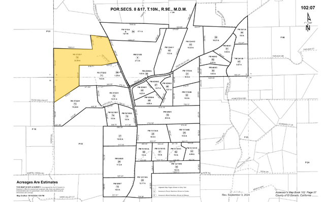
RS 37/22/1
102-070-070-000
EL DORADO
Agriculturalland
California
B and X Area of moderate flood hazard, usually the area between the limits of the 100-year and 500-year floods.
33.54 AC
2024
Outer El Dorado County
2025
Sacramento
030801
NEARBY LISTINGS FOR SALE OR LEASE
-
-
View all Rescue listings for sale on LoopNet.com
DEMOGRAPHICS near 771 Devota Dr
1 mile
3 mile
5 mile
2024 Total Population
281
9,776
56,141
2029 Population
266
9,689
56,131
Pop Growth 2024-2029
(5.34%)
(0.89%)
(0.02%)
Average Age
47
43
43
2024 Total Households
104
3,730
19,947
HH Growth 2024-2029
(4.81%)
(0.97%)
(0.12%)
Median Household Inc
$157,500
$113,039
$143,842
Avg Household Size
2.70
2.60
2.80
2024 Avg HH Vehicles
3.00
2.00
2.00
Median Home Value
$885,416
$853,874
$845,368
Median Year Built
1987
1990
1995
Nearby Places
Map Layers
Map Styles
 Street
 Aerial
Transit
 Traffic
 Biking
Places
Listings with unknown addresses are not visible on the map
- Restaurants
- Banks
- Shops
- Fitness
- Groceries
Nearby Properties
Address
Land Use
TOTAL SIZE
Lot Size
Zoning
Address
Land Use
TOTAL SIZE
Lot Size
Zoning
161,528 SF
10.65 AC
R2
Address
Land Use
TOTAL SIZE
Lot Size
Zoning
28,804 SF
2.43 AC
CP
Address
Land Use
TOTAL SIZE
Lot Size
Zoning
8,520 SF
7.32 AC
R1
Address
Land Use
TOTAL SIZE
Lot Size
Zoning
100,000 SF
5.92 AC
CP
Address
Land Use
TOTAL SIZE
Lot Size
Zoning
12,184 SF
2.68 AC
R2
Address
Land Use
TOTAL SIZE
Lot Size
Zoning
15,027 SF
11.07 AC
R1A
Address
Land Use
TOTAL SIZE
Lot Size
Zoning
37,164 SF
2.18 AC
R2
Address
Land Use
TOTAL SIZE
Lot Size
Zoning
16,506 SF
1.89 AC
CP
Address
Land Use
TOTAL SIZE
Lot Size
Zoning
30,520 SF
1.84 AC
R2
Address
Land Use
TOTAL SIZE
Lot Size
Zoning
24,496 SF
1.84 AC
R2
Address
Land Use
TOTAL SIZE
Lot Size
Zoning
4,881 SF
0.54 AC
R1
Address
Land Use
TOTAL SIZE
Lot Size
Zoning
5,852 SF
2.22 AC
R2
Address
Land Use
TOTAL SIZE
Lot Size
Zoning
4,224 SF
140.26 AC
RE10
Address
Land Use
TOTAL SIZE
Lot Size
Zoning
18,090 SF
1.55 AC
C
Address
Land Use
TOTAL SIZE
Lot Size
Zoning
4,335 SF
0.56 AC
R1
Address
Land Use
TOTAL SIZE
Lot Size
Zoning
8,329 SF
8.62 AC
RE10
Address
Land Use
TOTAL SIZE
Lot Size
Zoning
21,236 SF
0.92 AC
R2
Address
Land Use
TOTAL SIZE
Lot Size
Zoning
11,392 SF
0.53 AC
R2
Address
Land Use
TOTAL SIZE
Lot Size
Zoning
11,577 SF
0.94 AC
CP
Address
Land Use
TOTAL SIZE
Lot Size
Zoning
17,340 SF
1 AC
R2
Address
Land Use
TOTAL SIZE
Lot Size
Zoning
4,398 SF
0.49 AC
Address
Land Use
TOTAL SIZE
Lot Size
Zoning
5,299 SF
10 AC
RE10
Address
Land Use
TOTAL SIZE
Lot Size
Zoning
5,009 SF
0.71 AC
Address
Land Use
TOTAL SIZE
Lot Size
Zoning
3,920 SF
0.39 AC
R2
Address
Land Use
TOTAL SIZE
Lot Size
Zoning
4.61 AC
R1A
Address
Land Use
TOTAL SIZE
Lot Size
Zoning
3,442 SF
1.74 AC
Address
Land Use
TOTAL SIZE
Lot Size
Zoning
39,509 SF
0.91 AC
C
Address
Land Use
TOTAL SIZE
Lot Size
Zoning
13,788 SF
0.91 AC
C
Address
Land Use
TOTAL SIZE
Lot Size
Zoning
4,634 SF
0.60 AC
R1
Address
Land Use
TOTAL SIZE
Lot Size
Zoning
7,468 SF
0.45 AC
R2
The World's #1 Commercial Real Estate Marketplace
Connect with us
© 2026 CoStar Group
The information above has been obtained from sources believed reliable. While we do not doubt its accuracy we have not verified it and make no guarantee, warranty or representation about it. It is your responsibility to independently confirm its accuracy and completeness. Any projections, opinions, assumptions, or estimates used are for example only and do not represent the current or future performance of the property. The value of this transaction to you depends on tax and other factors which should be evaluated by your tax, financial, and legal advisors. You and your advisors should conduct a careful, independent investigation of the property to determine to your satisfaction the suitability of the property for your needs.