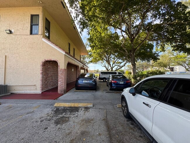
Property Record
7710 Nw 56Th Way, Pompano Beach, FL 33073


Current Lease Availabilities
NEARBY LISTINGS FOR SALE OR LEASE
Property Detail
7710 Nw 56Th Way
Fort Lauderdale-Pompano Beach-Deerfield Beach, FL
Hillsboro Pines Sec A 42-22 B
47-42-31-02-0080
HILLSBORO PINES SEC A 42-22 B LOT 1,2 BLK 2
Storesoffices
Broward
X
Florida
12099C1155F
1,2
2024
0.28 AC
2025
Pompano Beach
010502
South Florida
6,980 SF
DEMOGRAPHICS near 7710 Nw 56Th Way
1 Mile
3 Mile
5 Mile
2024 Total Population
19,147
105,772
294,224
2029 Population
19,411
106,574
297,409
Pop Growth 2024-2029
+ 1.38%
+ 0.76%
+ 1.08%
Average Age
39
40
43
2024 Total Households
6,895
38,371
118,132
HH Growth 2024-2029
+ 1.07%
+ 0.36%
+ 1.14%
Median Household Inc
$67,244
$86,313
$71,056
Avg Household Size
2.70
2.60
2.40
2024 Avg HH Vehicles
2.00
2.00
2.00
Median Home Value
$343,039
$400,852
$356,510
Median Year Built
1987
1988
1985
Nearby Places
Map Layers
Map Styles
 Street
 Aerial
- Restaurants
- Banks
- Shops
- Fitness
- Groceries
PUBLIC TRANSPORTATION
COMMUTER RAIL
Deerfield Beach (Tri-County Commuter - South Florida Regional Transportation Authority (Tri-Rail))
DRIVE
WALK
Distance
Deerfield Beach (Tri-County Commuter - South Florida Regional Transportation Authority (Tri-Rail))
11 min
5.8 mi
Pompano Beach (Tri-County Commuter - South Florida Regional Transportation Authority (Tri-Rail))
DRIVE
WALK
Distance
Pompano Beach (Tri-County Commuter - South Florida Regional Transportation Authority (Tri-Rail))
16 min
8.8 mi
AIRPORT
Fort Lauderdale/Hollywood International
DRIVE
WALK
Distance
Fort Lauderdale/Hollywood International
37 min
26.4 mi
Palm Beach International
DRIVE
WALK
Distance
Palm Beach International
43 min
31.7 mi
Freight Ports
Port Everglades
DRIVE
WALK
Distance
Port Everglades
36 min
25.1 mi
Nearby Properties
Address
Land Use
TOTAL SIZE
Lot Size
Zoning
Address
Land Use
TOTAL SIZE
Lot Size
Zoning
642,666 SF
16.33 AC
MXPD
Address
Land Use
TOTAL SIZE
Lot Size
Zoning
743,452 SF
25.24 AC
RTS
Address
Land Use
TOTAL SIZE
Lot Size
Zoning
600,712 SF
19.01 AC
AR
Address
Land Use
TOTAL SIZE
Lot Size
Zoning
393,810 SF
26.39 AC
RH
Address
Land Use
TOTAL SIZE
Lot Size
Zoning
421,779 SF
23.07 AC
PUD
Address
Land Use
TOTAL SIZE
Lot Size
Zoning
382,471 SF
32.64 AC
PUD
Address
Land Use
TOTAL SIZE
Lot Size
Zoning
405,715 SF
20.11 AC
PUD
Address
Land Use
TOTAL SIZE
Lot Size
Zoning
477,479 SF
26.73 AC
RTS
Address
Land Use
TOTAL SIZE
Lot Size
Zoning
396,020 SF
70.57 AC
A-1
Address
Land Use
TOTAL SIZE
Lot Size
Zoning
377,588 SF
44.94 AC
RM-10
Address
Land Use
TOTAL SIZE
Lot Size
Zoning
400,709 SF
29.62 AC
RH
Address
Land Use
TOTAL SIZE
Lot Size
Zoning
390,795 SF
16.83 AC
PUD
Address
Land Use
TOTAL SIZE
Lot Size
Zoning
353,440 SF
9.80 AC
PUD
Address
Land Use
TOTAL SIZE
Lot Size
Zoning
307,641 SF
20 AC
PUD
Address
Land Use
TOTAL SIZE
Lot Size
Zoning
311,680 SF
15.84 AC
PUD
Address
Land Use
TOTAL SIZE
Lot Size
Zoning
340,604 SF
31.31 AC
B-2
Address
Land Use
TOTAL SIZE
Lot Size
Zoning
311,836 SF
13.92 AC
RM-30
Address
Land Use
TOTAL SIZE
Lot Size
Zoning
205,022 SF
19.03 AC
MXPD
Address
Land Use
TOTAL SIZE
Lot Size
Zoning
201,834 SF
22.09 AC
CG
Address
Land Use
TOTAL SIZE
Lot Size
Zoning
269,508 SF
38.46 AC
A-1
Address
Land Use
TOTAL SIZE
Lot Size
Zoning
206,194 SF
20.06 AC
RM-10
Address
Land Use
TOTAL SIZE
Lot Size
Zoning
214,164 SF
11.31 AC
PUD
Address
Land Use
TOTAL SIZE
Lot Size
Zoning
199,177 SF
11.07 AC
PUD
Address
Land Use
TOTAL SIZE
Lot Size
Zoning
204,153 SF
17.19 AC
PUD
Address
Land Use
TOTAL SIZE
Lot Size
Zoning
130,440 SF
5.99 AC
RE
Address
Land Use
TOTAL SIZE
Lot Size
Zoning
188,849 SF
14.70 AC
CSH
Address
Land Use
TOTAL SIZE
Lot Size
Zoning
173,197 SF
19.28 AC
CG
Address
Land Use
TOTAL SIZE
Lot Size
Zoning
219,676 SF
5.78 AC
RH
Address
Land Use
TOTAL SIZE
Lot Size
Zoning
184,102 SF
18.46 AC
PUD
Address
Land Use
TOTAL SIZE
Lot Size
Zoning
119,203 SF
12.46 AC
MUPD
The World's #1 Commercial Real Estate Marketplace
Connect with us
© 2026 CoStar Group
The information above has been obtained from sources believed reliable. While we do not doubt its accuracy we have not verified it and make no guarantee, warranty or representation about it. It is your responsibility to independently confirm its accuracy and completeness. Any projections, opinions, assumptions, or estimates used are for example only and do not represent the current or future performance of the property. The value of this transaction to you depends on tax and other factors which should be evaluated by your tax, financial, and legal advisors. You and your advisors should conduct a careful, independent investigation of the property to determine to your satisfaction the suitability of the property for your needs.