Property Record
7710 W 41St St, Tulsa, OK 74107
NEARBY LISTINGS FOR SALE OR LEASE
-
-
View all Tulsa listings for sale on LoopNet.com
Property Detail
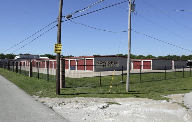
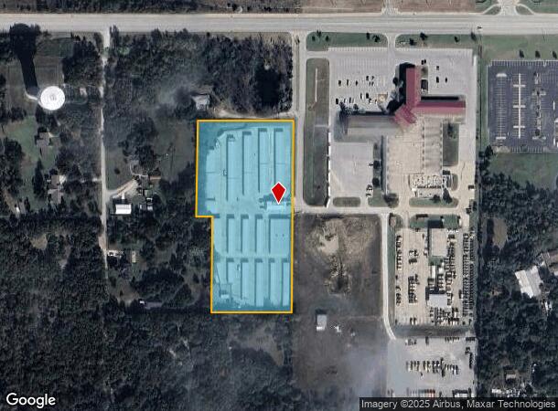
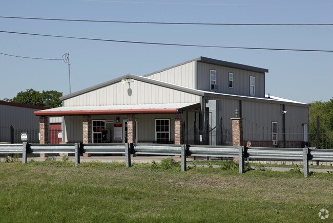
7710 W 41St St
Tulsa, OK
Unplatted
99230-92-30-60010
N330 S990 E640 NW NW LESS W310 & E277.45 N/2 SE NW NW SEC 30 19 12 4.60ACS
Officebuilding
Tulsa
X
Oklahoma
40143C0327L
1
2025
4.60 AC
2025
West
006507
Tulsa
71,287 SF
DEMOGRAPHICS near 7710 W 41St St
1 Mile
3 Mile
5 Mile
2024 Total Population
1,942
19,798
59,807
2029 Population
2,002
20,554
62,125
Pop Growth 2024-2029
+ 3.09%
+ 3.82%
+ 3.88%
Average Age
42
40
40
2024 Total Households
748
7,648
23,893
HH Growth 2024-2029
+ 3.07%
+ 3.88%
+ 3.91%
Median Household Inc
$80,147
$64,697
$54,344
Avg Household Size
2.60
2.50
2.40
2024 Avg HH Vehicles
2.00
2.00
2.00
Median Home Value
$191,864
$153,825
$146,477
Median Year Built
1984
1973
1973
Nearby Places
Map Layers
Map Styles
 Street
 Aerial
- Restaurants
- Banks
- Shops
- Fitness
- Groceries
PUBLIC TRANSPORTATION
AIRPORT
Tulsa International
DRIVE
WALK
Distance
Tulsa International
26 min
17.4 mi
Freight Ports
Tulsa Port Of Catoosa
DRIVE
WALK
Distance
Tulsa Port Of Catoosa
36 min
26.7 mi
Nearby Properties
Address
Land Use
TOTAL SIZE
Lot Size
Zoning
Address
Land Use
TOTAL SIZE
Lot Size
Zoning
1,134,776 SF
35.85 AC
CN
Address
Land Use
TOTAL SIZE
Lot Size
Zoning
92,076 SF
81.28 AC
IM
Address
Land Use
TOTAL SIZE
Lot Size
Zoning
174,776 SF
9.46 AC
RM2
Address
Land Use
TOTAL SIZE
Lot Size
Zoning
15,747 SF
2.50 AC
CM
Address
Land Use
TOTAL SIZE
Lot Size
Zoning
143,520 SF
25.14 AC
IM
Address
Land Use
TOTAL SIZE
Lot Size
Zoning
47,670 SF
10.05 AC
RS
Address
Land Use
TOTAL SIZE
Lot Size
Zoning
45,125 SF
7.05 AC
RM1
Address
Land Use
TOTAL SIZE
Lot Size
Zoning
22,078 SF
5.08 AC
CS
Address
Land Use
TOTAL SIZE
Lot Size
Zoning
28,240 SF
147.33 AC
NCU
Address
Land Use
TOTAL SIZE
Lot Size
Zoning
41,456 SF
2.39 AC
RS2
Address
Land Use
TOTAL SIZE
Lot Size
Zoning
117,372 SF
11.87 AC
CN
Address
Land Use
TOTAL SIZE
Lot Size
Zoning
20,771 SF
1.11 AC
RS3
Address
Land Use
TOTAL SIZE
Lot Size
Zoning
108,900 SF
6.82 AC
IM
Address
Land Use
TOTAL SIZE
Lot Size
Zoning
370,891 SF
26.43 AC
IM
Address
Land Use
TOTAL SIZE
Lot Size
Zoning
44,238 SF
9.11 AC
IH
Address
Land Use
TOTAL SIZE
Lot Size
Zoning
38,940 SF
16.24 AC
Address
Land Use
TOTAL SIZE
Lot Size
Zoning
70,910 SF
6.73 AC
IM
Address
Land Use
TOTAL SIZE
Lot Size
Zoning
16,456 SF
5.67 AC
RE
Address
Land Use
TOTAL SIZE
Lot Size
Zoning
31,600 SF
13.46 AC
Address
Land Use
TOTAL SIZE
Lot Size
Zoning
25,685 SF
5.04 AC
Address
Land Use
TOTAL SIZE
Lot Size
Zoning
28,347 SF
2.07 AC
RS
Address
Land Use
TOTAL SIZE
Lot Size
Zoning
8,784 SF
7.93 AC
CG
Address
Land Use
TOTAL SIZE
Lot Size
Zoning
17,801 SF
21.15 AC
IM
Address
Land Use
TOTAL SIZE
Lot Size
Zoning
16,903 SF
2.51 AC
RS1
Address
Land Use
TOTAL SIZE
Lot Size
Zoning
21,349 SF
2.10 AC
RS2
Address
Land Use
TOTAL SIZE
Lot Size
Zoning
9,060 SF
2.05 AC
CS
Address
Land Use
TOTAL SIZE
Lot Size
Zoning
137,923 SF
37.46 AC
IM
Address
Land Use
TOTAL SIZE
Lot Size
Zoning
19,188 SF
3.87 AC
RS3
Address
Land Use
TOTAL SIZE
Lot Size
Zoning
15,662 SF
0.78 AC
RS3
The World's #1 Commercial Real Estate Marketplace
Connect with us
© 2026 CoStar Group
The information above has been obtained from sources believed reliable. While we do not doubt its accuracy we have not verified it and make no guarantee, warranty or representation about it. It is your responsibility to independently confirm its accuracy and completeness. Any projections, opinions, assumptions, or estimates used are for example only and do not represent the current or future performance of the property. The value of this transaction to you depends on tax and other factors which should be evaluated by your tax, financial, and legal advisors. You and your advisors should conduct a careful, independent investigation of the property to determine to your satisfaction the suitability of the property for your needs.