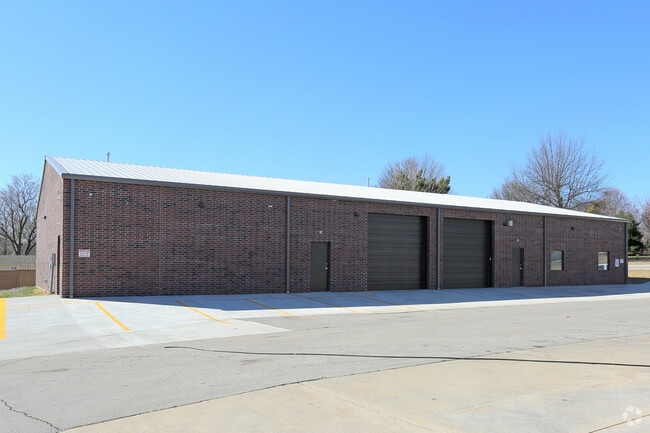
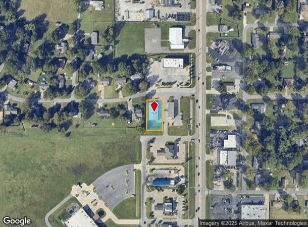
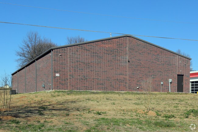
Property Record
7712 E 118Th St S, Bixby, OK 74008
NEARBY LISTINGS FOR SALE OR LEASE
Property Detail
7712 E 118Th St S
Tulsa, OK
Bixby Jiffy Lube Replat L1-3 B5 North Hg
57617-83-35-63570
LOT 2 BLOCK 1
Autorepair
Tulsa
X
Oklahoma
40143C0432M
2
2025
0.46 AC
2025
South Tulsa
007636
Tulsa
6,160 SF
DEMOGRAPHICS near 7712 E 118Th St S
1 mile
3 mile
5 mile
2024 Total Population
8,424
49,654
145,515
2029 Population
8,666
51,465
150,470
Pop Growth 2024-2029
+ 2.87%
+ 3.65%
+ 3.41%
Average Age
39
40
39
2024 Total Households
3,197
18,255
56,535
HH Growth 2024-2029
+ 2.66%
+ 3.55%
+ 3.35%
Median Household Inc
$85,332
$103,326
$86,638
Avg Household Size
2.60
2.70
2.50
2024 Avg HH Vehicles
2.00
2.00
2.00
Median Home Value
$340,504
$323,192
$267,502
Median Year Built
1999
1994
1992
Nearby Places
Map Layers
Map Styles
 Street
 Aerial
Transit
 Traffic
 Biking
Places
Listings with unknown addresses are not visible on the map
- Restaurants
- Banks
- Shops
- Fitness
- Groceries
PUBLIC TRANSPORTATION
AIRPORT
Tulsa International
Drive
Walk
Distance
Tulsa International
28 min
19.7 mi
Freight Ports
Drive
Walk
Distance
32 min
23.5 mi
Nearby Properties
Address
Land Use
TOTAL SIZE
Lot Size
Zoning
Address
Land Use
TOTAL SIZE
Lot Size
Zoning
134,232 SF
28.52 AC
R2
Address
Land Use
TOTAL SIZE
Lot Size
Zoning
55,384 SF
14.81 AC
AG
Address
Land Use
TOTAL SIZE
Lot Size
Zoning
8,388 SF
63.49 AC
AG
Address
Land Use
TOTAL SIZE
Lot Size
Zoning
176,243 SF
5.77 AC
CS
Address
Land Use
TOTAL SIZE
Lot Size
Zoning
152,422 SF
44.60 AC
AG
Address
Land Use
TOTAL SIZE
Lot Size
Zoning
65,385 SF
16.59 AC
AG
Address
Land Use
TOTAL SIZE
Lot Size
Zoning
33,668 SF
8.04 AC
CO
Address
Land Use
TOTAL SIZE
Lot Size
Zoning
27,278 SF
2.49 AC
CS
Address
Land Use
TOTAL SIZE
Lot Size
Zoning
98,290 SF
19.62 AC
RS3
Address
Land Use
TOTAL SIZE
Lot Size
Zoning
56,526 SF
25.18 AC
AG
Address
Land Use
TOTAL SIZE
Lot Size
Zoning
2,281,674 SF
147.83 AC
AG
Address
Land Use
TOTAL SIZE
Lot Size
Zoning
10,745 SF
56.52 AC
RS2
Address
Land Use
TOTAL SIZE
Lot Size
Zoning
35,904 SF
4.08 AC
RM1
Address
Land Use
TOTAL SIZE
Lot Size
Zoning
59,175 SF
8.28 AC
RS3
Address
Land Use
TOTAL SIZE
Lot Size
Zoning
330,744 SF
17.43 AC
RM3
Address
Land Use
TOTAL SIZE
Lot Size
Zoning
49,090 SF
12.91 AC
OL
Address
Land Use
TOTAL SIZE
Lot Size
Zoning
37,075 SF
21.33 AC
AG
Address
Land Use
TOTAL SIZE
Lot Size
Zoning
60,690 SF
4.32 AC
CN
Address
Land Use
TOTAL SIZE
Lot Size
Zoning
30,000 SF
5.13 AC
CS
Address
Land Use
TOTAL SIZE
Lot Size
Zoning
30,000 SF
5.06 AC
Address
Land Use
TOTAL SIZE
Lot Size
Zoning
219,987 SF
6.97 AC
RM3
Address
Land Use
TOTAL SIZE
Lot Size
Zoning
31,798 SF
4.42 AC
AG
Address
Land Use
TOTAL SIZE
Lot Size
Zoning
34,071 SF
9.29 AC
AG
Address
Land Use
TOTAL SIZE
Lot Size
Zoning
243,504 SF
13.97 AC
RM3
Address
Land Use
TOTAL SIZE
Lot Size
Zoning
10,584 SF
1.15 AC
CS
Address
Land Use
TOTAL SIZE
Lot Size
Zoning
295,254 SF
12.09 AC
CO
Address
Land Use
TOTAL SIZE
Lot Size
Zoning
28,174 SF
8.32 AC
AG
Address
Land Use
TOTAL SIZE
Lot Size
Zoning
27,896 SF
4.72 AC
AG
Address
Land Use
TOTAL SIZE
Lot Size
Zoning
199,720 SF
7.63 AC
RM1
Address
Land Use
TOTAL SIZE
Lot Size
Zoning
196,322 SF
23.55 AC
IM
The World's #1 Commercial Real Estate Marketplace
Connect with us
© 2026 CoStar Group
The information above has been obtained from sources believed reliable. While we do not doubt its accuracy we have not verified it and make no guarantee, warranty or representation about it. It is your responsibility to independently confirm its accuracy and completeness. Any projections, opinions, assumptions, or estimates used are for example only and do not represent the current or future performance of the property. The value of this transaction to you depends on tax and other factors which should be evaluated by your tax, financial, and legal advisors. You and your advisors should conduct a careful, independent investigation of the property to determine to your satisfaction the suitability of the property for your needs.