Property Record
7718 224Th St E, Graham, WA 98338

Property Detail
7718 224Th St E
041817-2009
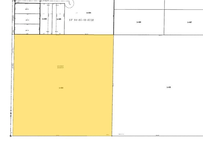
SECTION 17 TOWNSHIP 18 RANGE 04 QUARTER 23 : SW OF NW LESS W 30 FT CO RD EXC POR CYD TO P CO FOR ADDL R/W PER ETN 4642045 35991270DC 4/2/24 KG
Vacantlandnec
Pierce
R10
Washington
C and X Area of minimal flood hazard, usually depicted on FIRMs as above the 500-year flood level.
38.94 AC
2024
E Pierce County
2025
Seattle/Puget Sound
073116
Seattle-Tacoma-Bellevue, WA
3,496 SF
NEARBY LISTINGS FOR SALE OR LEASE
DEMOGRAPHICS near 7718 224Th St E
1 mile
3 mile
5 mile
2025 Total Population
4,440
44,081
115,327
2030 Population
4,442
44,206
116,764
Pop Growth 2025-2030
+ 0.05%
+ 0.28%
+ 1.25%
Average Age
38
38
37
2025 Total Households
1,389
14,330
37,288
HH Growth 2025-2030
+ 0.07%
+ 0.31%
+ 1.26%
Median Household Inc
$119,260
$111,487
$112,010
Avg Household Size
3.10
3.00
3.00
2025 Avg HH Vehicles
3.00
3.00
2.00
Median Home Value
$654,378
$485,082
$493,340
Median Year Built
1993
1995
1999
Nearby Places
Map Layers
Map Styles
 Street
 Aerial
Layers
 Traffic
 Biking
Places
Listings with unknown addresses are not visible on the map
- Restaurants
- Banks
- Shops
- Fitness
- Groceries
PUBLIC TRANSPORTATION
AIRPORT
Seattle-Tacoma International
Drive
Walk
Distance
Seattle-Tacoma International
60 min
34.6 mi
Freight Ports
Port of Tacoma
Drive
Walk
Distance
Port of Tacoma
38 min
19.1 mi
Nearby Properties
Address
Land Use
TOTAL SIZE
Lot Size
Zoning
Address
Land Use
TOTAL SIZE
Lot Size
Zoning
1,381,439 SF
209.68 AC
EC
Address
Land Use
TOTAL SIZE
Lot Size
Zoning
1,110,154 SF
53.99 AC
EC
Address
Land Use
TOTAL SIZE
Lot Size
Zoning
782,773 SF
53.33 AC
Address
Land Use
TOTAL SIZE
Lot Size
Zoning
77,520 SF
25 AC
EC
Address
Land Use
TOTAL SIZE
Lot Size
Zoning
753,069 SF
40.94 AC
Address
Land Use
TOTAL SIZE
Lot Size
Zoning
1,118,480 SF
75.62 AC
Address
Land Use
TOTAL SIZE
Lot Size
Zoning
611,206 SF
30.76 AC
Address
Land Use
TOTAL SIZE
Lot Size
Zoning
645,993 SF
62.57 AC
EC
Address
Land Use
TOTAL SIZE
Lot Size
Zoning
352,930 SF
20.68 AC
Address
Land Use
TOTAL SIZE
Lot Size
Zoning
218,262 SF
3.58 AC
MUD
Address
Land Use
TOTAL SIZE
Lot Size
Zoning
241,111 SF
16.67 AC
R10
Address
Land Use
TOTAL SIZE
Lot Size
Zoning
300,942 SF
18.82 AC
EC
Address
Land Use
TOTAL SIZE
Lot Size
Zoning
313,278 SF
57.62 AC
R5
Address
Land Use
TOTAL SIZE
Lot Size
Zoning
311,452 SF
18.90 AC
EC
Address
Land Use
TOTAL SIZE
Lot Size
Zoning
9,846 SF
42.52 AC
Address
Land Use
TOTAL SIZE
Lot Size
Zoning
181,241 SF
34.50 AC
EC
Address
Land Use
TOTAL SIZE
Lot Size
Zoning
375,000 SF
26.29 AC
EC
Address
Land Use
TOTAL SIZE
Lot Size
Zoning
319,500 SF
20.31 AC
EC
Address
Land Use
TOTAL SIZE
Lot Size
Zoning
203,889 SF
12.70 AC
EC
Address
Land Use
TOTAL SIZE
Lot Size
Zoning
106,599 SF
20.88 AC
MSF
Address
Land Use
TOTAL SIZE
Lot Size
Zoning
282,007 SF
14.20 AC
R10
Address
Land Use
TOTAL SIZE
Lot Size
Zoning
84,822 SF
20 AC
R10
Address
Land Use
TOTAL SIZE
Lot Size
Zoning
60,330 SF
11 AC
EC
Address
Land Use
TOTAL SIZE
Lot Size
Zoning
1 SF
20.11 AC
Address
Land Use
TOTAL SIZE
Lot Size
Zoning
4,800 SF
16.45 AC
EC
Address
Land Use
TOTAL SIZE
Lot Size
Zoning
41,070 SF
9.80 AC
EC
Address
Land Use
TOTAL SIZE
Lot Size
Zoning
82,882 SF
20.87 AC
R10
Address
Land Use
TOTAL SIZE
Lot Size
Zoning
47,442 SF
19.03 AC
R10
Address
Land Use
TOTAL SIZE
Lot Size
Zoning
20.01 AC
EC
Address
Land Use
TOTAL SIZE
Lot Size
Zoning
126,030 SF
5.88 AC
MHR
The World's #1 Commercial Real Estate Marketplace
Connect with us
© 2026 CoStar Group
The information above has been obtained from sources believed reliable. While we do not doubt its accuracy we have not verified it and make no guarantee, warranty or representation about it. It is your responsibility to independently confirm its accuracy and completeness. Any projections, opinions, assumptions, or estimates used are for example only and do not represent the current or future performance of the property. The value of this transaction to you depends on tax and other factors which should be evaluated by your tax, financial, and legal advisors. You and your advisors should conduct a careful, independent investigation of the property to determine to your satisfaction the suitability of the property for your needs.