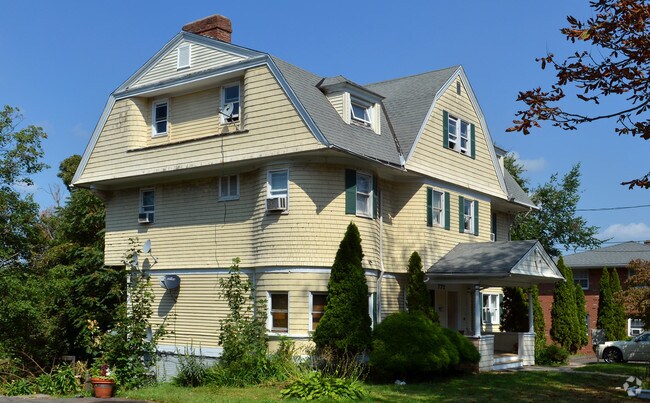
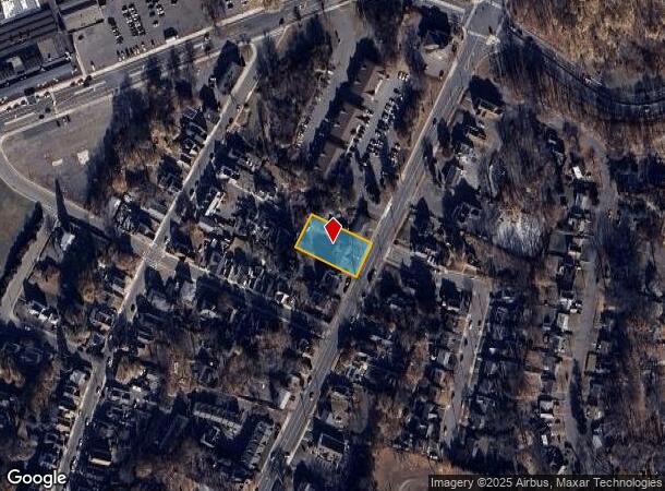
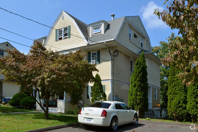
Property Record
772 Broad St, Meriden, CT 06450
NEARBY LISTINGS FOR SALE OR LEASE
Property Detail
772 Broad St
MERI-000304-000263-000024
New Haven
Apartmenthouse5plusunits
Connecticut
X
24
09009C0166H
0.42 AC
2024
Meriden/Wallingford
2025
Westchester/So Connecticut
171400
New Haven, CT
6,111 SF
DEMOGRAPHICS near 772 Broad St
1 Mile
3 Mile
5 Mile
2024 Total Population
20,218
59,103
94,075
2029 Population
20,242
58,835
93,666
Pop Growth 2024-2029
+ 0.12%
(0.45%)
(0.43%)
Average Age
37
40
41
2024 Total Households
8,111
23,639
36,512
HH Growth 2024-2029
+ 0.14%
(0.49%)
(0.50%)
Median Household Inc
$50,074
$61,069
$78,692
Avg Household Size
2.40
2.40
2.50
2024 Avg HH Vehicles
1.00
2.00
2.00
Median Home Value
$167,186
$186,066
$254,364
Median Year Built
1950
1959
1965
Nearby Places
Map Layers
Map Styles
 Street
 Aerial
- Restaurants
- Banks
- Shops
- Fitness
- Groceries
PUBLIC TRANSPORTATION
COMMUTER RAIL
DRIVE
WALK
Distance
3 min
17 min
0.9 mi
DRIVE
WALK
Distance
2 min
19 min
1.0 mi
AIRPORT
Tweed/New Haven
DRIVE
WALK
Distance
Tweed/New Haven
36 min
23.3 mi
Bradley International
DRIVE
WALK
Distance
Bradley International
47 min
32.4 mi
Freight Ports
Port of New Haven
DRIVE
WALK
Distance
Port of New Haven
31 min
22.1 mi
Nearby Properties
Address
Land Use
TOTAL SIZE
Lot Size
Zoning
Address
Land Use
TOTAL SIZE
Lot Size
Zoning
276,631 SF
27.60 AC
R-1
Address
Land Use
TOTAL SIZE
Lot Size
Zoning
267,249 SF
27.55 AC
R-1
Address
Land Use
TOTAL SIZE
Lot Size
Zoning
34.10 AC
C-3
Address
Land Use
TOTAL SIZE
Lot Size
Zoning
10.38 AC
M-1
Address
Land Use
TOTAL SIZE
Lot Size
Zoning
339,844 SF
52.43 AC
M-4
Address
Land Use
TOTAL SIZE
Lot Size
Zoning
159,085 SF
21.79 AC
C-3
Address
Land Use
TOTAL SIZE
Lot Size
Zoning
11.02 AC
S-R
Address
Land Use
TOTAL SIZE
Lot Size
Zoning
162,601 SF
11.44 AC
R-1
Address
Land Use
TOTAL SIZE
Lot Size
Zoning
3,952 SF
21.76 AC
R-1
Address
Land Use
TOTAL SIZE
Lot Size
Zoning
153,180 SF
3.07 AC
TODH
Address
Land Use
TOTAL SIZE
Lot Size
Zoning
1.67 AC
TODP
Address
Land Use
TOTAL SIZE
Lot Size
Zoning
598.20 AC
R-R
Address
Land Use
TOTAL SIZE
Lot Size
Zoning
16.24 AC
C-3
Address
Land Use
TOTAL SIZE
Lot Size
Zoning
880 SF
22.58 AC
C-1
Address
Land Use
TOTAL SIZE
Lot Size
Zoning
84,919 SF
7.53 AC
C-1
Address
Land Use
TOTAL SIZE
Lot Size
Zoning
228,233 SF
1.97 AC
TODH
Address
Land Use
TOTAL SIZE
Lot Size
Zoning
19.47 AC
RF40
Address
Land Use
TOTAL SIZE
Lot Size
Zoning
825.43 AC
R-R
Address
Land Use
TOTAL SIZE
Lot Size
Zoning
115,951 SF
14.77 AC
M-1
Address
Land Use
TOTAL SIZE
Lot Size
Zoning
171,057 SF
25.06 AC
M-4
Address
Land Use
TOTAL SIZE
Lot Size
Zoning
100,512 SF
6 AC
C-2
Address
Land Use
TOTAL SIZE
Lot Size
Zoning
18.61 AC
C-2
Address
Land Use
TOTAL SIZE
Lot Size
Zoning
143,412 SF
2.05 AC
R-3
Address
Land Use
TOTAL SIZE
Lot Size
Zoning
125,420 SF
6.79 AC
R-1
Address
Land Use
TOTAL SIZE
Lot Size
Zoning
172,508 SF
3.98 AC
C-1
Address
Land Use
TOTAL SIZE
Lot Size
Zoning
125,462 SF
16.02 AC
C-3
Address
Land Use
TOTAL SIZE
Lot Size
Zoning
3.60 AC
M-1
Address
Land Use
TOTAL SIZE
Lot Size
Zoning
13.62 AC
RF40
Address
Land Use
TOTAL SIZE
Lot Size
Zoning
8.68 AC
C-2
Address
Land Use
TOTAL SIZE
Lot Size
Zoning
326,730 SF
25.19 AC
M-1
The World's #1 Commercial Real Estate Marketplace
Connect with us
© 2026 CoStar Group
The information above has been obtained from sources believed reliable. While we do not doubt its accuracy we have not verified it and make no guarantee, warranty or representation about it. It is your responsibility to independently confirm its accuracy and completeness. Any projections, opinions, assumptions, or estimates used are for example only and do not represent the current or future performance of the property. The value of this transaction to you depends on tax and other factors which should be evaluated by your tax, financial, and legal advisors. You and your advisors should conduct a careful, independent investigation of the property to determine to your satisfaction the suitability of the property for your needs.