Property Record
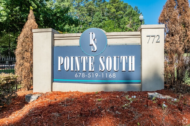
772 Pointe South Pkwy, Jonesboro, GA 30238
NEARBY LISTINGS FOR SALE OR LEASE
-
-
View all Jonesboro listings for sale on LoopNet.com
Property Detail
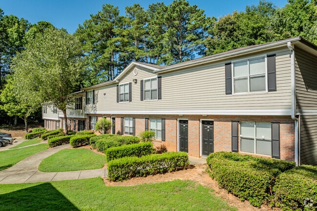
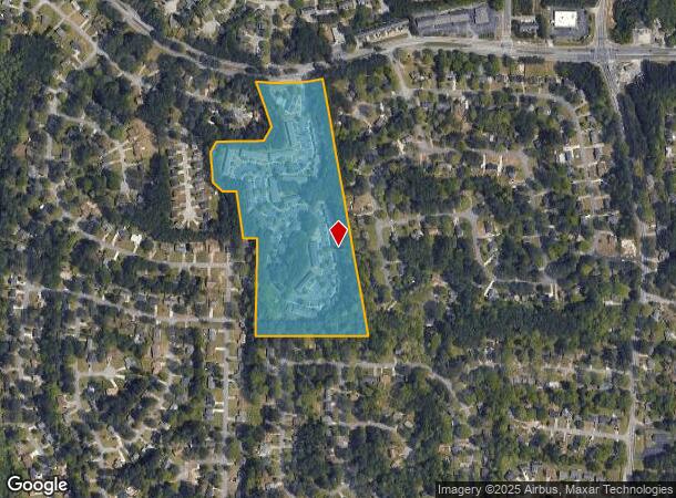
772 Pointe South Pkwy
Atlanta-Sandy Springs-Roswell, GA
Amresco Capital Corp
05-0247A-00A-030
COMMERCIAL
Gardenaptcourtapt5plusunits
Clayton
X
Georgia
13063C0068F
247
2024
19.95 AC
2024
Clayton County
040538
Atlanta
160 SF
DEMOGRAPHICS near 772 Pointe South Pkwy
1 Mile
3 Mile
5 Mile
2024 Total Population
10,138
59,157
146,029
2029 Population
10,069
59,105
146,988
Pop Growth 2024-2029
(0.68%)
(0.09%)
+ 0.66%
Average Age
36
36
37
2024 Total Households
3,606
20,719
51,967
HH Growth 2024-2029
(0.75%)
(0.11%)
+ 0.66%
Median Household Inc
$57,318
$55,456
$55,840
Avg Household Size
2.70
2.80
2.70
2024 Avg HH Vehicles
2.00
2.00
2.00
Median Home Value
$167,554
$182,152
$188,607
Median Year Built
1985
1986
1986
Nearby Places
Map Layers
Map Styles
 Street
 Aerial
- Restaurants
- Banks
- Shops
- Fitness
- Groceries
PUBLIC TRANSPORTATION
AIRPORT
Hartsfield - Jackson Atlanta International
DRIVE
WALK
Distance
Hartsfield - Jackson Atlanta International
21 min
10.9 mi
Freight Ports
Georgia Ports - Savannah
DRIVE
WALK
Distance
Georgia Ports - Savannah
274 min
237.9 mi
Nearby Properties
Address
Land Use
TOTAL SIZE
Lot Size
Zoning
Address
Land Use
TOTAL SIZE
Lot Size
Zoning
324 SF
49.49 AC
RM
Address
Land Use
TOTAL SIZE
Lot Size
Zoning
40,472 SF
116.70 AC
HI
Address
Land Use
TOTAL SIZE
Lot Size
Zoning
294 SF
21.17 AC
PUD
Address
Land Use
TOTAL SIZE
Lot Size
Zoning
316 SF
34.30 AC
RG75
Address
Land Use
TOTAL SIZE
Lot Size
Zoning
7,851 SF
94.84 AC
RS180
Address
Land Use
TOTAL SIZE
Lot Size
Zoning
424 SF
54.79 AC
RM
Address
Land Use
TOTAL SIZE
Lot Size
Zoning
270 SF
28.02 AC
RM
Address
Land Use
TOTAL SIZE
Lot Size
Zoning
88,509 SF
31.54 AC
C C3
Address
Land Use
TOTAL SIZE
Lot Size
Zoning
278 SF
18.53 AC
PUD
Address
Land Use
TOTAL SIZE
Lot Size
Zoning
80,942 SF
44.16 AC
C CH
Address
Land Use
TOTAL SIZE
Lot Size
Zoning
123,000 SF
48 AC
RS110
Address
Land Use
TOTAL SIZE
Lot Size
Zoning
256 SF
25 AC
PUD
Address
Land Use
TOTAL SIZE
Lot Size
Zoning
220 SF
26.84 AC
RM
Address
Land Use
TOTAL SIZE
Lot Size
Zoning
282 SF
25.90 AC
RM
Address
Land Use
TOTAL SIZE
Lot Size
Zoning
57.05 AC
GB
Address
Land Use
TOTAL SIZE
Lot Size
Zoning
200 SF
13.12 AC
RM
Address
Land Use
TOTAL SIZE
Lot Size
Zoning
481 SF
90.43 AC
RMH
Address
Land Use
TOTAL SIZE
Lot Size
Zoning
224 SF
25 AC
C
Address
Land Use
TOTAL SIZE
Lot Size
Zoning
176 SF
17.67 AC
RM
Address
Land Use
TOTAL SIZE
Lot Size
Zoning
198 SF
55.74 AC
RMH
Address
Land Use
TOTAL SIZE
Lot Size
Zoning
210,122 SF
16.77 AC
C C3
Address
Land Use
TOTAL SIZE
Lot Size
Zoning
138,822 SF
15.49 AC
C
Address
Land Use
TOTAL SIZE
Lot Size
Zoning
141,792 SF
18.50 AC
RS110
Address
Land Use
TOTAL SIZE
Lot Size
Zoning
86,781 SF
16 AC
RS110
Address
Land Use
TOTAL SIZE
Lot Size
Zoning
106 SF
10.19 AC
RM
Address
Land Use
TOTAL SIZE
Lot Size
Zoning
199,132 SF
19.59 AC
C PUD
Address
Land Use
TOTAL SIZE
Lot Size
Zoning
39,498 SF
28.80 AC
GB
Address
Land Use
TOTAL SIZE
Lot Size
Zoning
2,193 SF
8.49 AC
C
Address
Land Use
TOTAL SIZE
Lot Size
Zoning
49,812 SF
7.24 AC
C
The World's #1 Commercial Real Estate Marketplace
Connect with us
© 2025 CoStar Group
The information above has been obtained from sources believed reliable. While we do not doubt its accuracy we have not verified it and make no guarantee, warranty or representation about it. It is your responsibility to independently confirm its accuracy and completeness. Any projections, opinions, assumptions, or estimates used are for example only and do not represent the current or future performance of the property. The value of this transaction to you depends on tax and other factors which should be evaluated by your tax, financial, and legal advisors. You and your advisors should conduct a careful, independent investigation of the property to determine to your satisfaction the suitability of the property for your needs.