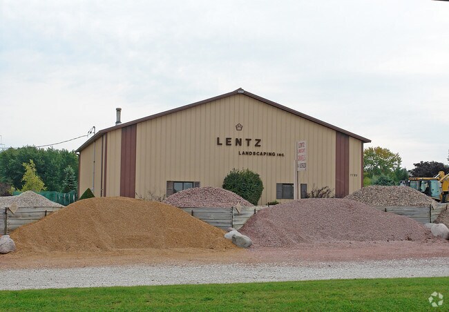
Property Record
7725 S 38, Caledonia, WI 53108


NEARBY LISTINGS FOR SALE OR LEASE
Property Detail
7725 S 38
104-042209053008
PT NW1/4 COM 1318 N OF W1/4 COR E300 S306 W300 N TO POB EXC W40 & COM W1/4 COR N1318 E299 TO POB E120 S305 W120 N306 TO POB P
Commercialnec
Racine
X
Wisconsin
55101C0083D
2.68 AC
2024
Racine East
2024
Milwaukee/Madison
001601
Racine, WI
DEMOGRAPHICS near 7725 S 38
1 Mile
3 Mile
5 Mile
2024 Total Population
388
8,857
37,288
2029 Population
379
8,586
36,357
Pop Growth 2024-2029
(2.32%)
(3.06%)
(2.50%)
Average Age
45
42
41
2024 Total Households
174
3,192
14,771
HH Growth 2024-2029
(2.87%)
(3.13%)
(2.53%)
Median Household Inc
$44,812
$119,587
$95,921
Avg Household Size
2.20
2.70
2.50
2024 Avg HH Vehicles
3.00
3.00
2.00
Median Home Value
$210,869
$288,035
$304,105
Median Year Built
1970
1990
1990
Nearby Places
Map Layers
Map Styles
 Street
 Aerial
- Restaurants
- Banks
- Shops
- Fitness
- Groceries
PUBLIC TRANSPORTATION
COMMUTER RAIL
DRIVE
WALK
Distance
17 min
8.4 mi
DRIVE
WALK
Distance
18 min
9.0 mi
AIRPORT
General Mitchell International
DRIVE
WALK
Distance
General Mitchell International
17 min
9.2 mi
Nearby Properties
Address
Land Use
TOTAL SIZE
Lot Size
Zoning
Address
Land Use
TOTAL SIZE
Lot Size
Zoning
23.29 AC
Address
Land Use
TOTAL SIZE
Lot Size
Zoning
21.59 AC
Address
Land Use
TOTAL SIZE
Lot Size
Zoning
48.65 AC
Address
Land Use
TOTAL SIZE
Lot Size
Zoning
28.04 AC
Address
Land Use
TOTAL SIZE
Lot Size
Zoning
16.25 AC
Address
Land Use
TOTAL SIZE
Lot Size
Zoning
Address
Land Use
TOTAL SIZE
Lot Size
Zoning
Address
Land Use
TOTAL SIZE
Lot Size
Zoning
13.05 AC
Address
Land Use
TOTAL SIZE
Lot Size
Zoning
95.21 AC
Address
Land Use
TOTAL SIZE
Lot Size
Zoning
411,369 SF
53.72 AC
Address
Land Use
TOTAL SIZE
Lot Size
Zoning
10.75 AC
Address
Land Use
TOTAL SIZE
Lot Size
Zoning
Address
Land Use
TOTAL SIZE
Lot Size
Zoning
24.91 AC
Address
Land Use
TOTAL SIZE
Lot Size
Zoning
8.74 AC
Address
Land Use
TOTAL SIZE
Lot Size
Zoning
Address
Land Use
TOTAL SIZE
Lot Size
Zoning
Address
Land Use
TOTAL SIZE
Lot Size
Zoning
Address
Land Use
TOTAL SIZE
Lot Size
Zoning
12.08 AC
Address
Land Use
TOTAL SIZE
Lot Size
Zoning
26.40 AC
Address
Land Use
TOTAL SIZE
Lot Size
Zoning
Address
Land Use
TOTAL SIZE
Lot Size
Zoning
39.67 AC
Address
Land Use
TOTAL SIZE
Lot Size
Zoning
5.61 AC
Address
Land Use
TOTAL SIZE
Lot Size
Zoning
3.54 AC
Address
Land Use
TOTAL SIZE
Lot Size
Zoning
222.20 AC
Address
Land Use
TOTAL SIZE
Lot Size
Zoning
13.10 AC
Address
Land Use
TOTAL SIZE
Lot Size
Zoning
22.90 AC
Address
Land Use
TOTAL SIZE
Lot Size
Zoning
0.37 AC
Address
Land Use
TOTAL SIZE
Lot Size
Zoning
Address
Land Use
TOTAL SIZE
Lot Size
Zoning
3.19 AC
Address
Land Use
TOTAL SIZE
Lot Size
Zoning
The World's #1 Commercial Real Estate Marketplace
Connect with us
© 2025 CoStar Group
The information above has been obtained from sources believed reliable. While we do not doubt its accuracy we have not verified it and make no guarantee, warranty or representation about it. It is your responsibility to independently confirm its accuracy and completeness. Any projections, opinions, assumptions, or estimates used are for example only and do not represent the current or future performance of the property. The value of this transaction to you depends on tax and other factors which should be evaluated by your tax, financial, and legal advisors. You and your advisors should conduct a careful, independent investigation of the property to determine to your satisfaction the suitability of the property for your needs.